Aubigné-sur-Layon
Aubigné-sur-Layon is a commune in the Maine-et-Loire department in western France.
Aubigné-sur-Layon | |
|---|---|
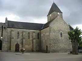 The church in Aubigné-sur-Layon | |
 Coat of arms | |
Location of Aubigné-sur-Layon 
| |
 Aubigné-sur-Layon  Aubigné-sur-Layon | |
| Coordinates: 47°12′46″N 0°27′35″W | |
| Country | France |
| Region | Pays de la Loire |
| Department | Maine-et-Loire |
| Arrondissement | Angers |
| Canton | Chemillé-en-Anjou |
| Intercommunality | CC Loire Layon Aubance |
| Government | |
| • Mayor (2014-2020) | Pierre Robé |
| Area 1 | 5.32 km2 (2.05 sq mi) |
| Population (2017-01-01)[1] | 366 |
| • Density | 69/km2 (180/sq mi) |
| Time zone | UTC+01:00 (CET) |
| • Summer (DST) | UTC+02:00 (CEST) |
| INSEE/Postal code | 49012 /49540 |
| Elevation | 36–80 m (118–262 ft) (avg. 44 m or 144 ft) |
| 1 French Land Register data, which excludes lakes, ponds, glaciers > 1 km2 (0.386 sq mi or 247 acres) and river estuaries. | |
Geography
The river Layon forms all of the commune's northern border.
Population
|
|
References
- "Populations légales 2017". INSEE. Retrieved 6 January 2020.
External links
| Wikimedia Commons has media related to Aubigné-sur-Layon. |
| Authority control |
|
|---|
This article is issued from Wikipedia. The text is licensed under Creative Commons - Attribution - Sharealike. Additional terms may apply for the media files.