Bouchemaine
Bouchemaine is a commune in the Maine-et-Loire department in western France.
Bouchemaine | |
|---|---|
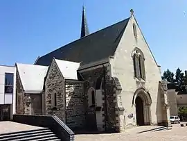 The church of St Symphorien in Bouchemaine | |
.svg.png.webp) Coat of arms | |
Location of Bouchemaine 
| |
 Bouchemaine  Bouchemaine | |
| Coordinates: 47°25′24″N 0°36′30″W | |
| Country | France |
| Region | Pays de la Loire |
| Department | Maine-et-Loire |
| Arrondissement | Angers |
| Canton | Angers-2 |
| Intercommunality | CU Angers Loire Métropole |
| Government | |
| • Mayor (2008–2014) | Anne-Sophie Hocquet de Lajartre |
| Area 1 | 19.81 km2 (7.65 sq mi) |
| Population (2017-01-01)[1] | 6,774 |
| • Density | 340/km2 (890/sq mi) |
| Time zone | UTC+01:00 (CET) |
| • Summer (DST) | UTC+02:00 (CEST) |
| INSEE/Postal code | 49035 /49080 |
| Elevation | 11–73 m (36–240 ft) (avg. 26 m or 85 ft) |
| 1 French Land Register data, which excludes lakes, ponds, glaciers > 1 km2 (0.386 sq mi or 247 acres) and river estuaries. | |
Population
| Year | Pop. | ±% |
|---|---|---|
| 1793 | 830 | — |
| 1800 | 1,151 | +38.7% |
| 1806 | 1,235 | +7.3% |
| 1821 | 1,319 | +6.8% |
| 1831 | 1,333 | +1.1% |
| 1836 | 1,229 | −7.8% |
| 1841 | 1,220 | −0.7% |
| 1846 | 1,307 | +7.1% |
| 1851 | 1,386 | +6.0% |
| 1856 | 1,226 | −11.5% |
| 1861 | 1,197 | −2.4% |
| 1866 | 1,166 | −2.6% |
| 1872 | 1,159 | −0.6% |
| 1876 | 1,225 | +5.7% |
| 1881 | 1,141 | −6.9% |
| 1886 | 1,196 | +4.8% |
| 1891 | 1,216 | +1.7% |
| 1896 | 1,128 | −7.2% |
| 1901 | 1,201 | +6.5% |
| 1906 | 1,209 | +0.7% |
| 1911 | 1,282 | +6.0% |
| 1921 | 1,182 | −7.8% |
| 1926 | 1,150 | −2.7% |
| 1931 | 1,155 | +0.4% |
| 1936 | 1,147 | −0.7% |
| 1946 | 1,266 | +10.4% |
| 1954 | 1,328 | +4.9% |
| 1962 | 1,282 | −3.5% |
| 1968 | 1,685 | +31.4% |
| 1975 | 3,223 | +91.3% |
| 1982 | 5,014 | +55.6% |
| 1990 | 5,799 | +15.7% |
| 1999 | 6,155 | +6.1% |
| 2006 | 5,918 | −3.9% |
| 2009 | 6,003 | +1.4% |
References
- "Populations légales 2017". INSEE. Retrieved 6 January 2020.
External links
| Wikimedia Commons has media related to Bouchemaine. |
| Authority control |
|---|
This article is issued from Wikipedia. The text is licensed under Creative Commons - Attribution - Sharealike. Additional terms may apply for the media files.