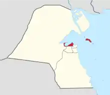
Areas of Kuwait
Kuwait is divided into six governorates, in each there are several areas (Arabic: مناطِق).

Areas, due to their small area which does not exceed 5 km2 (2 sq mi), are sometimes called towns. However they are officially translated to areas.[1][2][3] The Arabic word for area, Mintaqah منطقة can mean both mean area and region.[4][5] Areas are further subdivided into blocks, each of which is refereed by to a number. All blocks are divided into streets شوارع (singular شارع šāriʿ). However, some areas may be further subdivided into جادات Jaddāt (singular جادة Jadda), which might be translated to avenue or lane.
Each area in Kuwait has an official governmental facility called co-op society or just society (Arabic: جمعية). For example, in Surra, it's called Surra Co-op Society. Societies are mainly supermarkets that provide foods and produces, and they may take part in maintaining some on the areas' landmarks like parks and schools, but they're not legally obliged to. Societies have elected members who manage them. Only residents of the area can vote for their society membership.
Capital Governorate


The Capital Governorate (Arabic: العاصمة, romanized: al-ʿĀṣima Gulf Arabic: il-ʿĀṣma) houses the capital of the country, Kuwait City, the historic Failaka Island, as well as many suburban areas near the capital of the country.
| Official English | Arabic | Gulf Arabic Transliteration | Year Established | # of Blocks[6] | Population (2011)[6] | Notes |
|---|---|---|---|---|---|---|
| Kuwait City | مدينة الكويت | Madīnat li-Kwēt | 17th century | Kuwait City is the location of the historical districts of Old Kuwait. These are Šarg, Jibla, Mirgāb, and Dasmān. In addition to Bedouin villages, most Kuwaitis resided in these districts before the discovery of oil. Locally referred to as id-Dīra (the ends). | ||
| Abdulla Al-Salem | ضاحية عبد الله السالم | Ð̣āḥyat ʿAbdalla is-Sālim | 1963[7] | 4 | 13,098 | Often referred to simply as ið̣-Ð̣āḥya 'the suburb'. |
| Adailiya | العديلية | li-ʿDēlīya | 1963[7] | 4 | 11,006 | |
| Bnaid Al-Qar | بنيد القار | Bnēd il-Gār | 2 | 13,171 | ||
| Daʿiya | الدعية | id-Diʿīya | 1957[7] | 5 | 11,289 | |
| Dasma | الدسمة | id-Dasma | 1954[7] | 6 | 12,455 | |
| Doha | الدوحة | id-Dōḥa | 22,047 | Not to be confused with the Qatari Capital | ||
| Doha Port | ميناء الدوحة | Mina id-Dōḥa | 573 | |||
| Faiha' | الفيحاء | il-Fēḥa | 1956[7] | 9 | 12,333 | |
| Failaka | فيلكا | Fēliča | 147 | A historic island. Its name comes from Greek φυλάκιο(ν) - fylakio(n) 'outpost'. Used to be inhabited until the Iraqi invasion of Kuwait. Birthplace of Fēliča (sub)dialect of Kuwaiti Arabic. | ||
| Ghornata | غرناطة | Ġirnāṭa | 3 | 8,752 | It was named after the city of Granada in Spain | |
| Jaber Al-Ahmad City | مدينة جابر الأحمد | (Madīnat) Jābir il-Aḥmad | 40,591 | |||
| Kaifan | كيفان | Kēfān | 1955[7] | 7 | 17,300 | |
| Khaldiya | الخالدية | il-Xāldīya | 1961[7] | 4 | 9,820 | |
| Mansūriya | المنصورية | il-Manṣūrīya | 1965[7] | 2 | 5,589 | Location of Al-Arabi SC, one of the oldest sports clubs in Kuwait. |
| Nahdha | النهضة | in-Nahð̣a | 3 | Formerly East Sulaibikhat | ||
| North West Sulaibikhat | شمال غرب الصليبيخات | Šamāl Ġarb li-Ṣlēbixāt | 7,941 | Temporary name | ||
| Nuzha | النزهة | in-Nizha | 1963[7] | 3 | 8,372 | |
| Qadsiya | القادسية | il-Qādsīya | 1958[7] | 9 | 14,389 | |
| Qurtuba | قرطبة | Qurṭuba | 5 | 28,736 | ||
| Rawda | الروضة | ir-Rōð̣a | 1965[7] | 5 | 21,535 | |
| Shamiya | الشامية | iš-Šāmīya | 1955[7] | 10 | 8,351 | |
| Shuwaikh | الشويخ | li-Šwēx | 1954[7] | 8 | 3,012 | |
| Shuwaikh Industrial Area | الشويخ الصناعية | li-Šwēx iṣ-Ṣināʿīya | 2,518 | |||
| Shuwaikh Port | ميناء الشويخ | Mina li-Šwēx | 185 | |||
| Sulaibikhat | الصليبخات | li-Ṣlēbixāt | 5 | 23,686 | ||
| Surra | السرة | is-Sirra | 6 | 30,264 | ||
| Umm an Namil Island | جزيرة ام النمل | (Jazīrat) Umm in-Namil | 0 | |||
| Yarmouk | اليرموك | il-Yarmūk | 4 | 15,385 | ||
| 326,513 | ||||||
Hawalli Governorate
| English | Arabic | Population (2011)[6] | Notes/Landmarks |
|---|---|---|---|
| Anjafa | أنجفة | 596 | Anjafa beach |
| Bayān | بيان | 39,799 | Bayan Palace |
| Bi'da | البدع | Coastal area with many business with sea view. | |
| Hawally | حولي | 128,549 | Notable for its huge commercial activities and dozens of malls. |
| Hittin | حطين | 20,809 | |
| Jabriya | الجابرية | 56,392 | Home of multiple hospitals, including Mubarak Al-Kabeer Hospital, Hadi Hospital, and Royale Hayat Hospital, as well as many embassies, the Blood Bank of Kuwait and Health Sciences Campus of Kuwait University. |
| Maidan Hawalli | ميدان حولي | ||
| Mishrif | مشرف | 27,391 | |
| Mubarak Al-Jabir | مبارك الجابر | ||
| Nigra | النقرة | ||
| Rumaithiya | الرميثية | 41,787 | Has the largest number of Husainiyas in Kuwait. |
| Salam | سلام | 22,314 | |
| Salmiya | السالمية | 196,153 | Big commercial activities and a lot of malls. |
| Salwa | سلوى | 80,283 | |
| Sha'ab | الشعب | 10,084 | |
| Shuhada | الشهداء | 15,258 | |
| Siddiq | الصديق | 26 | |
| South Surra | جنوب السرة | ||
| Zahra | الزهراء | 23,792 | |
| 672,910 | |||
Mubarak Al-Kabeer Governorate
The Mubarak Al-Kabeer governorate (Arabic: مبارك الكبير, romanized: Mubārak al-Kabīr Gulf Arabic: Mbārak il-kabīir) is the governorate most recently established. It is named after Mubarak the Great.
| English | Arabic | Population (2011)[6] | Notes/Landmarks |
|---|---|---|---|
| Abu Al Hasaniya | أبو الحصانية | 1,682 | |
| Abu Futaira | أبو فطيرة | 57 | |
| Adān | العدان | 48,095 | |
| Al Qurain | القرين | 33,616 | |
| Al-Qusour | القصور | 38,606 | |
| Fintās | الفنطاس | ||
| Funaitīs | الفنيطيس | 578 | |
| Misīla | المسيلة | 1,022 | |
| Mubarak Al-Kabeer | مبارك الكبير | 48,196 | Governorate seat. |
| Sabah Al-Salem | صباح السالم | 83,437 | |
| Sabhān | صبحان | 2,903 | |
| South Wista | جنوب وسطي | 51 | |
| Wista | وسطي | 570 | |
| 258,813 | |||
Ahmadi Governorate
| English | Arabic | Population (2011)[6] | Notes/Landmarks |
|---|---|---|---|
| Abu Halifa | أبو حليفة | 29,870 | |
| Abdullah Port | ميناء عبد الله | 24,415 | |
| Ahmadi | الأحمدي | 21,469 | Governorate seat. |
| Ali As-Salim | علي صباح السالم | 42,173 | |
| Aqila | العقيلة | 13,579 | |
| Bar Al Ahmadi | بر الأحمدي | 723 | Desert area of Al Ahmadi. |
| Bneidar | بنيدر | ||
| Dhaher | بر الأحمدي | 33,197 | |
| Fahaheel | الفحيحيل | 54,157 | |
| Fahad Al-Ahmad | فهد الأحمد | 17096 | |
| Hadiya | هدية | 17,990 | |
| Jaber Al-Ali | جابر العلي | 38,868 | |
| Jawaher Al Wafra | جواخير الوفرة | 653 | |
| Jilei'a | الجليعة | ||
| Khairan | الخيران | 1,895 | |
| Mahbula | المهبولة | 77,988 | |
| Mangaf | المنقف | 73,378 | |
| Miqwa' | المقوع | 32 | |
| New Khairan City | مدينة الخيران الجديدة | 2 | |
| New Wafra | الوفرة الجديدة | 2,488 | |
| Nuwaiseeb | النويصيب | 537 | |
| Riqqa | الرقة | 36,058 | |
| Sabah Al-Ahmad City | مدينة صباح الأحمد | 1,235 | |
| Sabah Al-Ahmad Nautical City | مدينة صباح الأحمد البحرية | ||
| Sabahiya | الصباحية | 56,640 | |
| Shu'aiba (North & South) | الشعيبة | 26 | |
| South Sabahiya | جنوب الصباحية | 73 | |
| Wafra | الوفرة | 7,856 | |
| Zoor | الزور | 2,230 | |
| Zuhar | الظهر | ||
| 588,068 | |||
Farwaniya Governorate
| English | Arabic | Population (2011)[6] | Notes/Landmarks |
|---|---|---|---|
| Abdullah Al-Mubarak | عبدالله المبارك | 61,441 | Also known as West Jleeb Al-Shuyoukh. |
| Airport District | منطقة المطار | 29 | |
| Andalous | الأندلس | 42,325 | |
| Ardiya | العارضية | 47,928 | |
| Ardiya Herafiya | العارضية حرفية | 42,173 | |
| Ardiya Industrial Area | العارضية المنطقة الصناعية | 203 | |
| Ashbelya | اشبيلية | 21,848 | |
| Dhajeej | الضجيج | 99 | |
| Farwaniya | الفروانية | 136,260 | Governorate seat. |
| Fordous | الفردوس | 52,173 | |
| Jleeb Al-Shuyoukh | جليب الشيوخ | 227,980 | |
| Khaitan | خيطان | 109,901 | |
| Omariya | العمرية | 17,373 | |
| Rabiya | الرابية | 18,620 | |
| Rai | الري | 1,054 | Home to The Avenues (Kuwait), the world's second largest covered mall. |
| Al-Riggae | الرقعي | 24,820 | |
| Rihab | الرحاب | 15,682 | |
| Sabah Al-Nasser | صباح الناصر | 38,507 | |
| Sabaq Al Hajan | سباق الهجن | 2,218 | Camel racing area. |
| 818,571 | |||
Jahra Governorate
| English | Arabic | Population (2011)[6] | Notes/Landmarks |
|---|---|---|---|
| Abdali | العبدلي | 6,839 | |
| Al Nahda / East Sulaibikhat | النهضة / شرق الصليبخات | 6,756 | |
| Amghara | أمغرة | 8,623 | |
| Bar Jahra | بر الجهراء | 1,044 | Desert area of Jahra. |
| Jahra | الجهراء | 38,664 | Governorate seat. |
| Jahra Industrial Area | الجهراء المنطقة الصناعية | 1,259 | |
| Kabad | كبد | 3,602 | |
| Naeem | النعيم | 13,913 | |
| Nasseem | النسيم | 18,745 | |
| Oyoun | العيون | 31,009 | |
| Qasr | القصر | 42,050 | |
| Saad Al Abdullah City | مدينة سعد العبدالله | 65,394 | |
| Salmi | السالمي | 1,187 | |
| Sikrab | السكراب | 264 | |
| South Doha / Qairawān | جنوب الدوحة / القيروان | 15,200 | |
| Sulaibiya | الصليبية | 58,275 | |
| Sulaibiya Agricultural Area | الصليبية المنطقة الزراعية | 6,778 | |
| Taima | تيماء | 52,740 | |
| Waha | الواحة | 28,154 | |
| 400,975 | |||
See also
References
- Kuwait National News Agency
- Ministry of Interior
- "Ministry of Electricity and Water". Archived from the original on 2015-07-11. Retrieved 2015-04-13.
- Cambridge English-Arabic dictionary, Area translatation
- Cambridge English-Arabic dictionary, Region translatation
- "Geoportal for Kuwait Census 2011". Central Statistical Bureau of Kuwait. Retrieved 26 November 2019.
- Al-Nakib, Farah (2014). "Revisiting "Ḥaḍar" and "badū" in Kuwait: Citizenship, Housing, and the Construction of a Dichotomy". International Journal of Middle East Studies. 46 (1): 5–30. ISSN 0020-7438. JSTOR 43303105. Retrieved 2020-12-04.
List of cities in Asia | |
|---|---|
| Sovereign states |
|
| States with limited recognition |
|
| Dependencies and other territories |
|
| |