Arequipa Province
Arequipa is a province in the Arequipa Region, Peru. Its capital, Arequipa, is Peru's third most populous province of Peru. It borders the provinces of Islay, Camaná, Caylloma, and the Cusco and Puno regions. According to INEI in the year 2014 it has a population of 958.351 people.[2]
Arequipa | |
|---|---|
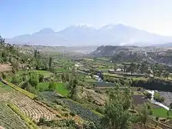 Chachani as seen from Carmen Alto, Arequipa Province | |
 Flag  Coat of arms | |
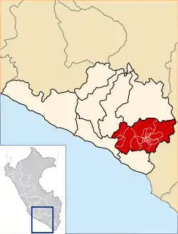 Location of Arequipa in the Arequipa Region | |
| Country | Peru |
| Region | Arequipa |
| Founded | 1540 |
| Capital | Arequipa |
| Government | |
| • Mayor | Omar Julio Candia Aguilar (2019-2022) |
| Area | |
| • Total | 9,682.02 km2 (3,738.25 sq mi) |
| Population | |
| • Total | 1'080,635[1] (Census 2,017) |
| UBIGEO | 0401 |
| Website | www |
Geography
Some of the highest peaks of the province are Chachani, the Misti volcano and Pikchu Pikchu. Other mountains are listed below:[3]
- Anta Q'awa
- Anta Saya
- Chachakumani
- Iru Qullu
- Janq'u Apachita
- Jayuni
- Jichu Qullu
- Kunturi
- Kunturini
- Llallawi
- Llallawani
- Misa Misani
- Misa Pilluni
- Ñuñu Muqu
- Pachakutiq
- Parwayuni
- Pikchu Pikchu
- Pilluni
- Pirwani
- Puka Muqu
- Puka Pukayuq
- Pukara
- Puka Saya
- Phichunchäni
- Qillqata
- Qiñwani
- Qiwlla Pununa
- Qullpani
- Qullqirani
- Saywa
- Saywani
- Sinqa
- Sura Wañusqa
- Suri Wasi
- Takuni
- Turini
- Wankarani
- Wanq'uni
- Waqullani
- Wayllani
- Wila Muqu
- Wila Wila
- Wilani
- Yuraq Pilluni
- Yuraq Apachita
- Yuraq Urqu
Political division
The province is divided into twenty-nine districts (Spanish: distritos, singular: distrito).
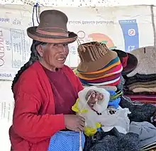
Ethnic groups
The province is inhabited by indigenous citizens of Aymara and Quechua descent. Spanish, however, is the language which the majority of the population (85.67%) learnt to speak in childhood, 1.64% of the residents started speaking using the Aymara language and 12.35% using Quechua (2007 Peru Census).[4]
See also
Sources
- "Directorio Nacional de Centros Poblados - Censos Nacionales 2017".
- "Perú:Estimaciones y proyecciones de Población Por sexo según Departamento, Provincia y Distrito 2012-2015 - INEI (page 129)".
- escale.minedu.gob.pe - UGEL map of the Arequipa Province (Arequipa Region)
- inei.gob.pe Archived January 27, 2013, at the Wayback Machine INEI, Peru, Censos Nacionales 2007
External links
| |
|---|---|