Arruda dos Vinhos
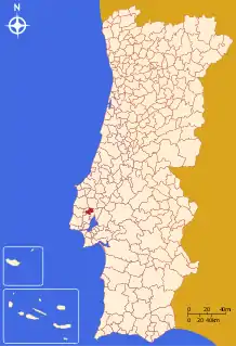
Arruda dos Vinhos (Portuguese pronunciation: [ɐˈʁuðɐ ðuʒ ˈviɲuʃ] (![]() listen)) is a municipality in the Lisbon District in Portugal. The population in 2011 was 13,391,[1] in an area of 77.96 km².[2]
listen)) is a municipality in the Lisbon District in Portugal. The population in 2011 was 13,391,[1] in an area of 77.96 km².[2]
Arruda dos Vinhos | |
|---|---|
.jpg.webp) Arruda dos Vinhos, Lisbon | |
 Flag  Coat of arms | |
 | |
| Coordinates: 38°59′N 9°04′W | |
| Country | |
| Region | Centro |
| Intermunic. comm. | Oeste |
| District | Lisbon |
| Parishes | 4 |
| Government | |
| • President | André Rijo (PS) |
| Area | |
| • Total | 77.96 km2 (30.10 sq mi) |
| Population (2011) | |
| • Total | 13,391 |
| • Density | 170/km2 (440/sq mi) |
| Time zone | UTC±00:00 (WET) |
| • Summer (DST) | UTC+01:00 (WEST) |
| Local holiday | Ascension Day date varies |
| Website | http://www.cm-arruda.pt |
The present Mayor is André Filipe dos Santos Rijo, elected from the Socialist Party.
Parishes
Administratively, the municipality is divided into 4 civil parishes (freguesias):[3]
- Arranhó
- Arruda dos Vinhos
- Cardosas
- Santiago dos Velhos
Places of interest
In 1809-10 several forts were constructed in the municipality as part of the Lines of Torres Vedras, which were defensive lines to protect the Portuguese capital Lisbon from invasion by the French during the Peninsular War (1807–14) or, in the event of defeat, to safely embark the British Army led by the Duke of Wellington. Two of the hilltop forts, the Fort of Carvalha and the Fort of Cego, were recently restored and can be visited.[4]
See also
- Arruda DOC, a wine designation.
References
- Instituto Nacional de Estatística Archived November 15, 2016, at the Wayback Machine
- "Áreas das freguesias, concelhos, distritos e país". Archived from the original on 2018-11-05. Retrieved 2018-11-05.
- Diário da República. "Law nr. 11-A/2013, page 552 19" (pdf) (in Portuguese). Retrieved 16 July 2014.
- "Forte da Carvalha". Freguesia de S. Tiago dos Velhos. Retrieved 30 August 2019.
External links
- Town Hall official website
- Arruda dos Vinhos' wine cellar
- Partido Socialista - Arruda dos Vinhos
- Schools:Externato João Alberto Faria Students
- History of Arruda dos Vinhos, people, links
- History of Arruda dos Vinhos, people, links
- Arrudense: Outdoor Activities, trekking
- Andre Rijo: Candidato do Partido Socialista à Câmara Municipal de Arruda dos Vinhos
