Asnières-sur-Blour
Asnières-sur-Blour is a commune in the Vienne department in the Nouvelle-Aquitaine region in western France.
Asnières-sur-Blour | |
|---|---|
Location of Asnières-sur-Blour 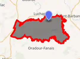
| |
 Asnières-sur-Blour  Asnières-sur-Blour | |
| Coordinates: 46°09′54″N 0°48′04″E | |
| Country | France |
| Region | Nouvelle-Aquitaine |
| Department | Vienne |
| Arrondissement | Montmorillon |
| Canton | Lussac-les-Châteaux |
| Intercommunality | CC Vienne Gartempe |
| Government | |
| • Mayor (2014-2020) | Maryse Legrand |
| Area 1 | 32.49 km2 (12.54 sq mi) |
| Population (2017-01-01)[1] | 182 |
| • Density | 5.6/km2 (15/sq mi) |
| Time zone | UTC+01:00 (CET) |
| • Summer (DST) | UTC+02:00 (CEST) |
| INSEE/Postal code | 86011 /86430 |
| Elevation | 163–232 m (535–761 ft) (avg. 210 m or 690 ft) |
| 1 French Land Register data, which excludes lakes, ponds, glaciers > 1 km2 (0.386 sq mi or 247 acres) and river estuaries. | |
Asnières-sur-Blour is located roughly halfway between the cities of Limoges and Poitiers. Its land is formed by a 3 percent of steep and grisp valleys, 38% of clay soils in the Seuil du Poitou upland, pink granite soils (21%), diorite soils (22%) and leucogranite soils (22%) in the surrounding "hillock arch".[2] The land is skimed by a 15 chilometers fluviale creek of which 5 km belongs to the French river Blourde. The climate is oceanic with moderate hot and dry summers, slowly raining in the fall and with no excessively cold winters.
Toponomastics
The toponym derives from the Latin word asinus and the suffix -aria to mean what has a concern or is a place of donkeys. Probably, the name is due to the presence of various mills which were steered by a high number of mules. In 2017 the global population counted 182 persons.[3]
Economy
The main source of employment is agriculture, mainly sheep farming.[4] Of a complexive farming surface which as of 2010 amounted to 2,590 hectars, 20% was used for the cultivation of common wheat and hordeum, 50% to forage and 23% for grass. From 2000 to 2010 the number of farm naimals more than doubled increasing from 942 to 1,732 units, so as to become the main economic activity of the area and to constitute one of the most important herd of the Vienne Department which in 2011 counted 48,000 registered farm animals.[5] As a part of a more general trend diffused in the whole region which in the 1990-2007 had lost the 43& of the numerosity of its sheeps solely destinated to the production of meat for human consumption, the numer of ovine resources felt down from 9,128 to 7,614 units during the 2000-2010 elapsed time interval. The poultry upbringing was totally estinguished in 2010.[4]
Landscape
In 1965 a French Revolution wood of freedom was hammered at the border with the departments of Charente and Haute-Vienne.[6] According to the local inventory of the remarkable trees updated by the Poitou-Charentes administration,[7] the town hosts a pedunculate oak.
The Asnières basins are protected under the EU Habitats Directive [8] and the land delimited by Villedon, Ecluseaux and the mills of Asnières belongs to a natural area of ecological, faunal and floristic interest (in French: Zone naturelle d'intérêt écologique, faunistique et floristique).[9]
See also
References
- "Populations légales 2017". INSEE. Retrieved 6 January 2020.
- Regional Chamber of Agricolture, Poitou-Charentes, 2007
- Department census
- Statistics of the Vienne Department - 2000/2010
- Agreste – Bulletin, no 12, May 2013
- Robert Petit, 'Les Arbres de la liberté à Poitiers et dans la Vienne, Poitiers: Éditions CLEF 89 / Fédération des travaux laïques, 1989, p. 219
- Poitou-Charentes Nature, 2000
- DREAL Poitou-Charentes / MNHN, 2013
- Secrétariat scientifique de l'inventaire des ZNIEFF, DREAL Poitou-Charentes , 2011
External link
 Media related to Asnières-sur-Blour at Wikimedia Commons
| Authority control |
|---|