Atascosa, Texas
Atascosa (/ˌætəsˈkoʊsə/ AT-əs-KOH-sə) is an unincorporated community located in southwest Bexar County, Texas, United States. Atascosa is 14 miles southwest of downtown San Antonio. It is located between Von Ormy and Lytle, Texas off I-35. The community is part of the San Antonio Metropolitan Statistical Area.
History
The Atascosa post office (78002) opened in 1872 and is located today on Old Pearsall Road at Jarratt Road. In 1885 the community had a Baptist church, a district school, a general store, a saloon, two blacksmiths, and a population of 180.[1] A coal mine was in operation by 1900.
Geography
Atascosa is located at 29°17.14′N 98°38.84′W [2] and is 41.97 square miles.
Demographics
As of the 2010 U.S. Census, there were 8,735 people residing in this populated place. The population density was 208 people per square mile. The racial makeup of this area is 63.66% White, 0.54% African American, 0.63% Native American, 0.42% Asian, 0.11% Pacific Islander, 34.63% from other races. The Hispanic population is 7,167 which is 82.05% of the total Atascosa population.
Features
- Education
Atascosa is included in the Southwest ISD. McNair Middle School and Elm Creek Elementary are located in Atascosa off Old Pearsall Road.[3] The high school serving Atascosa is San Antonio's Southwest High School.
- Agriculture
According to the National Agricultural Statistics Service 2007 census, there are more than 70 crop operations in Atascosa with three operations that are valued at more than $250,000 each. There are more than 125 animal operations in Atascosa zip code of 78002. Many people in the area raise cattle, horses, goats, pigs, peacocks, and other poultry.
- Utilities
Electricity is provided to area by CPS Energy. The water is supplied by Atascosa Rural Water Supply located off Jarratt Road and Pearsall.
References
- Atascosa, TX; Handbook of Texas Online;
- "US Gazetteer files: 2010, 2000, and 1990". United States Census Bureau. 2011-02-12. Retrieved 2011-04-23.
- "Southwest ISD (Archived copy)". Archived from the original on 2011-08-12. Retrieved 2011-08-02.
External links
Municipalities and communities of Bexar County, Texas, United States | ||
|---|---|---|
| Cities | 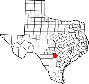 Bexar County map | |
| Towns | ||
| CDPs | ||
| Other unincorporated communities | ||
| Footnotes | ‡This populated place also has portions in an adjacent county or counties | |
| ||
