Austral Islands
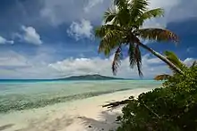
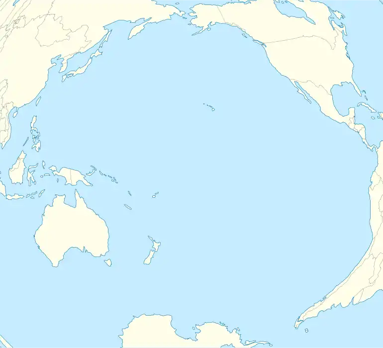
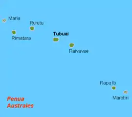
The Austral Islands (French: Îles Australes, officially Archipel des Australes; Tahitian: Tuha'a Pae) are the southernmost group of islands in French Polynesia, an overseas country of the French Republic in the South Pacific. Geographically, they consist of two separate archipelagos, namely in the northwest the Tupua'i islands (French: Îles Tubuaï) consisting of the Îles Maria, Rimatara, Rūrutu, Tupua'i Island proper and Ra'ivāvae, and in the southeast the Bass Islands (French: Îles basses) composed of the main island of Rapa Iti and the small Marotiri (also known as Bass Rocks or Îlots de Bass). Inhabitants of the islands are known for their pandanus fiber weaving skills.[2] The islands of Maria and Marotiri are not suitable for sustained habitation. Several of the islands have uninhabited islets or rocks off their coastlines. Austral Islands' population is 6,965 on almost 150 km2 (58 sq mi). The capital of the Austral Islands administrative subdivision is Tupua'i.
| Native name: Îles Australes (French) / Tuha'a Pae (Tahitian) | |
|---|---|
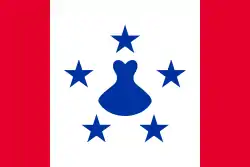 Flag of the Austral Islands | |
 | |
 Austral Islands 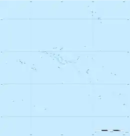 Austral Islands | |
| Geography | |
| Location | Pacific Ocean |
| Coordinates | 23°23′00″S 149°27′00″W |
| Archipelago | Polynesia |
| Total islands | 7 |
| Major islands | Tupua'i, Rūrutu, Ra'ivāvae, Rapa Iti |
| Area | 152 km2 (59 sq mi) |
| Highest elevation | 650 m (2130 ft) |
| Highest point | Mont Perau |
| Administration | |
| Collectivity | |
| Largest settlement | Rūrutu (pop. 2,466[1]) |
| Demographics | |
| Population | 6,965[1] (2017) |
| Pop. density | 43/km2 (111/sq mi) |
| Languages | French language, Tahitian, Rapa, Polynesian languages |
| Additional information | |
| Time zone |
|
History
Whaling vessels were among the earliest and most consistent visitors to the islands in the 19th century. The first such vessel for which a record exists is the New Hazard in 1813.[3] These ships came for fresh drinking water, firewood and food provisions. Sometimes they also took aboard islanders to serve as crewmen on their ships.
Geography
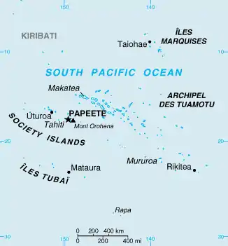
The Tuha'a Pae or Austral Islands (French: Îles Australes or Archipel des Australes) are the southernmost group of islands in French Polynesia, an overseas collectivity of France in the South Pacific. Geographically, the Austral Islands consist of two separate archipelagos. From northwest to southeast they are:
- The Tupua'i Islands (French: Îles Tubuaï), named for one of the main islands. They consist of:
- Îles Maria (21°48′00″S 154°41′00″W) in the northwest, part of Rimatara municipality
- Rimatara (22°38′25″S 152°50′16″W),
- Rūrutu (22°29′04″S 151°20′03″W),
- Tupua'i (23°23′00″S 149°27′00″W),
- Ra'ivāvae (23°52′00″S 147°40′00″W),
- The Bass Islands (French: Îles Bass) comprise:
- the main island of Rapa Iti (27°35′00″S 144°20′00″W),
- the small Marotiri island (27°55′00″S 143°26′00″W) in the southeast, part of Rapa municipality
The islands of Maria and Marotiri are not suitable for sustained habitation. Several of the islands have uninhabited islets or rocks off their coastlines.
The chain is associated with the Macdonald hotspot. The only active volcano is the Macdonald seamount (40m depth).[4]
In administrative terms, the Austral Islands (including the Bass Islands) constitute an administrative subdivision, the Tuha'a Pae or Austral Islands (subdivision administrative des (Îles) Australes), one of French Polynesia's five administrative subdivisions (subdivision administratives). Geographically, the administrative subdivision of the Austral Islands is identical with the constituency of the Austral Islands (circonscription des Îles Australes), one of French Polynesia's six constituencies (circonscriptions électorales) for the Assembly of French Polynesia.
The capital of the Austral Islands administrative subdivision is Tupua'i.
Ecology
The Austral islands constitute the Tubuai tropical moist forests terrestrial ecoregion. The natural vegetation consisted of lowland and montane rain forests. Much of the original forest has been mostly cleared for pasture and agriculture. The islands are home to several endemic plants and animals, including the Rimatara reed warbler (Acrocephalus rimatarae), Rapa fruit-dove (Ptilonopus huttoni), and Kuhl's lorikeet (Vini kuhli).[5]
Most of the islands are surrounded by coral reefs. The islands constitute a distinct marine ecoregion.
See also
References
- "Population". Institut de la statistique de la Polynésie française (in French). Retrieved 7 June 2019.
- "Australs Resorts". Tahiti Travel Planners. Retrieved 16 December 2014.
- Rober Langdon (ed.), Where the whalers went: an index to the Pacific ports and islands visited by American whalers (and some other ships) in the 19th century, (1984), Canberra, Pacfic Manuscripts Bureau, p.1. ISBN 0-86784-471-X
- Gillespie, Rosemary G.; David A. Clague (2009). Encyclopedia of Islands. Berkeley, CA: University of California Press. p. 342. ISBN 9780520256491. Retrieved 7 May 2013.
- "Tubuai tropical moist forests". Terrestrial Ecoregions. World Wildlife Fund.
External links
- Official site
- Archives, municipalities with maps
- Oceandots.com satellite images at the Wayback Machine (archived December 23, 2010)
| History |  | ||
|---|---|---|---|
| Geography |
| ||
| Politics | |||
| Economy | |||
| Culture |
| ||
| Authority control |
|---|