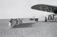
Béni Abbès Airport
Béni Abbès Airport is a public use airport located 2 kilometres (1.2 mi) east of Béni Abbès, a city in the Béchar Province of Algeria. The sand runway and ramp were paved sometime after 2007.[2]
Béni Abbès Airport مطار بني عباس | |||||||||||
|---|---|---|---|---|---|---|---|---|---|---|---|
 | |||||||||||
| Summary | |||||||||||
| Airport type | Public | ||||||||||
| Serves | Béni Abbès, Algeria | ||||||||||
| Elevation AMSL | 1,637 ft / 499 m | ||||||||||
| Coordinates | 30°7′32″N 2°8′14″W | ||||||||||
| Map | |||||||||||
 Béni Abbès Location of Béni Abbès Airport in Algeria | |||||||||||
| Runways | |||||||||||
| |||||||||||
Source: Landings.com[1] | |||||||||||
The Beni Abbes VOR-DME (Ident: BBS) and non-directional beacon (Ident: BBS) are located on the field.[3][4]
See also
 Aviation portal
- Transport in Algeria
- List of airports in Algeria
References
- "KBA @ aerobaticsweb.org". Landings.com.
- "Google Maps". Google Maps. Retrieved 2018-08-20.
- "Beni Abbes NDB". World Aero Data. Retrieved 30 November 2018.
- "Beni Abbes VOR". World Aero Data. Retrieved 30 November 2018.
- Google Earth Historical Image - Béni Abbès
This article is issued from Wikipedia. The text is licensed under Creative Commons - Attribution - Sharealike. Additional terms may apply for the media files.
