Baýramaly
Baýramaly (formerly Bayram-Ali, Turkmen: Baýramaly) is a city of Turkmenistan, a seat of Baýramaly District within Mary Province. It lies about 27 km east of the provincial capital Mary, along the main railway line from Ashgabat to Tashkent. In 2009, it had a population estimated at 88,486 (up from 43,824 in the 1989 census).[1]
Baýramaly | |
|---|---|
 Baýramaly in the late 1800s | |
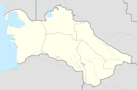 Baýramaly Location in Turkmenistan | |
| Coordinates: 37°37′N 62°09′E | |
| Country | |
| Province | Mary Province |
| District | Baýramaly District |
| Elevation | 233 m (764 ft) |
| Population (2009) | |
| • Total | 88,486 |
| Time zone | UTC+5 (+5) |
The city is located in a dry oasis in the Murgab. It is a climatic spa and the visitors are often sent to the city for the treatment of chronic kidney disease, acute forms of nephritis and nephrosis, hypertension, renal tuberculosis and problems of blood circulation.[2]
Climate
Baýramaly has a cold semi-arid climate (Köppen climate classification BSk), with cool winters and very hot summers. Rainfall is generally light and erratic, and occurs mainly in the winter and autumn months.
| Climate data for Baýramaly | |||||||||||||
|---|---|---|---|---|---|---|---|---|---|---|---|---|---|
| Month | Jan | Feb | Mar | Apr | May | Jun | Jul | Aug | Sep | Oct | Nov | Dec | Year |
| Record high °C (°F) | 28.0 (82.4) |
31.8 (89.2) |
37.0 (98.6) |
40.5 (104.9) |
50.0 (122.0) |
50.0 (122.0) |
47.5 (117.5) |
45.7 (114.3) |
44.0 (111.2) |
39.6 (103.3) |
35.2 (95.4) |
29.0 (84.2) |
50.0 (122.0) |
| Average high °C (°F) | 8.4 (47.1) |
11.4 (52.5) |
16.9 (62.4) |
24.7 (76.5) |
31.4 (88.5) |
36.2 (97.2) |
38.1 (100.6) |
36.1 (97.0) |
31.0 (87.8) |
24.1 (75.4) |
16.8 (62.2) |
10.3 (50.5) |
23.8 (74.8) |
| Daily mean °C (°F) | 1.9 (35.4) |
4.6 (40.3) |
9.9 (49.8) |
17.2 (63.0) |
23.6 (74.5) |
28.5 (83.3) |
30.5 (86.9) |
28.1 (82.6) |
22.1 (71.8) |
15.0 (59.0) |
8.7 (47.7) |
4.0 (39.2) |
16.2 (61.1) |
| Average low °C (°F) | −2.7 (27.1) |
−0.5 (31.1) |
4.1 (39.4) |
10.2 (50.4) |
15.3 (59.5) |
19.5 (67.1) |
21.7 (71.1) |
19.2 (66.6) |
12.9 (55.2) |
7.0 (44.6) |
2.1 (35.8) |
−1.0 (30.2) |
9.0 (48.2) |
| Record low °C (°F) | −26.3 (−15.3) |
−24.8 (−12.6) |
−16.8 (1.8) |
−3.6 (25.5) |
2.2 (36.0) |
7.6 (45.7) |
11.7 (53.1) |
7.4 (45.3) |
−1.8 (28.8) |
−8.3 (17.1) |
−21.5 (−6.7) |
−23.0 (−9.4) |
−26.3 (−15.3) |
| Average precipitation mm (inches) | 28.7 (1.13) |
24.9 (0.98) |
35.3 (1.39) |
26.0 (1.02) |
13.3 (0.52) |
1.1 (0.04) |
0.1 (0.00) |
0.1 (0.00) |
0.8 (0.03) |
6.7 (0.26) |
13.6 (0.54) |
23.2 (0.91) |
173.8 (6.82) |
| Average precipitation days (≥ 0.1 mm) | 7.2 | 6.2 | 5.9 | 3.8 | 2.3 | 0.5 | 0.2 | 0.3 | 0.3 | 2.2 | 5.1 | 6.1 | 40.1 |
| Average relative humidity (%) | 73.5 | 67.3 | 57.7 | 51.6 | 40.6 | 31.7 | 30.3 | 29.4 | 34.7 | 46.1 | 63.1 | 72.8 | 49.9 |
| Mean monthly sunshine hours | 129.7 | 137.4 | 168.9 | 217.2 | 304.7 | 356.2 | 371.7 | 355.0 | 302.4 | 249.0 | 185.1 | 128.7 | 2,906 |
| Source 1: climatebase.ru[3] | |||||||||||||
| Source 2: NOAA (sun only, 1961-1990)[4] | |||||||||||||
Economy
The economy is based around food and construction materials industries.[2] Natural gas is also extracted in the area.
Sights
People
- Mähri Hojaniyazova
- Suleyman Nazarov Berdiyevich
- Dzhamaldin Khodzhaniyazov
References
- Population census 1989 Archived 2012-02-04 at WebCite, Demoscope Weekly, No. 359-360, 1–18 January 2009 (search for Туркменская ССР) (in Russian)
- Great Soviet Encyclopedia (in Russian)
- "Bayram-Ali, Turkmenistan". Climatebase.ru. Retrieved 10 February 2013.
- "Climate Normals for Bayramaly". National Oceanic and Atmospheric Administration. Retrieved 10 February 2013.
