Bandadka
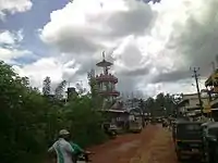
Bandadka is a Small Town in Kasaragod district in the state of Kerala, India. Which is also called as kottakal because of Bandadka Fort.It comes under Kuttikol Panchayath. It belongs to North Kerala Division . It is located 37 km towards East from District headquarters Kasaragod and 592 km from State capital Thiruvananthapuram.Bandadka Pin code is 671541 and postal head office is Chengala.[1]
Bandadka
Kottakkal | |
|---|---|
Small Town | |
 | |
 Bandadka Location in Kerala, India  Bandadka Bandadka (India) | |
| Coordinates: 12°30′0″N 75°16′0″E | |
| Country | |
| State | Kerala |
| District | Kasaragod |
| Government | |
| • Body | Kuttikkol Grama Panchayath |
| Population (2001) | |
| • Total | 7,740 |
| Languages | |
| • Official | Malayalam, English |
| Time zone | UTC+5:30 (IST) |
| Vehicle registration | KL-14 |
Demographics
As of 2001 India census, Bandadka is a small Village/hamlet in Kasargod Block in Kasaragod District of Kerala State, India. It comes under Kuttikol Panchayath. It belongs to North Kerala Division . It is located 35 km towards East from District headquarters Kasaragod. 29 km from Kasargod. 564 km from State capital Thiruvananthapuram. Bandadka Pin code is 671541 and postal head office is Chengala.
Paduppu (2 km),Panathur (15 km),Kuttikole (8 km)and Sullia (20 km) (in Karnataka State) are the nearby towns to Bandadka. Bandadka is surrounded by Sulya Block towards East, Kasargod Block towards west, Puttur Block towards North, Nileshwar Block towards South .
Bandadka has a population of 7740 with 3877 males and 3863 females. Local Language is Malayalam. Some residents also speak Kannada and Tulu languages. Bandadka Village Total population is 7824 and number of houses are 1849. Female Population is 50.2%. Village literacy rate is 78.5% and the Female Literacy rate is 37.7%. [1] Subramanya temple is in Bandadka. It is an agriculture based village.
Transportation
Bandadka is Situated between Poinachi - Aletty- Sullia road. Mysore and Bangalore can easily get by these road. Private and ksrtc Buses provide routes to Kasaragod, Kanhangad, Panathur, Mangalore and Kannur. The Nearest Railway station is Kasaragod and Kanhangad on Mangalore-Palakkad line. There are Airports at Mangalore International Airport in North and Kannur International Airport in South.
References
| Wikimedia Commons has media related to Bandadka. |
- "Census of India : Villages with population 5000 & above". Registrar General & Census Commissioner, India. Archived from the original on 8 December 2008. Retrieved 10 December 2008.