Palakkad
Palakkad ![]() pronunciation , also known as Palghat, is a city and municipality in the state of Kerala in India. It is spread over an area of 26.60 square kilometres (10.27 sq mi). It is the administrative headquarters of the Palakkad District. The city is situated about 350 kilometres (220 mi) north of state capital Thiruvananthapuram, 50 kilometres (31 mi) southwest of Coimbatore in Tamil Nadu, and 66 kilometres (41 mi) northeast of Thrissur on the Salem-Kochi National Highway NH 544. Palakkad is also known as the rice bowl of Kerala. The 18th-century Palakkad Fort has sturdy battlements, a moat, and a Hanuman temple on its grounds. North on the Kalpathy River, the 15th-century Viswanatha Swamy Temple is the main venue of the Ratholsavam chariot festival. Northeast, near Malampuzha Dam, the town of Malampuzha has a rock garden created from recycled materials.
pronunciation , also known as Palghat, is a city and municipality in the state of Kerala in India. It is spread over an area of 26.60 square kilometres (10.27 sq mi). It is the administrative headquarters of the Palakkad District. The city is situated about 350 kilometres (220 mi) north of state capital Thiruvananthapuram, 50 kilometres (31 mi) southwest of Coimbatore in Tamil Nadu, and 66 kilometres (41 mi) northeast of Thrissur on the Salem-Kochi National Highway NH 544. Palakkad is also known as the rice bowl of Kerala. The 18th-century Palakkad Fort has sturdy battlements, a moat, and a Hanuman temple on its grounds. North on the Kalpathy River, the 15th-century Viswanatha Swamy Temple is the main venue of the Ratholsavam chariot festival. Northeast, near Malampuzha Dam, the town of Malampuzha has a rock garden created from recycled materials.
Palakkad
Palghat | |
|---|---|
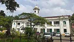
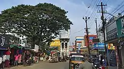
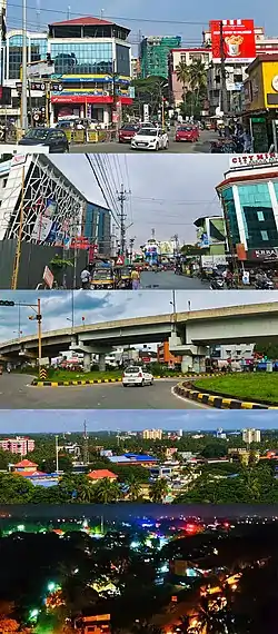 From top clockwise: IMA Junction,Near KSRTC Bus Stand,Chandranagar roundabout, Aerial view from Olavakode, Palakkad City Night View | |
 Palakkad  Palakkad  Palakkad .svg.png.webp) Palakkad | |
| Coordinates: 10.775°N 76.651°E | |
| Country | |
| State | |
| District | Palakkad |
| Government | |
| • Type | Municipality |
| • Body | Palakkad Municipality |
| • Chairperson | K.Priya Ajayan (BJP) |
| • Deputy Chairman | E. Krishnadas (BJP) |
| • Member of Parliament | V. K. Sreekandan |
| Area | |
| • City | 26.60 km2 (10.27 sq mi) |
| • Metro | 1,363 km2 (526 sq mi) |
| Elevation | 84 m (276 ft) |
| Population (2011) | |
| • City | 130,955 |
| • Density | 4,900/km2 (13,000/sq mi) |
| • Metro | 293,533 |
| Demonym(s) | Palakkadan |
| Language | |
| • Official | Malayalam |
| Time zone | UTC+5:30 (IST) |
| Postal Index Number | 678 XXX |
| Area code(s) | +91-(0)491 |
| Vehicle registration | KL-09 |
| Climate | Am/Aw (Köppen) |
| Website | www |
Etymology
The commonly held belief is that the name Palakkad is a fusion of two Malayalam words: Pala, which was the name given to barren land during the Sangam period, and Kadu, which means forest.[3]
Geography

Palakkad is the gateway to Kerala due to the presence of the Palakkad Gap in the Western Ghats. Malayalam is the official language in Palakkad. The district has many small and medium rivers, which are tributaries of the Bharathapuzha River. Of the numerous dams in Palakkad district, the largest Malampuzha dam is 12 kilometres (7.5 mi) from Palakkad city.[4]
Climate
Palakkad has a tropical wet and dry climate. Temperatures remain moderate throughout the year, with the exception being March and April, the hottest months. A very high amount of precipitation is received in Palakkad, mainly due to the South-West monsoon. July is the wettest month, and the total annual rainfall is around 83 inches (210 cm).
| Climate data for Palakkad (1981–2010, extremes 1943–2005) | |||||||||||||
|---|---|---|---|---|---|---|---|---|---|---|---|---|---|
| Month | Jan | Feb | Mar | Apr | May | Jun | Jul | Aug | Sep | Oct | Nov | Dec | Year |
| Record high °C (°F) | 37.6 (99.7) |
40.0 (104.0) |
41.4 (106.5) |
41.8 (107.2) |
41.2 (106.2) |
40.4 (104.7) |
33.6 (92.5) |
33.8 (92.8) |
35.8 (96.4) |
36.2 (97.2) |
38.0 (100.4) |
36.6 (97.9) |
41.8 (107.2) |
| Average high °C (°F) | 32.7 (90.9) |
35.2 (95.4) |
37.3 (99.1) |
36.6 (97.9) |
34.5 (94.1) |
29.9 (85.8) |
28.8 (83.8) |
28.9 (84.0) |
30.4 (86.7) |
31.5 (88.7) |
31.6 (88.9) |
31.5 (88.7) |
32.4 (90.3) |
| Average low °C (°F) | 22.0 (71.6) |
22.4 (72.3) |
24.1 (75.4) |
25.0 (77.0) |
24.8 (76.6) |
23.2 (73.8) |
22.6 (72.7) |
23.0 (73.4) |
23.0 (73.4) |
23.1 (73.6) |
23.1 (73.6) |
22.3 (72.1) |
23.2 (73.8) |
| Record low °C (°F) | 15.6 (60.1) |
15.8 (60.4) |
18.6 (65.5) |
18.8 (65.8) |
19.2 (66.6) |
19.0 (66.2) |
18.8 (65.8) |
19.2 (66.6) |
19.4 (66.9) |
15.8 (60.4) |
16.1 (61.0) |
14.0 (57.2) |
14.0 (57.2) |
| Average rainfall mm (inches) | 3.6 (0.14) |
3.6 (0.14) |
15.7 (0.62) |
61.3 (2.41) |
125.1 (4.93) |
410.6 (16.17) |
453.2 (17.84) |
290.3 (11.43) |
154.9 (6.10) |
196.1 (7.72) |
102.3 (4.03) |
21.3 (0.84) |
1,838 (72.36) |
| Average rainy days | 0.3 | 0.3 | 0.9 | 3.3 | 5.9 | 18.7 | 20.0 | 15.8 | 9.2 | 10.1 | 4.7 | 0.9 | 90.1 |
| Average relative humidity (%) (at 17:30 IST) | 46 | 39 | 38 | 52 | 60 | 79 | 82 | 81 | 75 | 73 | 65 | 56 | 61 |
| Source: India Meteorological Department[5][6] | |||||||||||||
Transport
Air
The nearest international airport is Coimbatore International Airport, which is about 62 kilometres (39 mi) from Palakkad. However, Cochin International Airport and Calicut International Airport serve the city as well.
There has been a proposal for a mini domestic airport at East Yakkara with respect to setting up domestic airports for enhanced air connectivity by the civil aviation ministry of India. 60 acres has been identified for the project at East Yakkara Palakkad.[7]
Railways

Palakkad is the HQ of the Palakkad Railway Division of Southern Railway Zone. The city is served by two railway stations – Palakkad Junction is a broad gauge railway junction (located at Olavakkode, about 4 km from Municipal bus stand) and Palakkad Town railway station located in the heart of the Palakkad city. The cities of Coimbatore, Tiruppur, Erode, Salem, Thiruvananthapuram, Kollam, Mangalore, Kozhikode and Ernakulam are connected by the broad gauge line. Train services to Pollachi, Dindigul and Madurai are through the broad gauge line through Palakkad Town station.[8]
Road
Palakkad is well connected by roads. The National Highway 544 from Salem to Ernakulam via Coimbatore, Palakkad and Thrissur – Kozhikode National Highway 966 via Malappuram pass through the district.[9] City has four bus stands, of which three are for private bus service and one is KSRTC bus stand.

Demographics
As per Census 2011, population of Palakkad in 2011 is 130,955; of which male and female are 63,833 and 67,122 respectively.[10]
Total literates in Palakkad city are 112,479 of which 56,065 are males while 56,414 are females. Average literacy rate of Palakkad city is 94.20 percent of which male and female literacy was 96.83 and 91.73 percent.The literacy rate of the Palakkad Metropolitan Area is 92.14%, much higher than the national average of 59.5%.[11][12]
Hindus form 68% of the population with 89098 members.[10] Muslims constitute 27.9% of the population with 36620 members.[10] Christians constitute 3.8% of the population with 5006 members.[10]
Governance
On 3 July 1866, the Governor of Madras declared Palakkad as a city.[13] On 11 September 1912, the system of electing the city father by the councillors began.[13] City Council expanded to 28 wards in 1938, 32 wards in 1973 and 36 wards in 1978.[13]
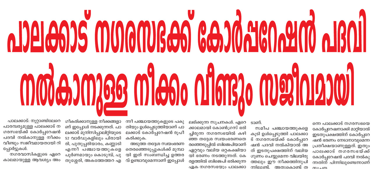
Proposed Palakkad Municipal Corporation
The metropolitan area of Palakkad includes Hemambikanagar, Marutharode, Palakkad municipality, Pirayiri, Pudussery Central, Pudussery West, and Puthuppariyaram.[12] Its urban / metropolitan population is 293,566 of which 143,650 are males and 149,916 are females. There is demand to upgrade Palakkad Municipality into a Municipal Corporation by adding the Outgrowth areas and nearby Urban Local bodies to the Palakkad Corporation.
- Palakkad Municipality
- Hemambikanagar
- Piriyari Grama Panchayath
- Marutharoad Panchayth
- Puduppariyaram Panchayath
- Pudussery Central
- Pudussery West
- Mathur Panchayath
- Kodumba Panchayath
- Kannadi (Urban areas only)
- Akathethara (Urban areas only)
- Malampuzha (excluding rural and forest areas)[14]
Education in Palakkad
Palakkad City has number of Prominent Educational Institutions which provide a great platform for higher education., IIT Palakkad[15]]s a public autonomous engineering and research institute located in Palakkad, Kerala. It is one of the five new IITs proposed in the 2014 Union budget of India. Victoria College in Palakkad is the oldest institution of higher learning in the Malabar region of Kerala. Government Medical College, Palakkad[16] is started in 2014 is the first Government medical college in the district.NSS College of Engineering[17] at Akathethara, is the Fourth Engineering Institution established in Kerala, India.Chembai Memorial Government Music College[18] is one of the main centres of excellence in teaching carnatic music in the state. Mercy College, Palakkad[19] a women's college established in 1964 is one of the familiar institution in city. Apart from these institutions other several Government & Private Schools and Colleges also present in and around the city.
Prominent People from Palakkad
- Kocheril R. Narayanan (former president of india)
- P. R. Pisharoty (Kollengode, Father of remote sensing in India)
- Vidya Balan
- Kunjan Nambiar
- Olappamanna
- M T Vasudevan Nair
- O V Vijayan
- Akkitham Achuthan Namboothiri
- Malayattoor Ramakrishnan
- Shashi Tharoor
- Kuttikrishna Marar
- O M C Narayanan Nambudiripad
- Anita Nair
- K. S. Sethumadhavan
- Shankar Mahadevan (Playback Singer and Composer)
- O.Rajagopal
- M. G. Ramachandran
- P. Unnikrishnan
Sports in Palakkad
Palakkad has a very rich history of producing some world class athletes in the state, Palakkad, Indira Gandhi Municipal Stadium in the center of city was once used for Major sports meets and football matches in state, now the stadium is not in condition for conducting games due to the lack of maintenance, There is a proposal for the renovation of the stadium with international facilities by the Municipality ,[20] The city has Fort Maidan[21] also known as Kota Maidanam, is a multi-use stadium in the center of the Palakkad, India. It is currently used mostly for cricket matches. The Fort Maidan holds a maximum capacity of 10,000 peoples at a time. Up till 2002 the ground was considered for local cricket only.[22] In 2003, Ranji Trophy was introduced in Fort Maidan. Now Fort Maidan is a regular venue for first class cricket. Many famous state level cricket matches were held in this stadium Indoor stadium. There is a Indoor Stadium is under construction in the City, There are decent number of Football grounds are also present in and around the City.
References
- "Thiruvananthapuram Corporation General Information". Corporation of Thiruvananthapuram. Retrieved 10 July 2018.
- "Urban Agglomerations/Cities having population 1 million and above" (PDF). Office of the Registrar General & Census Commissioner. Ministry of Home Affairs, Government of India. Retrieved 9 July 2018.
- A. Sreedhara Menon (1978). Kerala Samskāram. DC Books. p. 237. ISBN 9788126415854.
- Fact sheet on Indian dams at Diehardindian.com Archived 2006-12-13 at the Wayback Machine
- "Station: Palakkad (Palghat) Climatological Table 1981–2010" (PDF). Climatological Normals 1981–2010. India Meteorological Department. January 2015. pp. 581–582. Archived from the original (PDF) on 5 February 2020. Retrieved 29 February 2020.
- "Extremes of Temperature & Rainfall for Indian Stations (Up to 2012)" (PDF). India Meteorological Department. December 2016. p. M109. Archived from the original (PDF) on 5 February 2020. Retrieved 29 February 2020.
- "60 Acres Identified For Airport Project". The Hindu. Chennai, India. 21 May 2011.
- "Train services resume on Pollachi – Palakkad section". Coimbatore. The Hindu. 17 November 2015. Retrieved 25 November 2015.
- "National Highways and their lengths" Archived 6 September 2012 at the Wayback Machine. National Highways Authority of India. Retrieved 4 September 2015.
- http://www.censusindia.gov.in/2011census/C-01/DDW32C-01%20MDDS.XLS
- "Palakkad – Census of India". Censusindia.gov.in. Retrieved 4 September 2015.
- "Palakkad Urban Region". Census2011.co.in. Retrieved 4 September 2015.
- "ആമുഖം | Palakkad Municipality". web.archive.org. 30 December 2019. Retrieved 15 September 2020.
- https://i.postimg.cc/MHwqnmBg/19-2-19p1.jpg
- https://iitpkd.ac.in/
- http://www.gmcpalakkad.in/
- Official website
- http://www.cmgmusiccollege.org/index.php?option=com_content&view=article&id=19&Itemid=27
- https://web.archive.org/web/20170916095650/http://www.universityofcalicut.info/affiliated_colleges/2016_Affiliated_Colleges_and_courses_latest_list_on24May2016.pdf
- https://english.mathrubhumi.com/sports/sports-news/palakkad-municipal-stadium-turns-into-dump-yard-covered-with-weeds-1.3209529
- https://www.espncricinfo.com/india/content/ground/58364.html
- https://cricketarchive.com/Archive/Grounds/14/1962.html
External links
| Wikimedia Commons has media related to Palakkad. |
 Palakkad travel guide from Wikivoyage
- http://www.palakkad.gov.in – Official Website of Palakkad District Administration
- http://www.palakkadtourism.org – Palakkad District Tourism-Information
| States/UTs | |
|---|---|
| Districts |
|
| Taluks | |
| Municipal Corporations |
|
| Municipalities |
|
| Other towns |
|
| Historical regions | |
