Banks, Oregon
Banks is a city in Washington County, Oregon, United States which is located in the Tualatin Valley. It is the southern anchor to the Banks–Vernonia State Trail, which is a 21-mile (34 km) long linear trail popular with bicyclists, hikers, and equestrians. The population was 1,777 at the 2010 census.[2] The community was named for John and Nancy Banks, who owned a nearby dairy farm.[5] Incorporated in 1921, it is located in the western part of the county where Oregon Route 6 intersects Oregon Route 47.
Banks, Oregon | |
|---|---|
 City Hall in Banks | |
 Location in Oregon | |
 Banks, Oregon Location in the United States | |
| Coordinates: 45°36′51″N 123°6′39″W | |
| Country | United States |
| State | Oregon |
| County | Washington |
| Incorporated | January 16, 1906 |
| Government | |
| • Mayor | Pete Edison |
| Area | |
| • Total | 0.76 sq mi (1.97 km2) |
| • Land | 0.76 sq mi (1.97 km2) |
| • Water | 0.00 sq mi (0.00 km2) |
| Elevation | 250 ft (80 m) |
| Population | |
| • Total | 1,777 |
| • Estimate (2019)[3] | 2,036 |
| • Density | 2,671.92/sq mi (1,032.21/km2) |
| Time zone | UTC-8 (Pacific) |
| • Summer (DST) | UTC-7 (Pacific) |
| ZIP codes | 97106, 97109, 97125 |
| Area code(s) | 503 |
| FIPS code | 41-03850[2] |
| GNIS feature ID | 1157952[4] |
| Website | www.cityofbanks.org |
Geography
According to the United States Census Bureau, the city has a total area of 0.37 square miles (0.96 km2), all land.[6]
Demographics
| Historical population | |||
|---|---|---|---|
| Census | Pop. | %± | |
| 1930 | 209 | — | |
| 1940 | 247 | 18.2% | |
| 1950 | 376 | 52.2% | |
| 1960 | 347 | −7.7% | |
| 1970 | 430 | 23.9% | |
| 1980 | 489 | 13.7% | |
| 1990 | 563 | 15.1% | |
| 2000 | 1,286 | 128.4% | |
| 2010 | 1,777 | 38.2% | |
| 2019 (est.) | 2,036 | [3] | 14.6% |
| U.S. Decennial Census[7] | |||

2010 census
As of the census of 2010, there were 1,777 people, 553 households, and 445 families living in the city. The population density was 4,802.7 inhabitants per square mile (1,854.3/km2). There were 580 housing units at an average density of 1,567.6 per square mile (605.3/km2). The racial makeup of the city was 92.5% White, 0.3% African American, 0.6% Native American, 1.2% Asian, 0.3% Pacific Islander, 1.4% from other races, and 3.8% from two or more races. Hispanic or Latino of any race were 7.0% of the population.[2]
There were 553 households, of which 57.1% had children under the age of 18 living with them, 59.5% were married couples living together, 13.4% had a female householder with no husband present, 7.6% had a male householder with no wife present, and 19.5% were non-families. 14.3% of all households were made up of individuals, and 2.5% had someone living alone who was 65 years of age or older. The average household size was 3.21 and the average family size was 3.54.[2]
The median age in the city was 29.5 years. 37.8% of residents were under the age of 18; 7.4% were between the ages of 18 and 24; 31.7% were from 25 to 44; 19.2% were from 45 to 64; and 3.9% were 65 years of age or older. The gender makeup of the city was 50.6% male and 49.4% female.[2]
2000 census
As of the census of 2000, there were 1,286 people, 440 households, and 337 families living in the city. The population density was 3,885.7 people per square mile (1,504.6/km2). There were 492 housing units at an average density of 1,486.6 per square mile (575.6/km2). The racial makeup of the city was 91.14% White, 0.39% African American, 0.31% Native American, 1.79% Asian, 0.47% Pacific Islander, 2.80% from other races, and 3.11% from two or more races. Hispanic or Latino of any race were 3.81% of the population.[2]
There were 440 households, out of which 50.7% had children under the age of 18 living with them, 64.1% were married couples living together, 8.6% had a female householder with no husband present, and 23.4% were non-families. 17.7% of all households were made up of individuals, and 3.2% had someone living alone who was 65 years of age or older. The average household size was 2.92 and the average family size was 3.31.[2]
In the city, the population was spread out, with 35.8% under the age of 18, 7.8% from 18 to 24, 39.9% from 25 to 44, 12.5% from 45 to 64, and 4.0% who were 65 years of age or older. The median age was 29 years. For every 100 females, there were 97.5 males. For every 100 females age 18 and over, there were 93.4 males.[2]
The median income for a household in the city was $57,500, and the median income for a family was $61,932. Males had a median income of $42,330 versus $26,818 for females. The per capita income for the city was $21,354. About 3.1% of families and 3.2% of the population were below the poverty line, including 2.1% of those under age 18 and 4.6% of those age 65 or over.[2]
Schools
The city has three public schools, which are administered by the Banks School District. The city schools are Banks Elementary School, Banks Junior High School, and Banks High School.[8]
Attractions
References
- "2019 U.S. Gazetteer Files". United States Census Bureau. Retrieved July 28, 2020.
- "U.S. Census website". United States Census Bureau. Retrieved 2012-12-21.
- "Population and Housing Unit Estimates". United States Census Bureau. May 24, 2020. Retrieved May 27, 2020.
- "US Board on Geographic Names". United States Geological Survey. 2007-10-25. Retrieved 2008-01-31.
- "About Us". City of Banks. 2009. Retrieved 2015-04-11.
- "US Gazetteer files 2010". United States Census Bureau. Archived from the original on January 24, 2012. Retrieved 2012-12-21.
- "Census of Population and Housing". Census.gov. Retrieved June 4, 2015.
- "Banks School District". Banks School District. Retrieved 2011-06-14.
External links
| Wikimedia Commons has media related to Banks, Oregon. |
Municipalities and communities of Washington County, Oregon, United States | ||
|---|---|---|
| Cities | 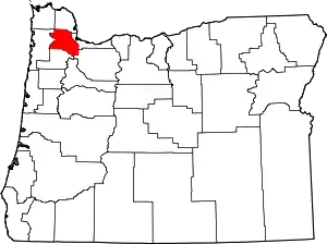 Washington County map | |
| CDPs | ||
| Unincorporated communities |
| |
| Ghost towns | ||
| Footnotes | ‡This populated place also has portions in an adjacent county or counties | |
| ||
| Authority control |
|---|