Bassenthwaite Lake
Bassenthwaite Lake is one of the largest water bodies in the English Lake District. It is long and narrow, approximately 4 miles (6.4 km) long and 0.75 miles (1 km) wide, but is also extremely shallow, with a maximum depth of about 70 ft (21 m).
| Bassenthwaite Lake | |
|---|---|
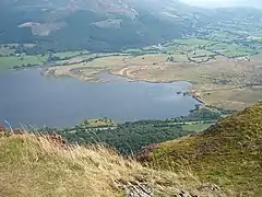
 View from Blackstock Point | |
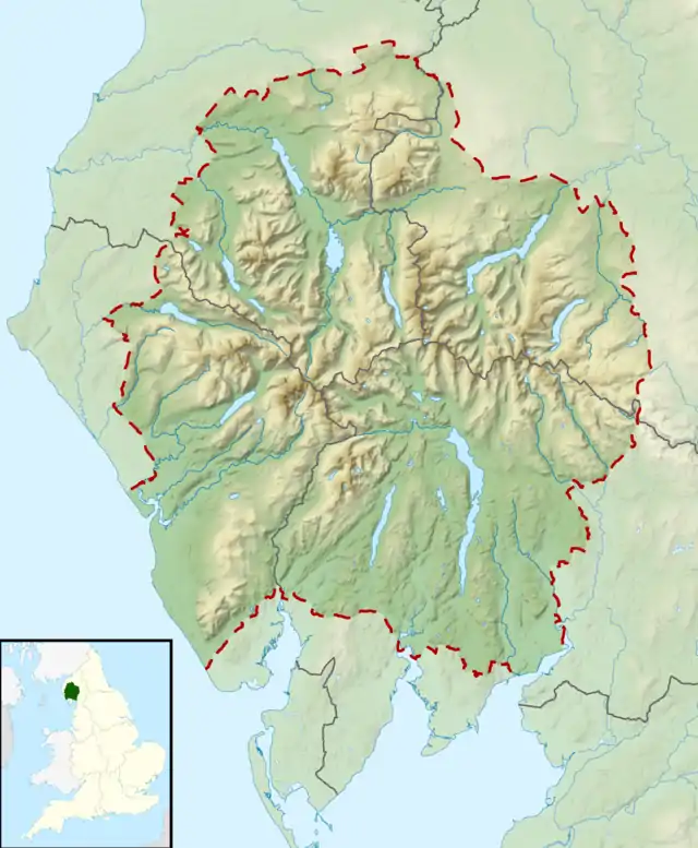 Bassenthwaite Lake Location in the Lake District National Park | |
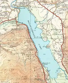 Map (1925) | |
| Location | Lake District |
| Coordinates | 54°39′N 3°13′W |
| Primary inflows | River Derwent Newlands Beck |
| Primary outflows | River Derwent |
| Catchment area | 96.5 sq mi (250 km2)[1] |
| Basin countries | United Kingdom |
| Max. length | 4 mi (6.4 km) |
| Max. width | 0.8 mi (1.3 km) |
| Surface area | 1.98 sq mi (5.1 km2) |
| Max. depth | 70 ft (21 m) |
| Shore length1 | 11.3 mi (18.2 km) |
| Surface elevation | 223 ft (68 m) |
| Islands | 0 |
| 1 Shore length is not a well-defined measure. | |

It is the only body of water in the Lake District to use the word "lake" in its name, all the others being "waters" (for example, Derwentwater), "meres" (for example, Windermere) or "tarns" (for example, Dock Tarn). It is fed by, and drains into, the River Derwent. The lake lies at the foot of Skiddaw, near the town of Keswick. Some maps dating from the 18th century do in fact mark this lake with the name Bassenwater, and the use of the name Broadwater for this lake is also attested.
The A66 dual carriageway runs roughly north/south along the western side of the lake. The lay-bys are popular spots for photographers and bird watchers looking for osprey. The section running south towards Keswick was built along the course of the former Cockermouth, Keswick and Penrith railway line.
Origin
Like the other Lake District lakes, Bassenthwaite Lake lies in a glacially eroded valley, left after the last glaciation. Bassenthwaite Lake is linked to Derwent Water by the River Derwent, which crosses the 3 miles (5 km) alluvial plain between the two lakes. There has been speculation that Derwent Water and Bassenthwaite Lake were once one larger lake with the alluvial flats now separating them formed from partial infill of the original basin.
Etymology
'Bassenthwaite' is "'Bastun's clearing', pers.[onal] n.[ame] plus 'þveit' 'clearing', also 'common', 'lake'. The 1st el[ement] is usually taken to be the Anglo-French nickname or surname 'Bastun', originally meaning 'stick', while the 2nd is ON 'þveit' 'clearing'. The lake, in early times known as 'Bastun's water', takes its name from the village." [2] (ON=Old Norse).
Biodiversity
The lake's catchment is the largest of any lake in the Lake District. This, along with a large percentage of cultivable land within this drainage area, makes Bassenthwaite Lake a fertile habitat.
The lake contains salmon, trout, pike, perch, minnow, dace, ruffe and eel, though the predominant species is roach, which is believed to have been introduced in the form of discarded live-baits by visiting pike anglers. Also present was the vendace, until it was declared extinct within the lake in 2001.
Birdlife
Cormorants have been known to fish the lake and herons can also be seen; at the turn of the 19th century there was a report of 60 nests in a heronry in nearby Wythop Woods.
Threats
Water quality is adversely affected by high sediment deposition, and there are other problems such as phosphate pollution. These issues are being addressed via the Bassenthwaite Lake Restoration Programme.[4][5] To reduce the sediment entering the lake more trees have been planted alongside watercourses, and clear felling of existing tree cover has been discouraged with the cooperation of the Forestry Commission.
Phosphates encourage algae formation.[4] The Environment Agency attributed unacceptable levels of phosphate in the catchment to Keswick wastewater treatment works, Greta Grove pumping station and the associated overflow.[6] Water company United Utilities was fined £27,000 in 2011 for allowing raw sewage to pollute nearby Pow Beck watercourse.[7] The company's £20 million sewer improvement scheme, begun in 2011, aims to improve water quality in the River Greta[8] and the lake itself.[9] The project will facilitate removal of greater quantities of phosphates.[10] Works to upgrade the wastewater treatment works and pumping station were begun in May 2010.[6]
Neolithic era
It has been reported that the wide gravel spreads between Derwent Water and Bassenthwaite Lake provided the best centre within Lakeland for Neolithic farming communities. Stone axes have been found in the area and particularly at Mossgarth, Portinscale.
References
- "Lakes - treating the land to fix the water". nationalparks.gov.uk. Archived from the original on 23 March 2012. Retrieved 15 February 2012.
Bassenthwaite Lake [...] catchment area of 250km sq [...]
- Whaley, Diana (2006). A dictionary of Lake District place-names. Nottingham: English Place-Name Society. pp. lx, 423 p.20. ISBN 0904889726.
- Ospreywatch, Lake District Osprey Project
- Lewes, Martin (17 May 2010). "Progress in campaign to reduce Lake District pollution". BBC News. Retrieved 15 February 2012.
The Bassenthwaite Lake Restoration Project is now reaching its first decade [...] Phosphates enrich the water, with the most visible result being blooms of algae [...]
- "River Basin Management Plan North West River Basin District" (PDF). Water for life and livelihoods. Environment Agency. December 2009. p. 76. Archived from the original (PDF) on 15 December 2010. Retrieved 15 February 2012.
the Environment Agency will work with partners to improve lakes, meres and reservoirs through: Implementing the actions of the five-year programme for the Bassenthwaite Lake Restoration programme and Windermere Catchment Restoration Programme [...]
- "Wastewater scheme will help restore lake". Cumberland and Westmorland Herald. 15 October 2010. Retrieved 15 February 2012.
Keswick wastewater treatment works, Greta Grove pumping station and the associated overflow have been identified by the Environment Agency as having contributed to unacceptable levels of phosphate in the Bassenthwaite Lake catchment. In May, United Utilities began work on the scheme to upgrade the wastewater treatment works and resolve the problem of the Greta Grove pumping station.
- "United Utilities fined £27,000 for Keswick sewage leaks". BBC News. 25 November 2011. Retrieved 15 February 2012.
[...] two leaks into the Pow Beck watercourse in Keswick [...]
- "Keswick project overview". United Utilities. Retrieved 15 February 2012.
[...] designed to improve the quality of water in the River Greta and Bassenthwaite Lake.
- "Keswick's £23m sewer revamp gets under way". BBC News. 19 September 2011. Retrieved 15 February 2012.
The United Utilities project aims to improve the public network, lessen the risk of flooding, and improve water quality of Bassenthwaite Lake.
- "£20m Keswick pollution project to benefit lake". Cumberland News. 26 August 2011. Archived from the original on 20 April 2013. Retrieved 15 February 2012.
[...] allowing it to treat larger amounts of water and remove greater quantities of dangerous phosphates.
Sources
- A Topographical Dictionary of England (1848)
External links
| Wikimedia Commons has media related to Bassenthwaite Lake. |
- Bassenthwaite entry at VisitCumbria
- Bassenthwaite Restoration Project
- Bassenthwaite Sailing Club
- Parliamentary questions and answers on pollution in the Lake
- Cockermouth, Keswick & Penrith Historic Rail Line
|
| Authority control |
|
|---|