Derwentwater
Derwentwater, or Derwent Water, is one of the principal bodies of water in the Lake District National Park in north west England. It lies wholly within the Borough of Allerdale, in the county of Cumbria.
| Derwentwater | |
|---|---|
 Derwentwater | |
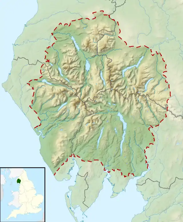 Derwentwater Location in the Lake District National Park | |
| Location | Lake District, England |
| Coordinates | 54°35′N 3°09′W |
| Primary inflows | River Derwent, Watendlath Beck, Brockle Beck |
| Primary outflows | River Derwent |
| Basin countries | United Kingdom |
| Max. length | 4.6 km (2.9 mi)[1] |
| Max. width | 1.91 km (1.19 mi)[1] |
| Surface area | 2 sq mi (5.2 km2) |
| Average depth | 5.5 m (18 ft)[1] |
| Max. depth | 22 m (72 ft)[1] |
| Water volume | 29 million cubic metres (1.0×10⁹ cu ft)[1] |
| Residence time | 55 days[1] |
| Shore length1 | 9.6 mi (15.4 km) |
| Surface elevation | 75 metres (246 ft) |
| Islands | 4 plus 9 small (13) |
| References | [1] |
| 1 Shore length is not a well-defined measure. | |

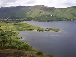
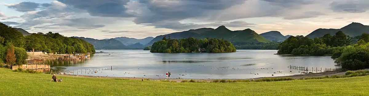
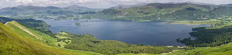
The lake occupies part of Borrowdale and lies immediately south of the town of Keswick. It is both fed and drained by the River Derwent. It measures approximately 3 miles (4.8 km) long by 1 mile (1.6 km) wide and is some 72 feet (22 m) deep. There are several islands within the lake, one of which is inhabited. Derwent Island House, an 18th-century residence, is a tenanted National Trust property open to the public on five days each year.

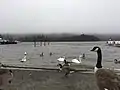
Derwentwater is a place of considerable scenic value. It is surrounded by hills (known locally as fells), and many of the slopes facing Derwentwater are extensively wooded. A regular passenger launch operates on the lake, taking passengers between various landing stages. There are seven lakeside marinas, the most popular stops being Keswick, Portinscale and the Lodore Falls, from which boats may be hired. Recreational walking is a major tourist activity in the area and there is an extensive network of footpaths in the hills and woods surrounding the lake.
The Keswick to Borrowdale road runs along the eastern shore of the lake and carries a regular bus service. There is a lesser, or unclassified, road along the western shore connecting the villages of Grange and Portinscale.
Derwentwater gave its name to the Earldom of Derwentwater.
From 2008 to 2014, the lake was believed to be the last remaining native habitat of the vendace (Coregonus vandesius) fish from the four originally known sites: Bassenthwaite Lake and Derwentwater in the Lake District, and the Castle Loch & Mill Loch in Lochmaben.[2] However, a breeding population was discovered at Bassenthwaite Lake by conservationists in September 2014.[3]
Etymology
'Derwent' is " '(River) with oak trees', traditionally explained from Brit." (i.e.: Brythonic Celtic) or Cymric Old Welsh, hence Cymria " 'derwā' 'oak' plus suffixes, hence of the same origin as other English rivers named Derwent, Darwen, Darent and Dart...The river gave its name to Derwent Water (which was also known as the 'Lake of Derwent', 'Keswick Lake', or 'Keswick Water' in the 18th-19th centuries)...".[4] Plus "OE 'wæter', with the meaning probably influenced by its ON relative 'vatn'."[5]
Derwentwater's islands
There are numerous islands in Derwentwater, the largest being Derwent Island, Lord's Island, St Herbert's Island, Rampsholme Island, Park Neb, Otter Island, and Otterbield Island. St. Herbert's Island is named after a 7th century hermit priest; Herbert of Derwentwater.
National Trust centenary stones
At Calfclose Bay on the shore of the lake is a sculpture by Peter Randall-Page,[6] commissioned by the National Trust in 1995 to commemorate the centenary of its founding. It was made from a large boulder of volcanic Borrowdale stone, sawn in half with each face carved into ten segments in a fan arrangement.[7]
In Literature
Letitia Elizabeth Landon's poetical illustration Derwent Water is attached to a plate of Derwent Water, from the Castle Head, Cumberland (artist Thomas Allom) in Fisher's Drawing Room Scrap Book, 1837.
| Wikisource has original text related to this article: |
In popular culture
Slightly cropped and color hue-edited real photo with an open view of the Derwentwater was used by Team Silent as a backdrop image at the very beginning of the Konami's "Silent Hill 2" video game, to serve as a higher ground touristic observational viewpoint of the fictional "Toluca Lake" (not to be confused with Toluca Lake, Los Angeles) in the local area encompassing the fictional eponymous town of "Silent Hill", Maine.
The album artwork for the 2010 album Black Sands by Bonobo features a photograph taken of Derwentwater. The tower in the background is located in Castlerigg (54°35′29.95″N 3°7′3.43″WCoordinates: 54°35′29.95″N 3°7′3.43″W).
Gallery
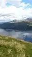 From Cat Bells
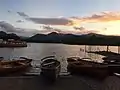
Panoramas
References
- McNamara, Jane, Table of lake facts, Environment Agency of England and Wales, archived from the original on 28 June 2009, retrieved 13 November 2007
- "Ice Age fish thrives in new home". BBC News. 27 February 2008. Retrieved 1 May 2010.
- "Extinct fish found in the Lake District after millions is spent on clean-up work".
- Whaley, Diana (2006). A dictionary of Lake District place-names. Nottingham: English Place-Name Society. pp. lx, 423 p.95. ISBN 0904889726.
- Whaley, 2006, p.422
- "Hundred Year Stone". Peter Randall-Page. Retrieved 7 August 2019.
- "The National Trust Centenary Stone from Keswick". WalkLakes. Retrieved 7 August 2019.
External links
- The Cumbria Directory - Derwent Water
- Lake District Walks - Derwent Water Keswick
- Robin Pecknold - "Derwentwater stones"
 Media related to Derwent Water at Wikimedia Commons
|
| Authority control |
|
|---|