Bengkalis Regency
Bengkalis Regency is a regency of Indonesia in the Riau province. The regency, which includes the whole of Bengkalis and Rupat Islands in the Strait of Malacca, has been established since 1956. The regency was formerly divided into 13 districts (or kecamatan); however five of these districts were removed to create the new Meranti Islands Regency, leaving eight districts in the Bengkalis Regency.
Bengkalis Regency
(Kabupaten Bengkalis) | |
|---|---|
 The Regency Office of Bengkalis | |
 Flag  Coat of arms | |
| Motto(s): Negeri Junjungan | |
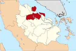 Location of Bengkalis Regency in Riau province | |
| Coordinates: 1°29′23″N 102°4′47″E | |
| Country | Indonesia |
| Province | Riau |
| Regency seat | Bengkalis |
| Government | |
| • Regent | H. Bustami HY (acting) |
| • Vice Regent | vacant |
| Area | |
| • Total | 7,773.93 km2 (3,001.53 sq mi) |
| Population (Census 2015)[1] | |
| • Total | 543,987 |
| • Density | 70/km2 (180/sq mi) |
| Time zone | UTC+7 (WIB) |
| Website | |
Bengkalis Regency produces natural resources, particularly petroleum, rubber, and coconut. The regency is home to the Bukit Batu Biosphere Reserve.
Geography
Bengkalis Regency comprises the whole of Bengkalis Island and Rupat Island which are located in the Straits of Malacca, together with a wide swathe of the eastern coastal area of Sumatra Island as well as other islands within the archipelago to its north-east. The land area covers 7,773.93 Km2 and it borders on the Malacca Straits to the North, on Siak Regency to the south, on the Meranti Islands Regency to the Southeast, and on Dumai municipality, Rokan Hilir Regency and Rokan Hulu Regency to the West.
The Bengkalis Strait separates Bengkalis Island from Sumatra as well as from Padang Island and Tebing Tinggi Island.
Population
Following the splitting of the Regency to create a new Meranti Islands Regency, the residual area of Bengkalis Regency had a population of 498,336 at the 2010 Census and 543,987 at the 2015 Census.[2]
Administrative Districts

The eight districts (kecamatan) currently forming the Regency are listed below with their areas and populations at the 2010 and 2015 Censuses:[3]
| Name | Area in sq.km. | Population Census 2010 | Population Census 2015 |
|---|---|---|---|
| Mandau | 937.47 | 219,264 | 239,513 |
| Pinggir | 2,503.00 | 77,654 | 86,535 |
| Bukit Batu | 1,128.00 | 30,129 | 32,840 |
| Siak Kecil | 742.21 | 18,709 | 20,220 |
| Rupat | 896.35 | 30,550 | 33,063 |
| Rupat Utara | 628.50 | 13,020 | 14,201 |
| Bengkalis | 514.00 | 72,121 | 78,571 |
| Bantan | 424.40 | 36,039 | 39,044 |
| Total Regency | 7,773.93 | 498,336 | 543,987 |
Bengkalis Island comprises Bengkalis and Bantan districts, while Rupat Island comprises Rupat and Rupat Utara (North Rupat) districts. The remaining districts lie on Sumatra Island.
References
- Badan Pusat Statistik, Jakarta, 2019.
- Badan Pusat Statistik, Jakarta, 2019.
- Badan Pusat Statistik, Jakarta, 2019.
| Authority control |
|---|
