Bidahochi Formation
The Pliocene to Late Neogene Bidahochi Formation lies at an elevation of about 6,300 feet (1,920 m) to 6,600 feet (2,012 m) at the southeast of the Colorado Plateau; the deposits are from Bidahochi Lake (also called Hopi Lake), and the deposits extend southwards to the region at the north perimeter of the White Mountains of central-east Arizona. Bidahochi Lake is thought to have been a single "large lake, or several shallow, and ephemeral ones."[2] Various fossil types are found; also bird trackways.
| Bidahochi Formation Stratigraphic range: Miocene–Pliocene 8–4.1 Ma | |
|---|---|
| Type | Geological formation |
| Underlies | volcanic tuff (locally), or Quaternary alluvium |
| Overlies | Chinle Formation-(225 Ma), erosion unconformity |
| Area | 16,000 km2 (6,200 sq mi) |
| Thickness | 488 feet (149 m) maximum, (east of Bidahochi, AZ),[1] variable |
| Lithology | |
| Primary | siltstone, sandstone, shale, volcanic tuff,[2] limestone |
| Location | |
| Coordinates | 35.401°N 110.138°W |
| Region | Colorado Plateau-(southeast perimeter), |
| Country | |
| Extent | SE perimeter Black Mesa (Arizona), NNW Defiance Plateau-(Uplift), S(E & NE north perimeter foothills White Mountains), NW & W Painted Desert |
| Type section | |
| Named for | Bidahochi, Arizona (Navajo Nation) |
| Named by | A.B. Regan |
| Year defined | 1924 |
 Bidahochi Formation (the United States) 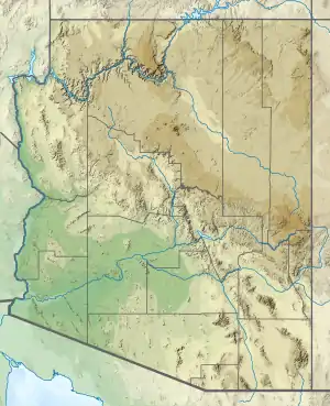 Bidahochi Formation (Arizona) | |
The Bidahochi Formation is a cliff-former unit, and exists on the Colorado Plateau as an erosional protecting unit above the highly erodable Chinle Formation. Locally it immediately overlies other rock units. The Bidahochi Formation extends approximately 112 miles[3] north–south, or north-northwest by south-southeast; the length is approximately equivalent to today's Great Salt Lake of Utah.
The presence of the Bidahochi Formation is a result of two factors. First it lies upon the major water divide of the (south perimeters) Chinle Wash (Chinle Valley) which flows north into the Colorado River watershed; it contrasts with the watershed to the west and south, the Little Colorado River, and the Puerco River tributary from New Mexico; the Defiance Plateau bordering the east of the Bidahochi, sheds water north, west, and south.
The second is the timeframe of the Colorado River drainage through Grand Canyon, known to be about 5.5 Ma, where 5.5 Ma marks the beginning of the last deposits in the Bidahochi. The Bidahochi contains lower, middle, and upper sections, thus the drainages at the beginning of the Colorado River through Grand Canyon are the same age as the end of Bidahochi Lake deposition.
Neogene Colorado Plateau geology
The present geologic status of most of the Colorado Plateau is in a sequence of erosion, caused by wind, water, and time; it is termed an unconformity, since river drainages are removing erosion products from the landscape. Late Paleogene geologic activity continued on the Colorado Plateau (Henry, Abajo, and La Sal Mountains);[4] it continued into the Early Neogene at the San Juan Mountains of southwest Colorado.[5]
Neogene volcanic activity was active on the Colorado Plateau. It ranged from the entire perimeter around the plateau, but also Kaibab Plateau at Grand Canyon, San Francisco Peaks (still active, Sunset Crater), and extended southeast to the Mogollon-Datil volcanic field. Besides alluvial deposits, or Quaternary sand dune deposits, the Bidahochi is possibly the sole geologic formation, that is non-volcanic in origin, during the Neogene, on the Colorado Plateau; it is at least one of the largest, non-volcanic in the Neogene on the plateau.
The formation is similar to the Ogallala Formation of eastern New Mexico and west Texas in both age and depositional environment.[6]
Present drainages of the Bidahochi
The Bidahochi Formation abuts the Defiance Plateau to the east and northeast; it was uplifted by the Defiance Uplift and is a mountainous, flattened upland. Except the Defiance Plateau's connection in the central-northeast to New Mexico mountains and river drainages, the entire Defiance Plateau is part of the Colorado River drainage.
The north-northwest of the Bidahochi abuts the southeast Black Mesa (Arizona), with drainage to east, then north through Chinle Valley (Chinle Wash) to the San Juan River, a southeast tributary to the Colorado River. The drainage from the Black Mesa southwest is towards the Little Colorado River, another southeast tributary of the Colorado River.
The south two-fifths of the Bidahochi Formation is cut by the drainage of the southwest-flowing Puerco River out of New Mexico, but the river meets the Little Colorado at the central extent of the Bidahochi (east to west), and the Little Colorado River then turns northwesterly, then more north-northwesterly to the Colorado River, at Grand Canyon. The entire region north and east of the Little Colorado River is the Painted Desert, composed of the bright, multi-colored, (non-consolidated), highly erodable Chinle Formation. From south of the Little Colorado–Puerco River, (towards the White Mountains), and extending north-northwest to the south of Black Mesa, the Bidahochi lies as a resistant layer, overlying the Chinle, and preventing its erosion in various exposures across the intervening washes, and mesas. In the centerpoint of the transect between the Puerco River, north-northwest to the southeast of Black Mesa is Bidahochi, Arizona. Due west lies the Hopi Buttes volcanic field, where some of the up to 200 vents are maars, erupted through the Bodahochi Formation; the thickest Bidahochi deposits lie due east of the Bidahochi townsite. The Bidahochi forms erosion-resistant, landslide slopes, at the base of specific individual Hopi volcanic buttes.
History of investigation
The formation was first named by A.B. Regan in 1924.[7] D.W. Love concluded that the members defined in the formation by earlier investigators were mere depositional facies and recommended their abandonment.[6]
References
- Summary at USA, National Geologic Map Database.
- Lucchitta, 2001. Hiking Arizona's Geology, Hike 11, Coliseum Diatreme, pp. 116-119, p. 117.
- Chronic, Halka, 1983. Roadside Geology of Arizona, roadtrip: Interstate 40 – Petrified Forest to New Mexico, pp. 210–212, p. 210.
- Blakey, Ranney, 2008. Ancient Landscapes of the Colorado Plateau, pp. 118-119.
- Blakey, Ranney, 2008. Ancient Landscapes of the Colorado Plateau, p. 119.
- Love 1989
- Regan 1924
- Blakey, Ronald C. (2008). Ancient landscapes of the Colorado plateau (1st ed.). Grand Canyon, AZ: Grand Canyon Association. ISBN 978-1934656037.
- Chronic, Halka (1983). Roadside geology of Arizona. Missoula: Mountain Press Pub. Co. pp. 209, 210–212. ISBN 978-0878421473.
- Lucchitta, Ivo (2001). Hiking Arizona's geology (1st ed.). Seattle, WA: Mountaineers Books. ISBN 0898867304.
- Love, D.W. (1989). "Bidahochi Formation; an interpretive summary" (PDF). New Mexico Geological Society Field Conference Guidebook. 40: 273–280. Retrieved 8 October 2020.
- Regan, A.B. (1924). "Stratigraphy of the Hopi Buttes volcanic field, Arizona". Pan-American Geologist. 41 (5): 355–366.
External links
Limestone fossils
Bidahochi & Petrified Forest
Bidahochi Formation
- USGS Professional Paper Volume 650, Parts 3-4
- Citation summary, Bidahochi Formation, National Geologic Map Database