Big Heath Conservation Park
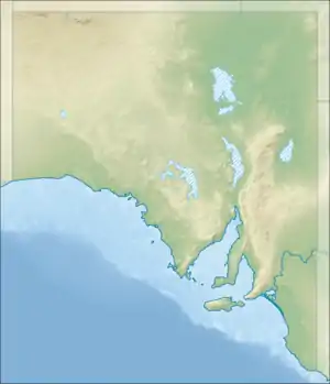
Big Heath Conservation Park (formerly the Big Heath National Park) is a protected area in the Australian state of South Australia located in the gazetted locality of Spence about 20 kilometres (12 mi) south-west of Naracoorte in the state's Limestone Coast region.[5][4]
| Big Heath Conservation Park South Australia | |
|---|---|
IUCN category Ia (strict nature reserve)[1] | |
 Big Heath Conservation Park | |
| Nearest town or city | Naracoorte |
| Coordinates | 37°06′02″S 140°33′19″E[1] |
| Established | 7 May 1964[2][3] |
| Area | 24.72 km2 (9.5 sq mi)[2] |
| Visitation | 'low' (in 1994)[4] |
| Managing authorities | Department for Environment and Water |
| Footnotes | Nearest town[5] |
| See also | Protected areas of South Australia |
The conservation park is located on land in sections 17 to 20, 169 and 179, and Allotment 500 in the cadastral unit of the Hundred of Spence.[4][5] A drain known as 'Drain M', which is part of the drainage infrastructure built in the south east of the state since European settlement, passes through the south-east corner of the conservation park, carrying water from Bool Lagoon in the east to the sea at Beachport in the south.[4][6]
Protected area status began for the land in sections 17 to 20 and 169 on 7 May 1964 when it was constituted under the Crown Lands Act 1929 as a wild life reserve.[3] On 9 November 1967, it was constituted as the Big Heath National Park under the National Parks Act 1966.[7] In 1972, it was constituted as a conservation park upon the proclamation of the National Parks and Wildlife Act 1972 on 27 April 1972.[8] In 1993, section 179 of the Hundred of Spence was added to the conservation park.[9] In 2010, a parcel of land known as Allotment 500 and which was dedicated as a conservation reserve known as the Big Heath Conservation Reserve under the Crown Lands Act 1929 on 9 December 1993 was added to the conservation park.[10][11] As of July 2016, the conservation park covered an area of 24.72 square kilometres (9.54 sq mi).[2]
As of 1994, the conservation park was reported as supporting a “diversity of vegetation types which correlate with the topography and soils of the area” as follows:[4]
- The north-eastern corner has some higher land with “terra rossa soils” which “support a eucalypt woodland with a sparse understorey.”
- The north western end has a soil of “deep sands” which supports a “low woodland” of brown stringybark and pink gum with the “dominant understorey species” being desert banksia.
- Limestone outcrops located throughout the conservation park's extent support woodlands of manna gum, South Australian blue gum and pink gum.
- ”Deep depressions” in the ground level typically lack “tree or scrub cover” and are surrounded by sedges. However, depressed areas in the south-eastern corner of the conservation park support several different plant associations. Firstly, the deeper depressions are surrounded by River Red gums of “varying age and densities.” Secondly, shallower depressions are surrounded by a “dense heath” of mallee honeymyrtle, yellow hakea and prickly tea-tree and which support the following species as the ground elevation increases - broombush, grass tree and dwarf Sheoak.
- Almost 20% of plant species recorded within the conservation park were introduced species with boneseed, a “scheduled pest plant” being the one of most concern.
As of 1994, visitor use was reported as being “low” and was mainly concerned with “nature study by the local and Naracoorte communities.”[4]
The conservation park is classified as an IUCN Category Ia protected area.[1]
References
- "Terrestrial Protected Areas of South Australia (refer 'DETAIL' tab )". CAPAD 2016. Australian Government, Department of the Environment (DoE). 2016. Retrieved 21 February 2018.
- "Protected Areas Information System - reserve list (as of 11 July 2016)" (PDF). Department of Environment Water and Natural Resources. 11 July 2016. Retrieved 14 July 2016.
- "CROWN LANDS ACT, 1929-1960 : HUNDRED OF SPENCE -WILD-LIFE RESERVE DEDICATED" (PDF). The South Australian Government Gazette. Government of South Australia: 946. 7 May 1964. Retrieved 21 January 2017.
- Owers, Terry, ed. (1994), Small inland parks of the South East : management plan, East Region, South Australia (PDF), Department of Environment and Natural Resources, Natural Resources Group, pp. 9–11, retrieved 20 August 2016
- "Search result for "Big Heath Conservation Park" (Record no. SA0006237) with the following layers selected - "Parcel labels", "Suburbs and Localities", "Hundreds", " Place names (gazetteer)" and "Road Labels"". Property Location Browser. Government of South Australia. Archived from the original on 12 October 2016. Retrieved 21 January 2017.
- "Upper South East Drainage Network Management Strategy, prepared under section 43a of the Upper South East Dryland Salinity And Flood Management Act 2002" (PDF). Government of South Australia, Department for Water. June 2011. p. 54. Retrieved 30 August 2016.
- Walsh, Frank (9 November 1967). "NATIONAL PARKS ACT, 1966: VARIOUS NATIONAL PARKS NAMED" (PDF). The South Australian Government Gazette. South Australian Government. p. 2043. Retrieved 17 March 2018.
- "No. 56 of 1972 (National Parks and Wildlife Act, 1972)". The South Australian Government Gazette. Government of South Australia: 700. 27 April 1972. Retrieved 20 January 2017.
- "NATIONAL PARKS AND WILDLIFE ACT 1972 PART III: CONSTITUTION OF NEW RESERVES AND ADDITION OF LAND TO EXISTING RESERVES WITH PRESERVATION OF EXISTING MINING RIGHTS" (PDF). The South Australian Government Gazette. Government of South Australia: 2174–2175. 4 November 1993. Retrieved 21 January 2017.
- "CROWN LANDS ACT, 1929: SECTION 5, The Fourth Schedule" (PDF). The South Australian Government Gazette. Government of South Australia: 2887. 9 December 1993. Retrieved 21 January 2017.
- "National Parks and Wildlife (Big Heath Conservation Park) Proclamation 2010" (PDF). The South Australian Government Gazette. Government of South Australia: 4872. 16 September 2010. Retrieved 21 January 2017.