Ngarkat Conservation Park
Ngarkat Conservation Park is a protected area located in South Australia's south-eastern corner about 200 kilometres (120 miles) south east of the Adelaide city centre.[5]
| Ngarkat Conservation Park Ngarkat, Parilla, Parrakie and Pinnaroo, South Australia | |
|---|---|
IUCN category Ia (strict nature reserve)[1] | |
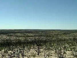
 Looking north near Tym's Lookout, showing the effects of a past bushfire | |
 Ngarkat Conservation Park | |
| Nearest town or city | Keith, Lameroo & Pinnaroo[2] |
| Coordinates | 35°43′S 140°36′E[1] |
| Established | 13 September 1979[3] |
| Area | 2,666.23 km2 (1,029.4 sq mi)[4] |
| Managing authorities | Department for Environment and Water |
| Website | Ngarkat Conservation Park |
| See also | Protected areas of South Australia |
The conservation park was proclaimed in 1979 "to conserve the mallee heath habitat of the 90 Mile Desert". On 27 May 2004, the following conservation parks which adjoined the boundaries of the Ngarkat Conservation Park were incorporated into the conservation park and then abolished - Mount Rescue Conservation Park, Mount Shaugh Conservation Park and Scorpion Springs Conservation Park.[6]
The conservation park is classified as an IUCN Category Ia protected area.[1]
The conservation park occupies in land in a number of gazetted localities with the majority being in Ngarkat and the remainder being in Parilla, Parrakie and Pinnaroo.[7]
References
- "Terrestrial Protected Areas of South Australia (refer 'DETAIL' tab )". CAPAD 2016. Australian Government, Department of the Environment (DoE). 2016. Retrieved 21 February 2018.
- "Search results for 'Ngarkat Conservation Park' with the following datasets selected – 'Suburbs and Localities', 'NPW and Conservation Properties', 'Hundreds', 'Roads' and 'Gazetteer'". Location SA Map Viewer. South Australian Government. Retrieved 14 July 2018.
- Virgo, Geoff (13 September 1979). "CROWN LANDS ACT, 1929-1978: OUT OF HUNDREDS (PINNAROO)—HUNDREDS OF FISK, DAY, McCAL- LUM AND MAKIN—NGARKAT CONSERVATION PARK CONSTITUTED" (PDF). The South Australian Government Gazette. South Australian Government. p. 643. Retrieved 14 July 2018.
- "Protected Areas Information System - reserve list (as of 17 Feb 2014)" (PDF). Department of Environment Water and Natural Resources. Retrieved 26 March 2014.
- "Ngarkat Complex of Conservation Parks Management Plan" (PDF). Department for Environment and Heritage. 2004. p. 6. Retrieved 29 November 2014.
- "National Parks and Wildlife (Ngarkat, Mount Rescue, Mount Shaugh and Scorpion Springs Conservation Parks) Proclamation 2004" (PDF). The South Australian Government Gazette. Government of South Australia: 1394–1395. 27 May 2004. Retrieved 13 March 2017.
- "Search result for " Ngarkat (Locality Bounded)" (Record noSA0040522) with the following layers selected - "Suburbs and Localities" and "Local Government Areas"". Department of Planning, Transport and Infrastructure. Archived from the original on 12 October 2016. Retrieved 12 April 2016.