Mount Gambier (volcano)
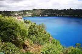
Mount Gambier (also known as Ereng Balam, meaning eagle hawk)[1] is a maar complex in South Australia associated with the Newer Volcanics Province. It contains four lake-filled maars called Blue Lake, Valley Lake, Leg of Mutton Lake, and Brownes Lake.[2] Both Brownes and Leg of Mutton lakes are dry in recent years, due to the lowering of the water table. It is one of Australia's youngest volcanoes, but estimates of the age have ranged from over 28,000 to less than 4,300.[3] The most recent estimate, based on radiocarbon dating of plant fibers in the main crater (Blue Lake) suggests an eruption a little before 6000 years ago.[3][4] It is believed to be dormant rather than extinct.
| Mount Gambier | |
|---|---|
| Ereng Balam | |
 Blue Lake maar of Mount Gambier | |
| Highest point | |
| Elevation | 190 m (620 ft) |
| Coordinates | 37°50′S 140°45′E |
| Geography | |
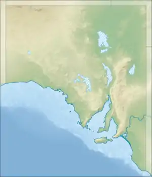
 Mount Gambier | |
Mount Gambier is thought to have formed by a mantle plume centre called the East Australia hotspot which may currently lie offshore.[5]
The mountain was sighted by Lieutenant James Grant on 3 December 1800 from the survey brig HMS Lady Nelson and named for Lord James Gambier, Admiral of the Fleet.[6]
This area is part of the UNESCO-endorsed Kanawinka Geopark.
Of the original four lakes found within the maars, only two remain. The Leg of Mutton Lake (named for the outline of its shoreline) became permanently dry in the 1990s. Brownes Lake suffered a similar fate during the late 1980s. Both these lakes were quite shallow; their demise is attributed to the lowering of the water table as a result of many years of land drainage to secure farmland. Brownes Lake was the site of Henty's cattle years in the 1840's and was named after Doctor Browne who lived at nearby Moorak station. The water level has fluctuated over the years, with it having a recorded depth of 20 feet in 1899.
The city of Mount Gambier partially surrounds the maar complex.
See also
References
- "Mount Gambier - mountain". Department of Planning Transport & Infrastructure. Archived from the original on 3 December 2013. Retrieved 19 January 2014.
- Sheard, M.J. (1978) "Geological History of the Mount Gambier Volcanic Complex, Southeast South Australia". Transactions of the Royal Society of South Australia 102(5): 125–139, Aug. 1978
- Grimes, Ken (2013). "The Ages of Our Volcanoes" (PDF). Archived from the original (PDF) on 8 August 2014. Retrieved 5 August 2014.
- Gouramanis, Chris; Wilkins, Daniel; De Deckker, Patrick (2010). "6000 years of environmental changes recorded in Blue Lake, South Australia, based on ostracod ecology and valve chemistry". Palaeogeography, Palaeoclimatology, Palaeoecology. 297: 223. doi:10.1016/j.palaeo.2010.08.005.
- Mt Gambier Volcano, Australia – John Search
- Grant, James (1803). The narrative of a voyage of discovery, performed in His Majesty's vessel the Lady Nelson, of sixty tons burthen: with sliding keels, in the years 1800, 1801, and 1802, to New South Wales. Printed by C. Roworth for T. Egerton. p. 68. ISBN 978-0-7243-0036-5. Retrieved 24 January 2012.