Black Crater
Black Crater is a steep-sided shield volcano in the Cascade Range of central Oregon, located north of the Three Sisters and east of McKenzie Pass. Ice Age glaciers carved a large cirque into the northern flank of the mountain, and snow often lingers in its shady depths until late summer. A United States Forest Service fire lookout tower was built on the summit in 1925, but was eventually destroyed and only remnants of the foundation remain today. A 3.7-mile (6.0 km) trail heads for the summit from the northwest on Oregon Route 242, eventually wrapping onto the northeast side for the upper part of the ascent.[4]
| Black Crater | |
|---|---|
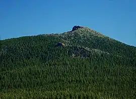 The mountain seen from the Dee Wright Observatory | |
| Highest point | |
| Elevation | 7,257 ft (2,212 m) NAVD 88[1] |
| Prominence | 1,411 ft (430 m) [2] |
| Coordinates | 44°15′58″N 121°44′55″W [1] |
| Geography | |
| Location | Deschutes County, Oregon, U.S. |
| Parent range | Cascade Range |
| Topo map | USGS Black Crater |
| Geology | |
| Age of rock | Late Pleistocene[3] |
| Mountain type | Shield volcano |
| Volcanic arc | Cascade Volcanic Arc |
| Climbing | |
| Easiest route | Trail |
References
- "Black Crater". NGS data sheet. U.S. National Geodetic Survey. Retrieved 2008-11-09. Note that station is 2 ft. below summit
- "Black Crater, Oregon". Peakbagger.com.
- "Dee Wright Observatory". USGS Cascades Volcano Observatory. Retrieved 2008-03-31.
- "Deschutes National Forest: Black Crater Trail #4058". USDA Forest Service. Archived from the original on 2009-04-09. Retrieved 2008-03-31.
Further reading
- Harris, Stephen L. (2005). Fire Mountains of the West: The Cascade and Mono Lake Volcanoes (3rd ed.). Mountain Press Publishing Company. ISBN 0-87842-511-X.
- Wood, Charles A.; Kienle, Jürgen, eds. (1990). Volcanoes of North America. Cambridge University Press. ISBN 0-521-43811-X.
- Kresek, Ray (1998). Fire Lookouts of the Northwest (3rd ed.). Historic Lookout Project. ISBN 0-87770-632-8.
External links
- "Black Crater". Geographic Names Information System. United States Geological Survey. Retrieved 2008-11-09.
This article is issued from Wikipedia. The text is licensed under Creative Commons - Attribution - Sharealike. Additional terms may apply for the media files.