Bobadah
Bobadah was a mining village in the Orana region of New South Wales, Australia.[2][3] It was also known as Carpina, its official name, although that name was rarely used. It is now a ghost town, with its community hall being its last remaining building. Its population in 2016, including the surrounding area, was 10.[1] It was once a larger settlement associated with the nearby Overflow Mine.
| Bobadah New South Wales | |
|---|---|
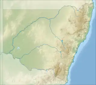 Bobadah Location in New South Wales | |
| Coordinates | 32°18′27.3″S 146°41′31.1″E |
| Population | 10 (2016 census)[1] |
| Postcode(s) | 2877 |
| Location | |
| LGA(s) | Bogan Shire |
| Region | Orana |
| County | Flinders |
| Parish | The Overflow |
| State electorate(s) | Barwon |
| Federal Division(s) | Parkes |
Location
By road, Bobadah is 563 km north-west of Sydney, 108 km north-west of Condoblin, 111 km south-west of Nyngan and 153 km south-east of Cobar. The two nearest settlements are Nymagee, 53 km to the north-west, and Tottenham, 76 km to the east.
History
Aboriginal history
The site that would become Bobadah is part of the traditional lands of the Wangaaypuwan dialect speakers (also known as Wangaibon) of the Ngiyampaa people.[4] The area is west of the traditional lands of the Wiradjuri, which extend to around Condoblin. Small stone flakes created by tool making have been found in the area, and it may have been a meeting place.[5]
The name, Bobadah, is of Aboriginal origin[6] and said to mean "never failing water supply". The other name of the village, Carpina, is also of Aboriginal origin and said to mean "a small bird's egg found here in great numbers".[7]
Mining village
After settler colonisation, the site of Bobadah was within the Parish of Cameron in the Flinders County, about 10km south of the homestead of the famous "The Overflow" sheep station. A deposit of silver-lead ore was found on this station in 1895, near to what would become Bobadah. The deposit became the site of the Overflow Mine. By 1897, mining and cyanide extraction of silver was underway.[5][8][9][10] Multiple shafts were sunk by the Overflow Mine, in its early years.[10]
By October 1896, the Chief Inspector of Mines, Mr Slee, had laid down a street—probably the one later called Slee Street[11]—for a mining settlement to be called Bobadah.[6][9] However, in April 1897, a surveyor, O’Connor, laid out a plan for a village to be called Carpina, at the same general location. The Village of Carpina was proclaimed on 3 November 1897, but the commonly used name remained Bobadah.[5][11] By 1898, Bobadah had a population of between 300 and 400—many of whom were children—three hotels, four stores, a boarding house, sawmill, baker, butcher. watchmaker and newsagent, but no clergyman.[12] From as early as 1907 to at least 1922, the town hosted a day of horse racing.[13][14]
A public school opened in August 1897, closed in May 1923, and reopened in 1943.[15] A police station opened in 1900.[5] Bobadah's post office opened in 1897.[16] Bobadah interests agitated for a railway to run via Bobadah, for many years,[17][18][19] but the railway was never built.
Bobadah's growth never met the early expectations. There were issues with treating the complex ores—containing silver, gold, copper and lead ores and pyrite—and an early attempt to use a water-jacket blast furnace around 1899 was an expensive and complete failure. The mine operator seemed to have had difficulty in determining which of the various minerals present should be the object of the mining.[20][21] An attempt in 1899 to auction 110 residential lots in Bobadah met with little interest, perhaps due to their cost[22] or to the doubtful future of the mine.
By 1900, the first phase of mining was over and there were said to be only 40 people left in the town.[23] Mining soon resumed at the Overflow Mine, under new management;[24] Mining continued, sporadically, and the village population grew once again. There was a second mine, 'Sullivan's Wonder', to the south of the town.[25] The Overflow Mine closed for the last time in 1942.[5]
.jpg.webp)
After mining
The story of Bobadah after the mine closed is one of a gradual decline. The plan of the village was altered more than once to reduce its size and more realistically reflect its diminished future prospects.[26][27][28] In 1931, Bobadah's population was 547.[29] In 1954, after mining had ceased, Bobadah was being described as a 'ghost town' and the population had sunk to 143, although some hopes were raised by the discovery of uranium in the area.[30]
Although there was grazing in the area, Bobadah's remoteness, lack of employment, and the economic gravity of other settlements caused it to fade away gradually. The school closed in December 1972,[15] followed by the post office in December 1979.[16]
Remnants
Like other smaller settlements, its last remaining building is its community hall; locals from the surrounding area successfully fought a demolition order and raised money to restore the hall.[31][32] The street plan and the residential lots of Bobadah[11] are still visible in modern day maps, near the location of the Bobadah Hall.[33] Two intersecting roads, at the old village site, still carry the names of village streets; Condoblin Street and Bindiguy Street.[33][11] Another remnant is the Bobadah-Carpina cemetery.[34]
Reference section
- Australian Bureau of Statistics (27 June 2017). "Bobadah". 2016 Census QuickStats. Retrieved 6 October 2020.

- "Bobadah". Geographical Names Board. Retrieved 6 October 2020.
- "Bobadah". OpenStreetMap. Retrieved 6 October 2020.
- Office of Environment and Heritage. "Cobar Peneplain - regional history". www.environment.nsw.gov.au. Retrieved 24 September 2020.
- Kass, Terry (March 2012). "A Thematic History of Bogan Shire - Draft Report" (PDF). p. 43.
- "The Overflow Silver Mines". Australian Town and Country Journal (Sydney, NSW : 1870 - 1907). 24 October 1896. p. 24. Retrieved 5 October 2020.
- State Library of New South Wales, Sydney (20 May 2017). "Box 4 Folder 1: New South Wales place names, 1899-1903 - Page 50". transcripts.sl.nsw.gov.au. Retrieved 22 October 2020.
- "Overflow Mine (Bobadah Mine), Bobadah, Flinders Co., New South Wales, Australia". www.mindat.org. Retrieved 5 October 2020.
- "Mining at Overflow". Sydney Morning Herald (NSW : 1842 - 1954). 16 October 1896. p. 7. Retrieved 5 October 2020.
- "The Overflow Mine". Daily Telegraph (Sydney, NSW : 1883 - 1930). 24 April 1897. p. 3. Retrieved 5 October 2020.
- "Parish of Cameron, County of Flinders [cartographic material] : Land District of Nyngan, Central Division N.S.W., Bogan Shire". Trove. Retrieved 5 October 2020.
- "Bobadah". Western Champion (Parkes, NSW : 1898 - 1934). 6 May 1898. p. 15. Retrieved 5 October 2020.
- "Local and General". Lachlander and Condobolin and Western Districts Recorder (NSW : 1899 - 1952). 23 January 1907. p. 4. Retrieved 5 October 2020.
- "Bobadah". Lachlander and Condobolin and Western Districts Recorder (NSW : 1899 - 1952). 25 January 1922. p. 8. Retrieved 5 October 2020.
- "Bobadah". nswgovschoolhistory.cese.nsw.gov.au. Retrieved 19 December 2020.
- "View Post Office Details - PPA (Bobadah)". www.premierpostal.com. Retrieved 4 October 2020.
- "Bobadah". Lachlander and Condobolin and Western Districts Recorder (NSW : 1899 - 1952). 30 June 1909. p. 2. Retrieved 5 October 2020.
- "Bobadah Railway". Lachlander and Condobolin and Western Districts Recorder (NSW : 1899 - 1952). 19 July 1916. p. 13. Retrieved 5 October 2020.
- "Burcher-Nyngan Railway Extension". Lachlander and Condobolin and Western Districts Recorder (NSW : 1899 - 1952). 13 March 1947. p. 4. Retrieved 5 October 2020.
- "Bobadah". Nepean Times (Penrith, NSW : 1882 - 1962). 11 June 1898. p. 4. Retrieved 5 October 2020.
- "Bobadah". Lachlander and Condobolin and Western Districts Recorder (NSW : 1899 - 1952). 27 October 1899. p. 11. Retrieved 5 October 2020.
- "Bobadah". Lachlander and Condobolin and Western Districts Recorder (NSW : 1899 - 1952). 19 May 1899. p. 7. Retrieved 5 October 2020.
- "Brief Mention". Western Champion (Parkes, NSW : 1898 - 1934). 13 April 1900. p. 8. Retrieved 5 October 2020.
- "The Mining Outlook". Lachlander and Condobolin and Western Districts Recorder (NSW : 1899 - 1952). 24 January 1902. p. 2. Retrieved 20 October 2020.
- "Bobadah". Cobar Herald (NSW : 1899 - 1914). 14 February 1913. p. 3. Retrieved 5 October 2020.
- "Proposed Alteration of Design of the Village of Carpina". Government Gazette of the State of New South Wales (Sydney, NSW : 1901 - 2001). 14 November 1930. p. 4609. Retrieved 28 December 2020.
- "Proposed Alteration of Design of Village of Carpina". Government Gazette of the State of New South Wales (Sydney, NSW : 1901 - 2001). 6 May 1949. p. 1334. Retrieved 28 December 2020.
- "Cancellation of Design of the Suburban Lands of the Village of Carpina". Government Gazette of the State of New South Wales (Sydney, NSW : 1901 - 2001). 9 January 1959. p. 94. Retrieved 28 December 2020.
- "Dubbo Has 12,862 Population". Dubbo Dispatch and Wellington Independent (NSW : 1887 - 1932). 12 March 1931. p. 3. Retrieved 5 October 2020.
- "Uranium found in N.S.W. 'ghost town'". Daily Telegraph (Sydney, NSW : 1931 - 1954). 24 October 1954. p. 11. Retrieved 5 October 2020.
- "The Bobadah Community Hall Fund". www.eastershow.com.au. Retrieved 4 October 2020.
- Downey, Emma (5 May 2013). "Banking on brunch". Farm Online. Retrieved 5 October 2020.
- "Bobadah". Google Maps. Retrieved 4 October 2020.
- "Australian Cemeteries Index - Cemetery 1083 - Bobadah". austcemindex.com. Retrieved 4 October 2020.
