Bonesteel, South Dakota
Bonesteel is a city in Gregory County, South Dakota, United States. The population was 275 at the 2010 census.
Bonesteel, South Dakota | |
|---|---|
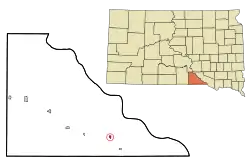 Location in Gregory County and the state of South Dakota | |
| Coordinates: 43°4′37″N 98°56′49″W | |
| Country | United States |
| State | South Dakota |
| County | Gregory |
| Founded | 1902[1] |
| Area | |
| • Total | 0.35 sq mi (0.92 km2) |
| • Land | 0.35 sq mi (0.92 km2) |
| • Water | 0.00 sq mi (0.00 km2) |
| Elevation | 1,965 ft (599 m) |
| Population | |
| • Total | 275 |
| • Estimate (2019)[4] | 273 |
| • Density | 771.19/sq mi (298.10/km2) |
| Time zone | UTC-6 (Central (CST)) |
| • Summer (DST) | UTC-5 (CDT) |
| ZIP code | 57317 |
| Area code(s) | 605 |
| FIPS code | 46-06220[5] |
| GNIS feature ID | 1254006[6] |
History
Bonesteel was laid out in 1902.[7] The city named for H. E. Bonesteel, who operated as a freight forwarder in the area.[8]
Geography
Bonesteel is located at 43°4′37″N 98°56′49″W (43.077044, -98.946858).[9]
According to the United States Census Bureau, the city has a total area of 0.35 square miles (0.91 km2), all land.[10]
Bonesteel has been assigned the ZIP code 57317, and the FIPS place code 06220.
Demographics
| Historical population | |||
|---|---|---|---|
| Census | Pop. | %± | |
| 1910 | 563 | — | |
| 1920 | 652 | 15.8% | |
| 1930 | 564 | −13.5% | |
| 1940 | 532 | −5.7% | |
| 1950 | 485 | −8.8% | |
| 1960 | 452 | −6.8% | |
| 1970 | 354 | −21.7% | |
| 1980 | 358 | 1.1% | |
| 1990 | 297 | −17.0% | |
| 2000 | 297 | 0.0% | |
| 2010 | 275 | −7.4% | |
| 2019 (est.) | 273 | [4] | −0.7% |
| U.S. Decennial Census[11] | |||
2010 census
As of the census[3] of 2010, there were 275 people, 125 households, and 74 families residing in the city. The population density was 785.7 inhabitants per square mile (303.4/km2). There were 170 housing units at an average density of 485.7 per square mile (187.5/km2). The racial makeup of the city was 73.5% White, 22.9% Native American, 1.8% from other races, and 1.8% from two or more races. Hispanic or Latino of any race were 4.0% of the population.
There were 125 households, of which 24.8% had children under the age of 18 living with them, 47.2% were married couples living together, 9.6% had a female householder with no husband present, 2.4% had a male householder with no wife present, and 40.8% were non-families. 38.4% of all households were made up of individuals, and 20% had someone living alone who was 65 years of age or older. The average household size was 2.20 and the average family size was 2.88.
The median age in the city was 49.8 years. 26.5% of residents were under the age of 18; 2.6% were between the ages of 18 and 24; 18.1% were from 25 to 44; 22.5% were from 45 to 64; and 30.2% were 65 years of age or older. The gender makeup of the city was 48.0% male and 52.0% female.
2000 census
As of the census[5] of 2000, there were 297 people, 137 households, and 90 families residing in the city. The population density was 863.1 people per square mile (337.3/km2). There were 164 housing units at an average density of 476.6 per square mile (186.2/km2). The racial makeup of the city was 90.57% White, 7.07% Native American, and 2.36% from two or more races. Hispanic or Latino of any race were 0.34% of the population.
There were 137 households, out of which 21.9% had children under the age of 18 living with them, 53.3% were married couples living together, 6.6% had a female householder with no husband present, and 34.3% were non-families. 33.6% of all households were made up of individuals, and 23.4% had someone living alone who was 65 years of age or older. The average household size was 2.09 and the average family size was 2.53.
In the city, the population was spread out, with 18.5% under the age of 18, 5.1% from 18 to 24, 16.5% from 25 to 44, 26.3% from 45 to 64, and 33.7% who were 65 years of age or older. The median age was 54 years. For every 100 females, there were 96.7 males. For every 100 females age 18 and over, there were 90.6 males.
The median income for a household in the city was $26,389, and the median income for a family was $30,833. Males had a median income of $21,500 versus $21,250 for females. The per capita income for the city was $13,621. About 8.0% of families and 14.6% of the population were below the poverty line, including 17.6% of those under the age of eighteen and 17.3% of those 65 or over.
Climate
This climatic region is typified by large seasonal temperature differences, with warm to hot (and often humid) summers and cold (sometimes severely cold) winters. According to the Köppen Climate Classification system, Bonesteel has a humid continental climate, abbreviated "Dfa" on climate maps.[12]
| Climate data for Bonesteel, South Dakota | |||||||||||||
|---|---|---|---|---|---|---|---|---|---|---|---|---|---|
| Month | Jan | Feb | Mar | Apr | May | Jun | Jul | Aug | Sep | Oct | Nov | Dec | Year |
| Average high °C (°F) | −1 (30) |
2 (36) |
7 (45) |
16 (60) |
22 (71) |
27 (81) |
31 (87) |
30 (86) |
24 (76) |
18 (64) |
8 (46) |
1 (34) |
16 (60) |
| Average low °C (°F) | −13 (8) |
−11 (13) |
−6 (22) |
2 (35) |
8 (46) |
13 (56) |
17 (62) |
16 (60) |
9 (49) |
3 (37) |
−5 (23) |
−11 (13) |
2 (35) |
| Average precipitation mm (inches) | 10 (0.4) |
18 (0.7) |
41 (1.6) |
76 (3) |
110 (4.2) |
94 (3.7) |
81 (3.2) |
69 (2.7) |
69 (2.7) |
46 (1.8) |
23 (0.9) |
10 (0.4) |
640 (25.1) |
| Source: Weatherbase [13] | |||||||||||||
References
- "SD Towns" (PDF). South Dakota State Historical Society. Archived from the original (PDF) on 2010-02-10. Retrieved 2010-02-11.
- "2019 U.S. Gazetteer Files". United States Census Bureau. Retrieved July 30, 2020.
- "U.S. Census website". United States Census Bureau. Retrieved 2012-06-21.
- "Population and Housing Unit Estimates". United States Census Bureau. May 24, 2020. Retrieved May 27, 2020.
- "U.S. Census website". United States Census Bureau. Retrieved 2008-01-31.
- "US Board on Geographic Names". United States Geological Survey. 2007-10-25. Retrieved 2008-01-31.
- Federal Writers' Project (1940). South Dakota place-names, v.1-3. University of South Dakota. p. 27.
- Chicago and North Western Railway Company (1908). A History of the Origin of the Place Names Connected with the Chicago & North Western and Chicago, St. Paul, Minneapolis & Omaha Railways. p. 45.
- "US Gazetteer files: 2010, 2000, and 1990". United States Census Bureau. 2011-02-12. Retrieved 2011-04-23.
- "US Gazetteer files 2010". United States Census Bureau. Archived from the original on 2012-01-25. Retrieved 2012-06-21.
- "Census of Population and Housing". Census.gov. Retrieved June 4, 2015.
- Climate Summary for Bonesteel, South Dakota
- "Weatherbase.com". Weatherbase. 2013. Retrieved on October 10, 2013.
Municipalities and communities of Gregory County, South Dakota, United States | ||
|---|---|---|
| Cities | 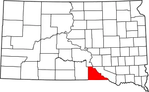 | |
| Towns | ||
| CDP | ||
| Unincorporated communities | ||
| Indian reservation | ||
| Footnotes | ‡This populated place also has portions in an adjacent county or counties | |
| ||