Gregory, South Dakota
Gregory is a city in western Gregory County, South Dakota, United States. The population was 1,295 at the 2010 census.
Gregory, South Dakota | |
|---|---|
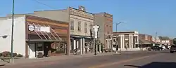 Main Street | |
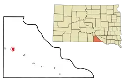 Location in Gregory County and the state of South Dakota | |
| Coordinates: 43°13′56″N 99°25′49″W[1] | |
| Country | United States |
| State | South Dakota |
| County | Gregory |
| Incorporated | December 7, 1908[2] |
| Government | |
| • Type | Aldermanic Form |
| • Mayor | Scott Anshutz |
| • City Administrator | Al Cerny |
| • Ward I | Gerrie Soper, Chad Peck |
| • Ward II | Maurice Schlaht, Blane Bartling |
| • Ward III | Tim Mills, Kevin Mikkelsen |
| Area | |
| • Total | 1.72 sq mi (4.46 km2) |
| • Land | 1.72 sq mi (4.46 km2) |
| • Water | 0.00 sq mi (0.00 km2) |
| Elevation | 2,169 ft (661 m) |
| Population | |
| • Total | 1,295 |
| • Estimate (2019)[5] | 1,242 |
| • Density | 721.67/sq mi (278.63/km2) |
| Time zone | UTC−6 (Central (CST)) |
| • Summer (DST) | UTC−5 (CDT) |
| ZIP code | 57533 |
| Area code(s) | 605 |
| FIPS code | 46-26180[6] |
| Website | http://www.cityofgregory.com/ |
History
Gregory was laid out in 1904.[7] The city took its name from its location in Gregory County.[8] A post office called Gregory has been in operation since 1904.[8] The local paper for Gregory and the surrounding county, the Gregory Times-Advocate, was founded in 1910.[9]
On May 8, 1965, an F5 tornado touched down on the town without causing any fatalities.
Geography
Gregory is located along U.S. Route 18 and South Dakota Highway 47 between Burke, seven miles to the southeast and Dallas, four miles to the west. Ponca Creek flows past Gregory, two miles to the south and the headwaters of South Fork Whetstone Creek lie to the northeast.[10]
According to the United States Census Bureau, the city has a total area of 1.71 square miles (4.43 km2), all land.[11]
Gregory has been assigned the ZIP code 57533 and the FIPS place code 26180.
Climate
| Climate data for Gregory, South Dakota | |||||||||||||
|---|---|---|---|---|---|---|---|---|---|---|---|---|---|
| Month | Jan | Feb | Mar | Apr | May | Jun | Jul | Aug | Sep | Oct | Nov | Dec | Year |
| Record high °F (°C) | 71 (22) |
76 (24) |
91 (33) |
98 (37) |
103 (39) |
107 (42) |
114 (46) |
113 (45) |
105 (41) |
97 (36) |
85 (29) |
79 (26) |
114 (46) |
| Average high °F (°C) | 32.2 (0.1) |
36.9 (2.7) |
46.8 (8.2) |
60.8 (16.0) |
71.9 (22.2) |
81.5 (27.5) |
89.2 (31.8) |
87.6 (30.9) |
78.3 (25.7) |
65.7 (18.7) |
48.0 (8.9) |
36.1 (2.3) |
61.3 (16.3) |
| Daily mean °F (°C) | 20.6 (−6.3) |
24.9 (−3.9) |
34.5 (1.4) |
47.3 (8.5) |
58.4 (14.7) |
68.4 (20.2) |
75.1 (23.9) |
73.4 (23.0) |
63.7 (17.6) |
51.3 (10.7) |
35.7 (2.1) |
24.8 (−4.0) |
48.2 (9.0) |
| Average low °F (°C) | 8.9 (−12.8) |
12.8 (−10.7) |
22.2 (−5.4) |
34.0 (1.1) |
44.9 (7.2) |
55.3 (12.9) |
61.2 (16.2) |
59.2 (15.1) |
49.1 (9.5) |
36.9 (2.7) |
23.5 (−4.7) |
13.6 (−10.2) |
35.1 (1.7) |
| Record low °F (°C) | −29 (−34) |
−28 (−33) |
−25 (−32) |
−4 (−20) |
16 (−9) |
32 (0) |
38 (3) |
33 (1) |
20 (−7) |
7 (−14) |
−24 (−31) |
−36 (−38) |
−36 (−38) |
| Average precipitation inches (mm) | 0.5 (13) |
0.6 (15) |
1.5 (38) |
2.6 (66) |
3.4 (86) |
4.0 (100) |
2.7 (69) |
2.4 (61) |
2.2 (56) |
1.7 (43) |
0.9 (23) |
0.6 (15) |
23.1 (585) |
| Source: [12] | |||||||||||||
Demographics
| Historical population | |||
|---|---|---|---|
| Census | Pop. | %± | |
| 1910 | 1,142 | — | |
| 1920 | 1,067 | −6.6% | |
| 1930 | 1,034 | −3.1% | |
| 1940 | 1,246 | 20.5% | |
| 1950 | 1,375 | 10.4% | |
| 1960 | 1,478 | 7.5% | |
| 1970 | 1,756 | 18.8% | |
| 1980 | 1,503 | −14.4% | |
| 1990 | 1,486 | −1.1% | |
| 2000 | 1,342 | −9.7% | |
| 2010 | 1,295 | −3.5% | |
| 2019 (est.) | 1,242 | [5] | −4.1% |
| U.S. Decennial Census[13] | |||
2010 census
As of the census[4] of 2010, there were 1,295 people, 611 households, and 326 families living in the city. The population density was 757.3 inhabitants per square mile (292.4/km2). There were 730 housing units at an average density of 426.9 per square mile (164.8/km2). The racial makeup of the city was 90.3% White, 0.2% African American, 6.8% Native American, 0.6% Asian, and 2.2% from two or more races. Hispanic or Latino of any race were 0.8% of the population.
There were 611 households, of which 23.9% had children under the age of 18 living with them, 39.4% were married couples living together, 10.5% had a female householder with no husband present, 3.4% had a male householder with no wife present, and 46.6% were non-families. 43.7% of all households were made up of individuals, and 25.9% had someone living alone who was 65 years of age or older. The average household size was 2.05 and the average family size was 2.82.
The median age in the city was 48.5 years. 21.8% of residents were under the age of 18; 6.8% were between the ages of 18 and 24; 17% were from 25 to 44; 28.1% were from 45 to 64; and 26.3% were 65 years of age or older. The gender makeup of the city was 47.8% male and 52.2% female.
2000 census
As of the census[6] of 2000, there were 1,342 people, 613 households, and 351 families living in the city. The population density was 982.6 people per square mile (378.2/km2). There were 718 housing units at an average density of 525.7 per square mile (202.4/km2). The racial makeup of the city was 95.68% White, 3.28% Native American, 0.07% Asian, 0.07% from other races, and 0.89% from two or more races. Hispanic or Latino of any race were 0.89% of the population.
There were 613 households, out of which 25.0% had children under the age of 18 living with them, 47.5% were married couples living together, 7.2% had a female householder with no husband present, and 42.6% were non-families. 40.0% of all households were made up of individuals, and 26.6% had someone living alone who was 65 years of age or older. The average household size was 2.19 and the average family size was 2.94.
In the city, the population was spread out, with 24.0% under the age of 18, 4.4% from 18 to 24, 21.7% from 25 to 44, 22.0% from 45 to 64, and 27.9% who were 65 years of age or older. The median age was 45 years. For every 100 females, there were 84.1 males. For every 100 females age 18 and over, there were 78.9 males.
As of 2000 the median income for a household in the city was $23,173, and the median income for a family was $31,250. Males had a median income of $25,057 versus $16,923 for females. The per capita income for the city was $13,626. About 12.9% of families and 18.8% of the population were below the poverty line, including 25.9% of those under age 18 and 20.7% of those age 65 or over.
Notable person
- Oscar Micheaux, first major African-American feature filmmaker[14]
See also
References
- U.S. Geological Survey Geographic Names Information System: Gregory, South Dakota
- "SD Towns" (PDF). South Dakota State Historical Society. Archived from the original (PDF) on 2010-02-10. Retrieved 2010-02-12.
- "2019 U.S. Gazetteer Files". United States Census Bureau. Retrieved July 30, 2020.
- "U.S. Census website". United States Census Bureau. Retrieved 2012-06-21.
- "Population and Housing Unit Estimates". United States Census Bureau. May 24, 2020. Retrieved May 27, 2020.
- "U.S. Census website". United States Census Bureau. Retrieved 2008-01-31.
- Federal Writers' Project (1940). South Dakota place-names, v.1-3. University of South Dakota. p. 40.
- Chicago and North Western Railway Company (1908). A History of the Origin of the Place Names Connected with the Chicago & North Western and Chicago, St. Paul, Minneapolis & Omaha Railways. p. 79.
- Library of Congress, Chronicling America. Record for Gregory Times-Advocate, Retrieved 8 June 2016.
- Gregory, SD, 7.5 Minute Topographic Quadrangle, USGS, 1964
- "US Gazetteer files 2010". United States Census Bureau. Archived from the original on 2012-01-25. Retrieved 2012-06-21.
- "Monthly Averages for Gregory, SD". weatherbase.com. Retrieved 2017-12-24.
- United States Census Bureau. "Census of Population and Housing". Retrieved June 7, 2016.
- "Newsroom | South Dakota Tourism Industry". Retrieved 2019-02-23.
External links
![]() Media related to Gregory, South Dakota at Wikimedia Commons
Media related to Gregory, South Dakota at Wikimedia Commons
Municipalities and communities of Gregory County, South Dakota, United States | ||
|---|---|---|
| Cities | 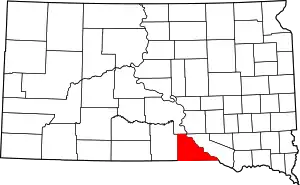 | |
| Towns | ||
| CDP | ||
| Unincorporated communities | ||
| Indian reservation | ||
| Footnotes | ‡This populated place also has portions in an adjacent county or counties | |
| ||
| Authority control |
|---|