Bramcote
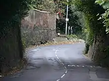
Bramcote is a large village in the Broxtowe District in Nottinghamshire, between Stapleford and Beeston. One of the main roads between Nottingham and Derby used to pass through the old village centre, entering a steep-sided cutting that formed a blind bend. The main Nottingham–Derby road today is the A52, also called the Brian Clough Way. A country-house estate to the north of the village became publicly owned in the 1960s – the house was demolished in 1968 and its grounds made a public area of parkland and wooded hillside known as Bramcote Hills Park. Nearby are Beeston, Wollaton, Chilwell and Stapleford. Bramcote is in the borough of Broxtowe and Broxtowe parliamentary constituency, having been in Stapleford Rural District until 1935 and then Beeston and Stapleford Urban District.
| Bramcote | |
|---|---|
 Bramcote Location within Nottinghamshire | |
| Population | 7,270 (Ward. 2011) |
| OS grid reference | SK 50941 37703 |
| District | |
| Shire county | |
| Region | |
| Country | England |
| Sovereign state | United Kingdom |
| Post town | NOTTINGHAM |
| Postcode district | NG9 |
| Dialling code | 0115 |
| Police | Nottinghamshire |
| Fire | Nottinghamshire |
| Ambulance | East Midlands |
| UK Parliament | |
Demography
The population of Bramcote is 9,270 with a household average of 2.3. The Broxtowe Ward population measured at the Census 2011 showed a population of 7,270.[1]
The proportion of residents identifying as White British is 82.7 per cent with 17.3 per cent originating from 41 other countries, in the main India, Pakistan, Bangladesh, Sri Lanka, China, Jamaica, Barbados, Poland, Italy, the Netherlands, Greece, Russia and Australia. In religion, 60.7 per cent of Bramcote people see themselves as Christian, 3.6 per cent as Muslim, 2.8 per cent as Hindu and 2.5 per cent as Sikhs, while 22.6 per cent adhere to no religion.[2]
Schools
There are four local schools:
- Bramcote C of E (Aided) Primary School
- Bramcote Hills Primary School
- The Bramcote School
- Foxwood Foundation School and Technology College
St John's College, Nottingham is a Church of England theological college situated in Bramcote on the southern edge.
There used to be a second comprehensive school in Bramcote, Bramcote Hills Sport & Community College , but this was recently found unsafe and demolished. Local school children were moved into the nearby Bramcote Park and Alderman White schools. The building has now been refurbished and is now the site of Bramcote Hills College Sixth Form.
In 2009, Bramcote Park Sports, Business & Enterprise School, Bramcote Hills College Sixth Form and Alderman White School joined to form White Hills Park Federation of Schools. Year 10 and 11 students can travel between the sites for lessons in a school minibus.
Leisure centre
Bramcote Leisure Centre[3] in Bramcote Park, just off the A52, contains a 33-metre pool with a water slide (recently divided into a 25-metre pool and family splash pool), a teaching pool, a gym (currently being extended), a junior gym, a five-a-side pitch (housing a successful local team, the Bramcote Beers), a health suite and crèche.[4] The centre achieved Quest Accreditation in March 2008 and in November 2008 was the first centre in Nottinghamshire to achieve the Aquamark, the ASA National Award Scheme for swimming programme quality.[5][6] The Vitality fitness suite has recently had a £250,000 renovation, refurbishment and extension. The poolside changing rooms have also been updated.
Transport
Nottingham City Transport[7]
- 30: Nottingham - Ilkeston Road - Jubilee Campus - Wollaton Park - Bramcote - Wollaton Vale
Trentbarton[8]
- i4: Nottingham - Stapleford - Sandiacre - Derby
- 21: Nottingham - Kirk Hallam - Ilkeston
- eighteen: Nottingham - Beeston - Stapleford
- 20: Nottingham - Rylands - Beeston - Stapleford - Ilkeston - Heanor
Nottingham Community Transport[9]
- L10: Wollaton - Bramcote - Beeston
Historical landmarks
- Frances Longden Almshouses, Cow Lane
- The remains of Bramcote Hall, in Bramcote Park. The bottom few layers of brick remain.
- Bramcote Manor House dates back to the Elizabethan period.[10]
- Bramcote Memorial Hall in Church Street commemorates those who died in the First World War.[11]
Churches
The Church of St Michael and All Angels, Bramcote, is in Church Street. It has three Sunday services and runs spiritual and social activities for all ages. Built in 1861, it marked its 150th anniversary year in 2011. The churchyard contains war graves of three World War I soldiers and one World War II.[12] Only the churchyard and tower remain of a previous Anglican church off Town Street, known locally known as the Sunken Church.
Bramcote Methodist Church is in Chapel Street. It has a Sunday morning service and an evening Communion service once a month.[13]
Emmanuel Church is an independent Evangelical church, which meets on Sunday mornings at Bramcote College. It runs a programme for youth and children, a men's breakfast group, prayer groups and house groups.[14]
Parks and open spaces
Bramcote Park is the biggest of the parks in Bramcote. Its wooded area stretches from Bramcote Park School towards Stapleford, Wollaton and the former landfill site. It is one of the few sites in the Nottingham area with a Green Flag Award. It features an extensive children's playground, car park and easy-access paths.
King George's Park offers views across Bramcote from a steeply sloping site with a network of surfaced paths linked to adjacent countryside. There are two free tennis courts, a children's playground and several parking areas.
Bramcote Ridge Open Space of about 12 hectares (29 acres) consists of a mosaic of acid grassland, naturally regenerating scrub and mature woodland managed as a nature reserve. It is a designated Grade II Site Important for Nature Conservation, and a listed Area of Restricted Development. It is surrounded on three sides by residential development, in which there is roadside parking.
References
- "Broxtowe ward population 2011". Neighbourhood Statistics. Office for National Statistics. Retrieved 6 April 2016.
- Services, Good Stuff IT. "Broxtowe - UK Census Data 2011".
- Retrieved 15 November 2019.
- Retrieved 15 November 2019.
- Retrieved 15 November 2019.
- "Archived copy". Archived from the original on 19 June 2017. Retrieved 2 July 2017.CS1 maint: archived copy as title (link)
- "Bramcote History Group: Manor House".
- "Bramcote History Group: WW1".
- CWGC Cemetery Report, details from casualty record.
- Trent Valley Circuit. Retrieved 16 November 2019.
External links
![]() Media related to Bramcote at Wikimedia Commons
Media related to Bramcote at Wikimedia Commons
- Bramcote Today: official village website and community blog
- Bramcote Hills Park Community Cafe
- The Friends of Bramcote Ridge
- Bramcote Conservation Society
- Bramcote History Group
- The Friends of Bramcote Old Church Tower
| Unitary authorities | |
|---|---|
| Boroughs or districts | |
| Major settlements | |
| Topics | |
| Authority control |
|---|