Stapleford, Nottinghamshire
Stapleford is a town and civil parish in Nottinghamshire, England, 5.6 miles (9.0 km) west of Nottingham. The population at the 2011 census was 15,241.[2]
| Stapleford | |
|---|---|
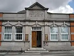 Community Centre | |
 Stapleford Location within Nottinghamshire | |
| Population | 15,241 (2011) |
| OS grid reference | SK 48796 37125 |
| Civil parish |
|
| District | |
| Shire county | |
| Region | |
| Country | England |
| Sovereign state | United Kingdom |
| Post town | NOTTINGHAM |
| Postcode district | NG9 |
| Dialling code | 0115 |
| Police | Nottinghamshire |
| Fire | Nottinghamshire |
| Ambulance | East Midlands |
| UK Parliament | |
Geography
Stapleford lies on the border between Nottinghamshire and Derbyshire. To the north of Stapleford is Ilkeston and to the east is Beeston. To the west across the River Erewash is Sandiacre, and in the south is Toton.
Politics
Stapleford is part of Broxtowe borough and the Broxtowe Parliamentary Constituency. From 1935 until 1974 Stapleford was paired with the town of Beeston in the Beeston and Stapleford Urban District, having previously been part of the Stapleford Rural District.[3] The town was parished in 1987 and now has a town council.
The local MP is Darren Henry of the Conservative Party from December 2019, and the town is represented on Nottinghamshire County Council by the Conservative Party and also on Broxtowe Borough Council by two Labour Party, one Conservative Party and one Independent Councillor and two Liberal Democrats. The town council is a mixture of Labour Party, Conservative, Liberal Democrat, Green and 4 Independent Councillors since the election in May 2019.
Brief history
The place-name is first attested in the Domesday Book of 1086, where it appears, unusually, spelt as now, and in the Pipe Rolls of 1194 . The name means "ford marked by a post or posts".[4]
Stapleford's origins can be traced to before the Norman Conquest.[5] In the churchyard of St Helen's church is the Stone Cross which is Saxon and believed to be the oldest Christian monument in the Midlands.[6] Stapleford owed its development in part to its closeness to the River Trent and the River Erewash as the town became a central point for trade. The antiquary John Weever defined a staple town "to be a place, to which by the prince's authority and privilege wool, hides of beasts, wine, corn or grain, and other exotic or foreign merchandize are transferred, carried or conveyed to be sold."[7] The area also expanded in the late 18th century when the stocking hose trade thrived in the Midlands. Evidence of this history can be found today with the original Stocking Knitters' Houses still standing alongside more modern properties and shops such as on Nottingham Road. The main crossroads in Stapleford at the junction of Nottingham Road, Derby Road, Toton Lane and Church Street is called The Roach. The name is from the time when French prisoners from the Napoleonic Wars were set the task of cutting through rock to create roads and this was referred to as La Roche.
Stapleford is also home to the Hemlock Stone on Stapleford Hill. It is approximately 200 million years old, dating to the Triassic Period.
In 2006, a new NHS Health Centre and Walk-In Centre opened in the town, but has since closed and has been succeeded by a large multi use healthcare centre with a mental health unit and cafe on site. Sainsbury's local was opened on the site of the former Total petrol station in 2007.
Stapleford is the home of the Full Mash microbrewery.[8]
Notable people
- Tom Johnston, football manager and player.[11]
- Arthur Mee, the writer, journalist and educator, was born in Stapleford in 1875.
- Gallipoli hero Walter Richard Parker, VC, lived in Stapleford and is buried in the town cemetery.
- Dave Watson, who was a defender in the Sunderland team that won the FA Cup in 1973, was born in Stapleford in 1946.
- Sir John Borlase Warren, an 18th-century MP for Nottingham and an admiral, lived in Stapleford. The now closed Happy Man and Warren Arms pubs were named after him and his family. A large Wetherspoons named after him is located in the town centre.
- John Radford, wine and food writer, author and broadcaster, grew up in Stapleford from 1949–1965
- Frederick Attenborough, academic, principal of University College, Leicester.
- Frederick Randon, cricketer
- Sir Robert Salisbury, renowned educationalist, professor and author
Schools and colleges
Primary schools
- Albany Infant and Nursery School
- Albany Junior School
- Fairfield Primary Academy
- Wadsworth Fields Primary School (formerly Fredrick Harrison's Infant school & Stevenson's Junior School)
- St John's C of E Primary School (The oldest building still in use as a school in Nottinghamshire)[12]
- William Lilley Infant and Nursery School
Secondary schools
Colleges
- George Spencer Sixth Form
Transport
Road transport is the primary method of transport in and out of the area. East Midlands Airport is approximately 16 kilometres away, the airport provides domestic and international routes, focused mainly on EU/EEA/Swiss routes.
Bus
Bus services operate to Nottingham, Derby, Beeston, Ilkeston and other local towns.
Trentbarton
- i4: Nottingham – QMC – Stapleford – Sandiacre – Risley – Derby.[13]
- my15: Old Sawley – Stapleford – Ilkeston.[14]
- 20: Nottingham – QMC – University Boulevard – Boots – Beeston – Ilkeston – Heanor. (Sundays only)[15]
- 21: Nottingham – QMC – Stapleford – Kirk Hallam – Ilkeston.[16]
NottsBus
- 510: Beeston – Attenborough – Toton – Stapleford. (Subsidised by Nottinghamshire County Council)[17]
- 511: Stapleford Shopper. (Subsidised by Nottinghamshire County Council)[17]
CT4N
In October 2018 CT4N, the operating arm of Nottingham Community Transport, took over the running of the trentbarton service '18'.
- eighteen: Nottingham - QMC - University Boulevard - Boots - Beeston - Stapleford
Roads
Stapleford is connected to Nottingham, Derby and the M1 motorway by the A52.
Railway
The closest railway station (with regular services) is Beeston providing direct services to Nottingham, Derby, London, Lincoln, Bedford, Burton upon Trent, Leicester, Loughborough, Tamworth, Newark (Castle), Luton, East Midlands Parkway, Birmingham and Matlock.
Light rail
In August 2015, a Light Rail (tram) line was opened towards Stapleford via Beeston and Chilwell as part of the Nottingham Express Transit system. A park and ride station, called Toton Lane Park & Ride has been built about 1 mile south of Stapleford town centre, and adjacent to some residential areas of the town. It is on Toton Lane, just south of the A52 roundabout, and is the terminus of line 1 of the Phase 2 expansion. There are no plans for extension into the centre of Stapleford.
Destinations from Stapleford | ||||||||||
|---|---|---|---|---|---|---|---|---|---|---|
| ||||||||||
References
- http://www.staplefordtowncouncil.org.uk/
- "Town population 2011". Neigfhbouyrhood Statistics. Office for National Statistics. Retrieved 14 April 2016.
- "Stapleford RD through time – Census tables with data for the Local Government District". www.visionofbritain.org.uk. Archived from the original on 14 May 2011. Retrieved 4 April 2018.
- Eilert Ekwall, The Concise Oxford Dictionary of English Place-names, p.439.
- http://www.stapleford-notts.co.uk/stapleford%20history.htm
- http://www.stapleford-notts.co.uk/places%20of%20interest.htm
- Weever, Antient Funeral Monuments, section "Within the Diocese of Rochester:Deptford" (1767 ed. p 134), noting the Florentine merchant Lodovico, Guicciardini.
- Becca Bryers (16 April 2008). "Brewing: An out of terrace experience". BBC News Nottingham. Retrieved 13 January 2014.
- "Stabbo fail to captilise as Butterley bat out". Retrieved 4 April 2018.
- "21 Nottingham phrases you might not have heard before". Nottingham Post. 19 May 2015. Retrieved 21 July 2015.
- "Nottingham Forest – News – Where Are They Now – Where Are They Now – Sadly Passed Away". world.nottinghamforest.co.uk. Retrieved 4 April 2018.
- http://www.nottinghamng9.co.uk/towns/stapleford.
- "trentbarton – Service i4". trentbarton. Trent Motor Traction Company. Retrieved 12 May 2016.
- "trentbarton – Service my15". trentbarton. Trent Motor Traction Company. Retrieved 12 May 2016.
- "trentbarton – Service 20". trentbarton. Trent Motor Traction Company. Retrieved 12 May 2016.
- "trentbarton – Service 21". trentbarton. Trent Motor Traction Company. Retrieved 12 May 2016.
- "NottsBus Connect Leaflet 2 (Broxtowe)" (PDF). Nottinghamshire County Council. Nottinghamshire County Council. Retrieved 12 May 2016.
External links
- Official site of Stapleford Town Council
- Stapleford Town Football Club
- Stapleford Community Group Website
- Stapleford Website
- Broxtowe Borough Council
- Local news and events website, includes town history
| Unitary authorities | |
|---|---|
| Boroughs or districts | |
| Major settlements | |
| Topics | |