Bassetlaw District
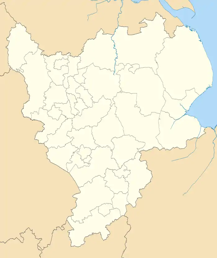
Bassetlaw is the northernmost district of Nottinghamshire, England. The district is predominantly rural, with three towns: Worksop, site of the borough council offices, Tuxford and Retford.
Bassetlaw District | |
|---|---|
District | |
 Logo | |
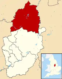 Shown within Nottinghamshire | |
| Sovereign state | United Kingdom |
| Constituent country | England |
| Region | East Midlands |
| Administrative county | Nottinghamshire |
| Founded | 1 April 1974 |
| Admin. HQ | Worksop |
| Government | |
| • Type | Non-metropolitan district |
| • Governing body | Bassetlaw District Council |
| • Council Leader | Cllr Simon Greaves (Lab) |
| • Executive | Labour |
| • MPs: | Brendan Clarke-Smith, Robert Jenrick |
| Area | |
| • Total | 246.3 sq mi (637.8 km2) |
| Area rank | 64th |
| Population (mid-2019 est.) | |
| • Total | 117,459 |
| • Rank | Ranked 201st |
| • Density | 480/sq mi (180/km2) |
| Time zone | UTC+0 (Greenwich Mean Time) |
| • Summer (DST) | UTC+1 (British Summer Time) |
| Postcode Areas | |
| ONS code | 37UC (ONS) E07000171 (GSS) |
| Ethnicity | 97.5% White 1.0% S.Asian |
| Website | bassetlaw.gov.uk |
History
Bassetlaw was created as a non-metropolitan district in 1974 by the merger of the municipal boroughs of Worksop and East Retford and most of Worksop Rural District and East Retford Rural District following the passage of the Local Government Act 1972. Local Government in Nottinghamshire is organised on a two-tier basis, with local district councils such as Bassetlaw District Council responsible for local services such as housing, local planning and refuse collection and Nottinghamshire County Council responsible for "wide-area" services, including education, social services and public transport.
The district is named after the ancient Bassetlaw wapentake of Nottinghamshire.
Settlements
Bassetlaw is divided into 66 parishes, each governed by an elected parish council or parish meeting. The two main settlements of Retford and Worksop are the only areas of the district that are unparished, however, both towns are entitled to elect a town mayor via their respective charter trustees.
| Name | Status | Image | Population (2011)[1] | Ward(s) |
|---|---|---|---|---|
| Retford | Unparished (Charter trustees) | 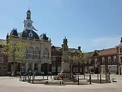 Retford Town Hall | 22,023 |
|
| Worksop | Unparished (Charter trustees) | _crossing_the_Chesterfield_Canal_-_geograph.org.uk_-_1041399.jpg.webp) Chesterfield Canal, Worksop | 43,252 |
|
| Askham | Civil parish |  St. Nicholas' Church, Askham | 181 | East Markham |
| Babworth | Civil parish | 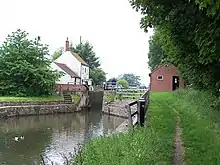 Chesterfield Canal, Babworth | 1,687 | Sutton |
| Barnby Moor | Civil parish |  Ye Olde Bell, Barnby Moor | 278 | Sutton |
| Beckingham | Civil parish | 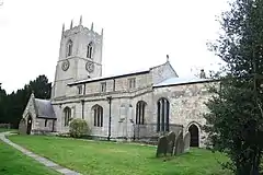 All Saints' Church, Beckingham | 1,098 | Beckingham |
| Bevercotes | Civil parish | _-_geograph.org.uk_-_724513.jpg.webp) Farm buildings in Bevercotes | Unknown | East Markham |
| Blyth | Civil parish | 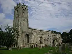 St Mary and St Martin's Church, Blyth | 1,233 | Blyth |
| Bole | Civil parish | 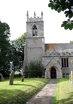 St Martin's Church, Bole | 247 | Sturton |
| Bothamsall | Civil parish | .jpg.webp) Lound Hall, Bothamsall | 270 | East Markham |
| Carburton | Civil parish |  Ollerton Road Bridge, Carburton | Unknown | Welbeck |
| Carlton in Lindrick | Civil parish | .jpg.webp) St. John's Church, Carlton in Lindrick | 5,623 | Carlton |
| Clarborough and Welham | Civil parish | 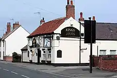 Public house in Clarborough | 1,088 | Clayworth |
| Clayworth | Civil parish | 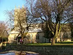 St Peter's Church, Clayworth | 419 | Clayworth |
| Clumber and Hardwick | Civil parish |  Clumber Park | Unknown | Welbeck |
| Cottam | Civil parish | 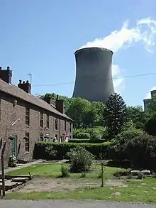 Cottages in Cottam | 108 | Rampton |
| Darlton | Civil parish | 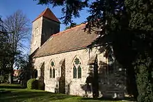 St. Giles Church, Darlton | 110 | Tuxford and Trent |
| Dunham-on-Trent | Civil parish |  St. Oswald's Church, Dunham-on-Trent | 343 | Tuxford and Trent |
| East Drayton | Civil parish |  St. Peter's Church, East Drayton | 252 | Tuxford and Trent |
| East Markham | Civil parish | .jpg.webp) St. John the Baptist Church | 1,160 | East Markham |
| Eaton | Civil parish |  Eaton | 233 | East Markham |
| Elkesley | Civil parish | 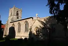 St. Giles Church, Elkesley | 822 | Welbeck |
| Everton | Civil parish | 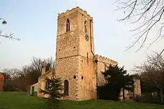 Holy Trinity Church, Everton | 839 | Everton |
| Fledborough | Civil parish | 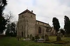 St Gregory's Church, Fledborough | Unknown | Tuxford and Trent |
| Gamston | Civil parish | 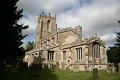 St Peter's Church, Gamston | 246 | East Markham |
| Gringley on the Hill | Civil parish |  St Peter & St Paul's Church | 699 | Everton |
| Grove | Civil parish |  View towards Grove | 105 | Rampton |
| Harworth Bircotes | Civil parish |  All Saints Church, Harworth | 7,948 | Harworth |
| Haughton | Civil parish |  Haughton watermill | Unknown | East Markham |
| Hayton | Civil parish | 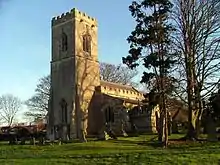 St. Peter's Church, Hayton | 385 | Clayworth |
| Headon cum Upton | Civil parish |  St. Peter's Church, Headon | 253 | Rampton |
| Hodsock | Civil parish | 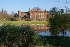 Hodsock Priory | 2,472 | Langold |
| Holbeck | Civil parish | 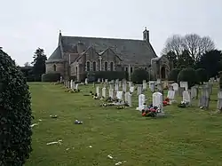 Chapel of St. Winifred | 195 | Welbeck |
| Laneham | Civil parish | 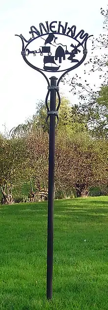 Signpost in Laneham | 312 | Tuxford and Trent |
| Lound | Civil parish |  Lound | 471 | Sutton |
| Marnham | Civil parish | 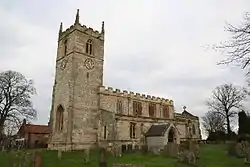 St. Wilfrid's Church, Marnham | 117 | Tuxford and Trent |
| Mattersey | Civil parish | 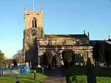 All Saints' Church, Mattersey | 792 | Ranskill |
| Misson | Civil parish | 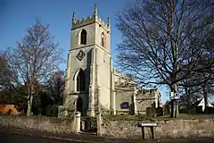 St. John the Baptist Church, Misson | 745 | Everton |
| Misterton | Civil parish | 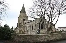 All Saints' Church, Misterton | 2,140 | Misterton |
| Nether Langwith | Civil parish | 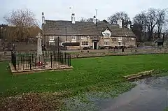 Public house in Nether Langwith | 526 | Welbeck |
| Normanton on Trent | Civil parish | 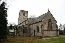 St. Matthew's Church | 345 | Tuxford and Trent |
| North and South Wheatley | Civil parish | .jpg.webp) Church of St. Peter and St. Paul's | 509 | Sturton |
| North Leverton with Habblesthorpe | Civil parish |  North Leverton Windmill | 1,047 | Sturton |
| Norton and Cuckney | Civil parish | 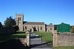 St. Mary's Church, Cuckney | 351 | Welbeck |
| Ragnall | Civil parish |  St.Leonard's Church, Ragnall | Unknown | Tuxford and Trent |
| Rampton and Woodbeck | Civil parish | 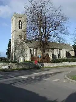 All Saints' Church, Rampton | 1,139 | Rampton |
| Ranskill | Civil parish | .jpg.webp) Church of St Barnabas, Ranskill | 1,362 | Rampton |
| Rhodesia | Civil parish | 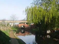 Chesterfield Canal, Rhodesia | 982 | Worksop North West |
| Saundby | Civil parish | 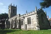 Church of St Martin of Tours | 165 | Worksop North West |
| Scaftworth | Civil parish |  Public house in Scaftworth | Unknown | Everton |
| Scrooby | Civil parish | 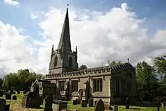 St. Wilfrid's Church, Scrooby | 315 | Blyth |
| Shireoaks | Civil parish | 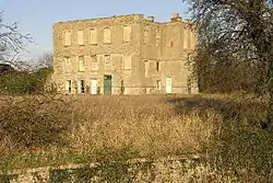 Shireoaks Hall | 1,432 | Worksop North West |
| South Leverton | Civil parish | 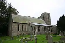 All Saints’ Church, South Leverton | 480 | Rampton |
| Stokeham | Civil parish | .jpg.webp) St. Peter's Church, Stokeham | Unknown | Rampton |
| Sturton le Steeple | Civil parish |  Sturton le Steeple | 486 | Sturton |
| Styrrup with Oldcotes | Civil parish | 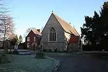 St. Helen's Church, Oldcotes | 684 | Blyth |
| Sutton | Civil parish | 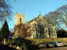 St. Bartholomew’s Church | 673 | Sutton |
| Torworth | Civil parish | 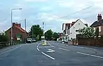 Great North Road, Torworth | 263 | Ranskill |
| Treswell | Civil parish | .jpg.webp) St. John the Baptist Church, Treswell | 211 | Rampton |
| Tuxford | Civil parish | 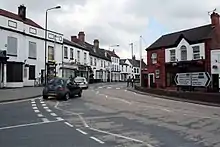 Tuxford High Street | 2,649 | Tuxford and Trent |
| Walkeringham | Civil parish | 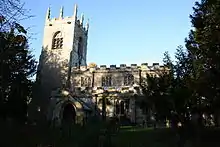 St. Mary Magdalene Church, Walkeringham | 1,022 | Beckingham |
| Wallingwells | Civil parish | 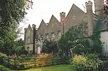 Wallingwells Hall | 22 | Carlton |
| Welbeck | Civil parish | 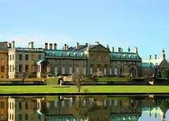 Welbeck Abbey | Unknown | Welbeck |
| West Burton | Civil parish | 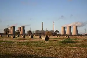 West Burton power stations | Unknown | Sturton |
| West Drayton | Civil parish |  West Drayton | 225 | East Markham |
| West Markham | Civil parish | 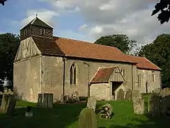 All Saints' Church, West Markham | 170 | East Markham |
| West Stockwith | Civil parish | 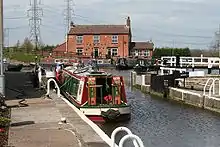 West Stockwith lock | 327 | Misterton |
| Wiseton | Civil parish |  Cottages in Wiseton | Unknown | Clayworth |
Politics
Parliamentary constituency
The constituency was created in 1885 by the Redistribution of Seats Act. Bassetlaw was for many years a safe seat for the Labour Party. Labour first won the seat in the 1929 general election. However, its Member of parliament Malcolm MacDonald was one of the few Labour MPs to join his father Ramsay MacDonald's National Government. MacDonald held the seat as a National Labour candidate in the 1931 election, but was defeated at the next election in 1935 by Labour's Frederick Bellenger.
The constituency was held by the Labour Party until December 2019, when the incumbent Labour MP John Mann stood down to take on a full-time role as the government’s antisemitism tsar. He was later given a life peerage in Theresa May's resignation honours list, styling himself Baron Mann, of Holbeck Moor in the City of Leeds. In the 2019 general election the Conservative Party candidate Brendan Clarke-Smith won the seat with the biggest swing in the election, turning a 4,852 Labour majority into a 14,013 Conservative majority and becoming the first non-Labour MP to represent the constituency in 90 years.[2]
Members of Parliament:
- 1929-1935 Malcolm MacDonald (Labour, National Labour)
- 1935-1968 Frederick Bellenger (Labour)
- 1968-2001 Joe Ashton (Labour)
- 2001-2019 John Mann (Labour)
- 2019-current Brendan Clarke-Smith Conservative
Council elections
Bassetlaw District Council was created in 1974 following the passage of the Local Government Act 1972. The first elections to the council took place on 7 June 1973, which resulted in the Labour Party taking control of the newly created council after winning 29 of 51 seats available. Following the next set of elections in 1976, the Labour Party lost its majority and no single party held a majority of seats. Labour regained control of the council following the 1979 local elections and continued to hold a majority of seats on the council for a further 25 years until they once again lost their majority in 2004. In 2006, the Conservatives gained control of the council for the first time and held control until 2010 when a series of by-election defeats caused them to lose their majority. Labour regained control of the council in 2011 for the first time in seven years and has been in control of the council since.
The most recent council election on 2 May 2019 resulted in the Labour Party retaining its control of the council with an increased majority. The Conservative Party suffered its worst defeat in Bassetlaw since 1973, winning only 5 seats of the 12 seats it was defending. Both Independents and Labour gained seats from the Conservatives. The Liberal Democrats gained a seat from Labour in East Retford West, the first Liberal Democrat elected in Bassetlaw since 2006.[3]
| Year | Labour | Conservative | Independent | Liberal Democrats |
|---|---|---|---|---|
| 2019 election | 37 | 5 | 5 | 1 |
| 2015 election | 33 | 12 | 3 | 0 |
| 2011 election | 27 | 18 | 3 | 0 |
| 2010 election | 20 | 25 | 3 | 0 |
| 2008 election | 16 | 30 | 2 | 0 |
| 2007 election | 16 | 27 | 5 | 0 |
| 2006 election | 14 | 28 | 5 | 1 |
Wards
Bassetlaw is divided into 25 wards for electoral purposes. Each ward returns either one, two or three councillors at each election depending upon the number of electors within each ward.[4]
|
 |
Demography
Population
| Population of Bassetlaw (1811–2011) | |||||||
|---|---|---|---|---|---|---|---|
| Year | Population | Year | Population | Year | Population | ||
| 1811 | 25,813 | 1881 | 43,735 | 1951 | 101,590 | ||
| 1821 | 30,148 | 1891 | 45,203 | 1961 | 99,221 | ||
| 1831 | 32,950 | 1901 | 50,796 | 1971 | 96,918 | ||
| 1841 | 34,961 | 1911 | 57,084 | 1981 | 101,119 | ||
| 1851 | 37,180 | 1921 | 63,854 | 1991 | 105,354 | ||
| 1861 | 39,365 | 1931 | 71,427 | 2001 | 107,701 | ||
| 2011 | 112,863 | ||||||
| Pre-1974 statistics were gathered from local government areas that now comprise Bassetlaw. Source: Great Britain Historical GIS.[5] | |||||||
Town twinning
 Farmers Branch, Texas, USA
 Garbsen, Germany
- Pfungstadt, Germany
 Aurillac, France
References
- "Local Area Reports". Nomis - Official Labour Market Statistics. Office for National Statistics. Retrieved 30 June 2020.
- "Bassetlaw voters reject Labour in 'gigantic' swing to Tories at General Election". Lincolnshire Live.
- "Council Results". www.electionscentre.co.uk. Elections Centre. Retrieved 3 May 2019.
- "Bassetlaw". Local Government Boundary Commission for England. Retrieved 30 June 2020.
- Bassetlaw District: Historical statistics: Population, A Vision of Britain through Time, retrieved 18 April 2011
- Bassetlaw: Census Area Statistics, Office for National Statistics, retrieved 18 April 2011