Bridgeport, Nevada County, California
Bridgeport (also: Nyes Landing and Nye's Crossing) is a former settlement on the Yuba River in Nevada County, California, 2 mi (3.2 km) from the town of French Corral. Its elevation is 567 ft (173 m) above sea level.[2]
Bridgeport | |
|---|---|
Former settlement | |
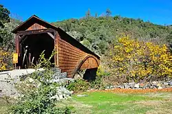 Bridgeport Covered Bridge, a well-known local landmark | |
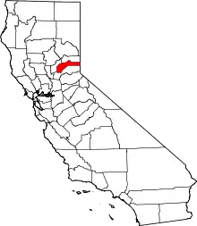
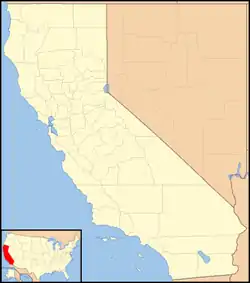 Bridgeport Location in California | |
| Coordinates: 39°17′30″N 121°11′37″W | |
| Country | |
| State | |
| County | Nevada County |
| Elevation | 581 ft (177 m) |
It is notable for the Bridgeport Covered Bridge, a national and state historic landmark, used as a pedestrian crossing over the South Yuba River.[3] The South Yuba River State Park is adjacent.
History
In 1849, as part of the California Gold Rush, brothers Urias and Manual Nye built a trading post on the site.[4]
See also
- Yuba River topics
- Mining communities of the California Gold Rush
References
- U.S. Geological Survey Geographic Names Information System: Bridgeport, Nevada County, California
- "NEVADA COUNTY, CALIFORNIA". calsign.com. Archived from the original on 2009-01-06. Retrieved 2009-05-28.
- "California Historical Landmarks in Nevada County". noehill.com. Retrieved 2009-05-28.
- Durham, David L. (1998). California's Geographic Names: A Gazetteer of Historic and Modern Names of the State. Quill Driver Books. p. 454. ISBN 1-884995-14-4.
This article is issued from Wikipedia. The text is licensed under Creative Commons - Attribution - Sharealike. Additional terms may apply for the media files.