Union Hill, California
Union Hill is a former settlement in Nevada County, California, 1.5 mi (2.4 km) from Grass Valley.[2] Its elevation is 2,700 ft (820 m) above sea level.[1]
Union Hill | |
|---|---|
Former settlement | |
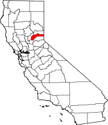
 Union Hill Location in California | |
| Coordinates: 39°12′20″N 121°02′15″W | |
| Country | |
| State | |
| County | Nevada County |
| Elevation | 2,700 ft (823 m) |
| Time zone | UTC-8 (Pacific (PST)) |
| • Summer (DST) | UTC-7 (PDT) |
Gold mining is recorded as early as January 30, 1851. A number of mines yielded eighty dollars per ton at times. Sulfurets were said to yield 420 dollars per ton. First arrastres were in use, then a number of stamp mills. [3]
The Union Hill School District, established in 1868, continues to operate in Grass Valley, though at a different location.
Beginning in 1876, travelers could reach Union Hill via the Nevada County Narrow Gauge Railroad.[4] Its station was located on the Union Hill road, southeast of Grass Valley and northwest of Colfax.[5]
The Union Hill mine was a good producer of gold for many years.
References
- U.S. Geological Survey Geographic Names Information System: Union Hill, California
- Durham, David L. (1998). California's Geographic Names: A Gazetteer of Historic and Modern Names of the State. Quill Driver Books. p. 571. ISBN 1-884995-14-4.
- Bean, Edwin F. (1867). History and Directory of Nevada County. p. 220.
- Preston, E. M. (1886). Nevada County, the famous Bartlett pear belt of California. Digitized Aug 29, 2008. Nevada County Land and Improvement Association. Brown & Calkins, Printers. p. 51.
- Shearer, Frederick E. (1882). The Pacific Tourist: J.R. Bowman's Illustrated Transcontinental Guide of Travel, from the Atlantic to the Pacific Ocean (Digitized Jan 30, 2008 ed.). J.R. Bowman. p. 253.