Bro Garmon
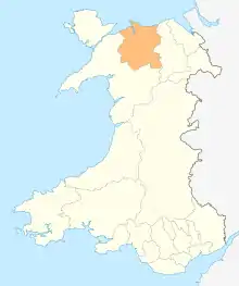
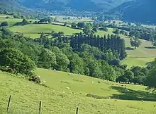
Bro Garmon is a sparsely populated [1] community in Conwy County Borough, in Wales. It is located on the eastern side of the Conwy Valley, stretching from north east of Llanrwst to just west of Pentrefoelas, and includes the villages of Capel Garmon, Glan Conwy, Melin-y-Coed, Nebo, Oaklands, Rhydlanfair and Pentre-tafarn-y-fedw. Moel Seisiog, on the eastern boundary, rises to a height of 1,535 feet (468 m). The main settlement, Capel Garmon, lies 2.4 miles (3.9 km) east of Betws-y-Coed, 5.2 miles (8.4 km) north west of Pentrefoelas, 4.4 miles (7.1 km) south of Llanrwst and 15.7 miles (25.3 km) south of Conwy. At the 2001 census the community had a population of 648,[2] increasing slightly at the 2011 census to 652.[3]
| Bro Garmon | |
|---|---|
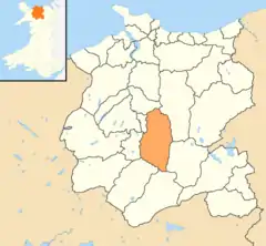 Location of Bro Garmon within Conwy County Borough | |
| Area | 54.67 km2 (21.11 sq mi) |
| Population | 652 (2011) |
| • Density | 12/km2 (31/sq mi) |
| OS grid reference | SH8155 |
| Community |
|
| Principal area | |
| Ceremonial county | |
| Country | Wales |
| Sovereign state | United Kingdom |
| Post town | LLANRWST |
| Postcode district | LL26 |
| Dialling code | 01690 |
| Police | North Wales |
| Fire | North Wales |
| Ambulance | Welsh |
| UK Parliament | |
| Senedd Cymru – Welsh Parliament | |
Saint Garmon's church, in Capel Garmon, was consecrated in 1862, but is no longer in use.[4] An Iron Age firedog, discovered buried in a nearby field in 1852, and now held at the National Museum of Wales, is considered to have been produced by a master craftsman. It depicts two mythical creatures, part horse and part bull, and is rated as one of the most important examples of decorative ironwork found in the United Kingdom.[5] To the south of the village, a Neolithic chamber tomb has been dated to 5,500 years ago.[6] Nearby, Melin Plas-yn-Rhos is a water-powered corn mill thought to date from the 18th century.[7]
Waterloo Bridge, which carries the A5 across the River Conwy to Betws-y-Coed, was built by Thomas Telford in 1815, the year of the Battle of Waterloo, and is made wholly from cast iron.[8] It is Grade I listed,[9] and Cyffdy Hall, at Melin-y-coed, and Cilcennus at Oaklands are Grade II* listed.[10][11] Numerous houses, farm buildings and several bridges in the community are Grade II listed.
The community is part of the Uwch Conwy ward for elections to Conwy County Borough Council.
References
- https://www.nomisweb.co.uk/reports/localarea?compare=W04000108
- "Census 2001: Parish Headcounts: Conwy". Neighbourhood Statistics. Office for National Statistics. Archived from the original on 29 November 2014. Retrieved 9 April 2013.
- "Community population 2011". Retrieved 22 May 2015.
- "Capel Garmon Parish Church". Coflein. Royal Commission on the Ancient and Historical Monuments of Wales. Retrieved 10 April 2013.
- "Stunning Ironwork Firedog Discovered in Farmer's Field". Rhagor. National Museum of Wales. Archived from the original on 5 November 2013. Retrieved 10 April 2013.
- "Capel Garmon Burial Ghamber". Coflein. Royal Commission on the Ancient and Historical Monuments of Wales. Retrieved 10 April 2013.
- "Melin Plas-yn-Rhos Corn Mill". Coflein. Royal Commission on the Ancient and Historical Monuments of Wales. Retrieved 10 April 2013.
- "Waterloo Bridge, Betws-y-Coed". Engineering Timelines. Retrieved 10 April 2013.
- "Waterloo Bridge, Bro Garmon". British Listed Buildings. Retrieved 10 April 2013.
- "Cyffdy Hall (Including Attached Coach House), Bro Garmon". British Listed Buildings. Retrieved 10 April 2013.
- "Cilcennus". British Listed Buildings. Retrieved 10 April 2013.
External links
![]() Media related to Bro Garmon at Wikimedia Commons
Media related to Bro Garmon at Wikimedia Commons
- Bro Garmon Community Council
- A Vision of Britain Through Time
- British Listed Buildings
- Clwyd Churches
- Genuki
- Geograph
- Office for National Statistics