Brookfield Township, Tioga County, Pennsylvania
Brookfield Township is a township in Tioga County, Pennsylvania, in the United States. The population was 421 at the 2010 census.[4]
Brookfield Township, Pennsylvania | |
|---|---|
 Brookfield Township | |
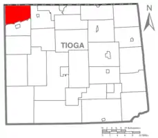 Map of Tioga County Highlighting Brookfield Township | |
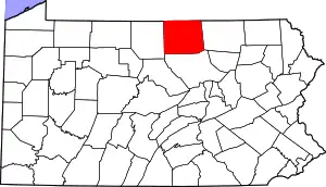 Map of Pennsylvania highlighting Tioga County | |
| Country | United States |
| State | Pennsylvania |
| County | Tioga |
| Settled | 1809 |
| Incorporated | 1827 |
| Area | |
| • Total | 31.88 sq mi (82.56 km2) |
| • Land | 31.88 sq mi (82.56 km2) |
| • Water | 0.00 sq mi (0.00 km2) |
| Population (2010) | |
| • Total | 421 |
| • Estimate (2016)[2] | 409 |
| • Density | 12.83/sq mi (4.95/km2) |
| Time zone | Eastern Time Zone (North America) |
| • Summer (DST) | EDT |
| FIPS code | 42-117-09072 |
| Historical population | |||
|---|---|---|---|
| Census | Pop. | %± | |
| 2000 | 443 | — | |
| 2010 | 421 | −5.0% | |
| 2016 (est.) | 409 | [2] | −2.9% |
| U.S. Decennial Census[3] | |||
Geography
According to the United States Census Bureau, the township has a total area of 31.8 square miles (82 km2), all of it land.
Brookfield Township is bordered by the Town of Troupsburg, Steuben County, New York to the north, Deerfield Township to the east, Westfield Township to the south and Harrison Township in Potter County to the west.
Demographics
As of the census[5] of 2000, there were 443 people, 171 households, and 132 families residing in the township. The population density was 13.9 people per square mile (5.4/km2). There were 247 housing units at an average density of 7.8/sq mi (3.0/km2). The racial makeup of the township was 99.10% White, and 0.90% from two or more races. Hispanic or Latino of any race were 0.90% of the population.
There were 171 households, out of which 27.5% had children under the age of 18 living with them, 67.8% were married couples living together, 5.8% had a female householder with no husband present, and 22.8% were non-families. 19.3% of all households were made up of individuals, and 6.4% had someone living alone who was 65 years of age or older. The average household size was 2.59 and the average family size was 2.98.
In the township the population was spread out, with 23.0% under the age of 18, 7.4% from 18 to 24, 25.5% from 25 to 44, 28.2% from 45 to 64, and 15.8% who were 65 years of age or older. The median age was 42 years. For every 100 females, there were 112.0 males. For every 100 females age 18 and over, there were 101.8 males.
The median income for a household in the township was $34,318, and the median income for a family was $36,250. Males had a median income of $28,750 versus $20,938 for females. The per capita income for the township was $14,673. About 11.8% of families and 15.2% of the population were below the poverty line, including 24.0% of those under age 18 and 15.5% of those age 65 or over.
Communities and locations
- Austinburg – A village in the northeast part of the township on Pennsylvania Route 249.
- Brookfield – A village in the northwest part of the township near the New York state line.
- Sylvester – A village in the central part of the township.
References
- "2016 U.S. Gazetteer Files". United States Census Bureau. Retrieved Aug 14, 2017.
- "Population and Housing Unit Estimates". Retrieved June 9, 2017.
- "Census of Population and Housing". Census.gov. Retrieved June 4, 2016.
- "U.S. Census website". United States Census Bureau. Retrieved 2017-02-27.
- "U.S. Census website". United States Census Bureau. Retrieved 2008-01-31.
Municipalities and communities of Tioga County, Pennsylvania, United States | ||
|---|---|---|
| Boroughs | | |
| Townships | ||
| CDPs | ||
| Unincorporated communities | ||
| ||