Rutland Township, Tioga County, Pennsylvania
Rutland Township is a township in Tioga County, Pennsylvania, in the United States. The population was 805 at the 2010 census.[4]
Rutland Township, Pennsylvania | |
|---|---|
Township | |
 A Rutland Township farm | |
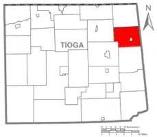 Map of Tioga County Highlighting Rutland Township | |
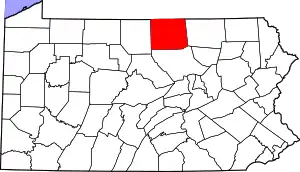 Map of Pennsylvania highlighting Tioga County | |
| Country | United States |
| State | Pennsylvania |
| County | Tioga |
| Settled | 1806 |
| Incorporated | 1828 |
| Area | |
| • Total | 36.31 sq mi (94.03 km2) |
| • Land | 36.29 sq mi (93.99 km2) |
| • Water | 0.02 sq mi (0.04 km2) |
| Population (2010) | |
| • Total | 805 |
| • Estimate (2016)[2] | 831 |
| • Density | 22.90/sq mi (8.84/km2) |
| Time zone | Eastern Time Zone (North America) |
| • Summer (DST) | EDT |
| FIPS code | 42-117-66912 |
| Historical population | |||
|---|---|---|---|
| Census | Pop. | %± | |
| 2000 | 736 | — | |
| 2010 | 805 | 9.4% | |
| 2016 (est.) | 831 | [2] | 3.2% |
| U.S. Decennial Census[3] | |||
Geography
According to the United States Census Bureau, the township has a total area of 35.4 square miles (91.7 km2), of which, 35.4 square miles (91.7 km2) is land and 0.03% is water.
Rutland Township is bordered by Jackson Township to the north, Wells and Columbia Townships in Bradford County to the east, Sullivan Township to the south, Richmond Township to the south and west, and Tioga Township to the west.
Demographics
As of the census[5] of 2000, there were 736 people, 270 households, and 207 families residing in the township. The population density was 20.8 people per square mile (8.0/km2). There were 347 housing units at an average density of 9.8/sq mi (3.8/km2). The racial makeup of the township was 98.78% White, 0.41% African American, 0.54% Native American, and 0.27% from two or more races.
There were 270 households, out of which 33.3% had children under the age of 18 living with them, 70.0% were married couples living together, 3.7% had a female householder with no husband present, and 23.3% were non-families. 20.0% of all households were made up of individuals, and 7.4% had someone living alone who was 65 years of age or older. The average household size was 2.63 and the average family size was 2.97.
In the township the population was spread out, with 24.2% under the age of 18, 5.2% from 18 to 24, 28.0% from 25 to 44, 26.4% from 45 to 64, and 16.3% who were 65 years of age or older. The median age was 41 years. For every 100 females, there were 101.6 males. For every 100 females age 18 and over, there were 101.4 males.
The median income for a household in the township was $35,368, and the median income for a family was $37,054. Males had a median income of $29,167 versus $19,500 for females. The per capita income for the township was $16,125. About 7.9% of families and 7.1% of the population were below the poverty line, including 4.7% of those under age 18 and 8.9% of those age 65 or over.
Communities and locations
- Lawrence Corners – A village on Pennsylvania Route 549 in the western part of the township.
- Roseville – A very small borough on Pennsylvania Route 549 in the central part of the township.
References
- "2016 U.S. Gazetteer Files". United States Census Bureau. Retrieved Aug 14, 2017.
- "Population and Housing Unit Estimates". Retrieved June 9, 2017.
- "Census of Population and Housing". Census.gov. Retrieved June 4, 2016.
- "U.S. Census website". United States Census Bureau. Retrieved 2017-02-27.
- "U.S. Census website". United States Census Bureau. Retrieved 2008-01-31.
Municipalities and communities of Tioga County, Pennsylvania, United States | ||
|---|---|---|
| Boroughs | | |
| Townships | ||
| CDPs | ||
| Unincorporated communities | ||
| ||