Bryn Mawr, Minneapolis
Bryn Mawr (pronounced /ˌbrɪnˈmɑːr/ from Welsh for "big hill") is a neighborhood within the Calhoun-Isles community in Minneapolis. It is located directly west of downtown Minneapolis. The oddly-shaped neighborhood is bound by parkland: Theodore Wirth Park to the north and west, Bassett Creek to the north, Bryn Mawr Meadows to the east, and Cedar Lake Park to the south. Nearby neighborhoods include Harrison to the north, Lowry Hill to the east, and Kenwood and Cedar-Isles-Dean to the south. To the west is the city limit, where the neighborhood borders on the suburbs of Saint Louis Park and Golden Valley. Prior to the 1960s, the neighborhood was home to many workers of the nearby Minneapolis and St. Louis Railway yard.
Bryn Mawr | |
|---|---|
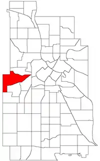 Location of Bryn Mawr within the U.S. city of Minneapolis | |
| Country | United States |
| State | Minnesota |
| County | Hennepin |
| City | Minneapolis |
| Community | Calhoun-Isles |
| Area | |
| • Total | 1.348 sq mi (3.49 km2) |
| Population (2010)[2] | |
| • Total | 2,651 |
| • Density | 2,000/sq mi (760/km2) |
| Time zone | UTC-6 (CST) |
| • Summer (DST) | UTC-5 (CDT) |
| ZIP code | 55405, 55416 |
| Area code(s) | 612 |
| Historical population | |||
|---|---|---|---|
| Census | Pop. | %± | |
| 1980 | 2,777 | — | |
| 1990 | 2,845 | 2.4% | |
| 2000 | 2,663 | −6.4% | |
| 2010 | 2,651 | −0.5% | |
References
- "Bryn-Mawr neighborhood in Minneapolis, Minnesota (MN), 55405, 55416 detailed profile". City-Data. 2011. Retrieved 2013-11-12.
- "Minneapolis Neighborhood Profile: Bryn Mawr" (PDF). Minnesota Compass. October 2011. Retrieved 2013-11-12.
- Bryn Mawr, Minneapolis, MN. Google Earth. Retrieved 2011-03-09.
External links
- Bryn Mawr Elementary
- City of Minneapolis: Bryn Mawr Neighborhood Profile
- Bryn Mawr Neighborhood Association
- Bryn Mawr of Minneapolis Photo Group
Places adjacent to Bryn Mawr, Minneapolis | ||||||||||
|---|---|---|---|---|---|---|---|---|---|---|
| ||||||||||
This article is issued from Wikipedia. The text is licensed under Creative Commons - Attribution - Sharealike. Additional terms may apply for the media files.