Bueng Na Rang District
Bueng Na Rang (Thai: บึงนาราง, pronounced [bɯ̄ŋ nāː rāːŋ]) is a district (amphoe) in the western part of Phichit Province, central Thailand.
Bueng Na Rang
บึงนาราง | |
|---|---|
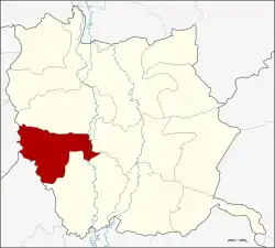 Amphoe location in Phichit Province | |
| Coordinates: 16°10′18″N 100°7′36″E | |
| Country | Thailand |
| Province | Phichit |
| Seat | Huai Kaeo |
| Area | |
| • Total | 450.610 km2 (173.981 sq mi) |
| Population (2005) | |
| • Total | 28,277 |
| • Density | 62.3/km2 (161/sq mi) |
| Time zone | UTC+7 (ICT) |
| Postal code | 66130 |
| Geocode | 6610 |
Geography
Neighboring districts are (from the north clockwise) Pho Prathap Chang, Taphan Hin and Pho Thale of Phichit Province, Banphot Phisai of Nakhon Sawan Province and Bueng Samakkhi of Kamphaeng Phet Province.
History
The minor district was established on 15 July 1996 by splitting off five tambon from Pho Thale District.[1]
The Thai government on 15 May 2007 upgraded all 81 minor districts to full districts.[2] With publication in the Royal Gazette on 24 August the upgrade became official .[3]
Administration
The district is divided into five sub-districts (tambon), which are further subdivided into 50 villages (muban). There are no municipal (thesaban) areas, and five tambon administrative organizations (TAO).
| No. | Name | Thai name | Villages | Pop. | |
|---|---|---|---|---|---|
| 1. | Huai Kaeo | ห้วยแก้ว | 8 | 4,504 | |
| 2. | Pho Sai Ngam | โพธิ์ไทรงาม | 9 | 4,137 | |
| 3. | Laem Rang | แหลมรัง | 14 | 8,150 | |
| 4. | Bang Lai | บางลาย | 9 | 6,538 | |
| 5. | Bueng Na Rang | บึงนาราง | 10 | 4,948 |
References
- ประกาศกระทรวงมหาดไทย เรื่อง แบ่งเขตท้องที่อำเภอโพทะเล จังหวัดพิจิตร ตั้งเป็นกิ่งอำเภอบึงนาราง (PDF). Royal Gazette (in Thai). 113 (Special 18 ง): 21. June 26, 1996.
- แถลงผลการประชุม ครม. ประจำวันที่ 15 พ.ค. 2550 (in Thai). Manager Online.
- พระราชกฤษฎีกาตั้งอำเภอฆ้องชัย...และอำเภอเหล่าเสือโก้ก พ.ศ. ๒๕๕๐ (PDF). Royal Gazette (in Thai). 124 (46 ก): 14–21. August 24, 2007.