Dong Charoen District
Dong Charoen (Thai: ดงเจริญ, pronounced [dōŋ t͡ɕā.rɤ̄ːn]) is a district (amphoe) in the southeastern part of Phichit Province, central Thailand.
Dong Charoen
ดงเจริญ | |
|---|---|
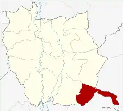 District location in Phichit Province | |
| Coordinates: 16°1′42″N 100°37′36″E | |
| Country | Thailand |
| Province | Phichit |
| Seat | Wang Ngio Tai |
| Area | |
| • Total | 220.3 km2 (85.1 sq mi) |
| Population (2007) | |
| • Total | 18,214 |
| • Density | 82.7/km2 (214/sq mi) |
| Time zone | UTC+7 (ICT) |
| Postal code | 66210 |
| Geocode | 6611 |
Geography
Neighboring districts are (from the west clockwise) Bang Mun Nak and Thap Khlo of Phichit Province, Chon Daen of Phetchabun Province and Nong Bua of Nakhon Sawan Province.
History
The minor district (king amphoe) was established on 15 July 1996 by splitting off five tambons from Bang Mun Nak District.[1]
The Thai government on 15 May 2007 upgraded all 81 minor districts to full districts.[2] On 24 August the upgrade became official.[3]
Administration
The district is divided into five sub-districts (tambons), which are further subdivided into 54 villages (mubans). The township (thesaban tambon) Samnak Khun Nen covers parts of tambon Samnak Khun Nen. There are a further five tambon administrative organizations (TAO).
| No. | Name | Thai name | Villages | Pop. | |
|---|---|---|---|---|---|
| 1. | Wang Ngio Tai | วังงิ้วใต้ | 9 | 3,511 | |
| 2. | Wang Ngio | วังงิ้ว | 11 | 3,797 | |
| 3. | Huai Ruam | ห้วยร่วม | 12 | 3,325 | |
| 4. | Huai Phuk | ห้วยพุก | 11 | 3,993 | |
| 5. | Samnak Khun Nen | สำนักขุนเณร | 11 | 5,789 |
References
- ประกาศกระทรวงมหาดไทย เรื่อง แบ่งเขตท้องที่อำเภอมูลนาก จังหวัดพิจิตร ตั้งเป็นกิ่งอำเภอดงเจริญ (PDF). Royal Gazette (in Thai). 1113 (Special 18 ง): 17. June 26, 1996.
- แถลงผลการประชุม ครม. ประจำวันที่ 15 พ.ค. 2550 (in Thai). Manager Online.
- พระราชกฤษฎีกาตั้งอำเภอฆ้องชัย...และอำเภอเหล่าเสือโก้ก พ.ศ. ๒๕๕๐ (PDF). Royal Gazette (in Thai). 124 (46 ก): 14–21. August 24, 2007.