Thap Khlo District
Thap Khlo (Thai: ทับคล้อ, pronounced [tʰáp kʰlɔ́ː]) is a district (amphoe) in the eastern part of Phichit Province, central Thailand.
Thap Khlo
ทับคล้อ | |
|---|---|
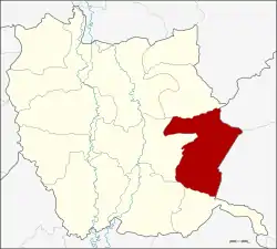 Amphoe location in Phichit Province | |
| Coordinates: 16°9′42″N 100°35′48″E | |
| Country | Thailand |
| Province | Phichit |
| Seat | Thap Khlo |
| Area | |
| • Total | 378.287 km2 (146.057 sq mi) |
| Population (2005) | |
| • Total | 46,377 |
| • Density | 122.6/km2 (318/sq mi) |
| Time zone | UTC+7 (ICT) |
| Postal code | 66150 |
| Geocode | 6608 |
Geography
Neighboring districts are (from the south clockwise) Dong Charoen, Bang Mun Nak, Taphan Hin and Wang Sai Phun of Phichit Province, Noen Maprang of Phitsanulok Province, Wang Pong and Chon Daen of Phetchabun Province.
History
On 1 May 1983 the minor district (king amphoe) Thap Khlo was established as a subordinate of Taphan Hin District, from which four tambon were split off.[1] On 13 August 1987 it was upgraded to a full district.[2]
Economy
Khao Chet Luk in the Thap Khlo District is the site of Thailand's largest gold mine, the Chatree Mining Complex. Akara Resources PCL, a Thai-Australian firm, owns and operates the mine. Akara is a subsidiary of Australian company, Kingsgate Consolidated Ltd. The complex includes the Chatree South ore field, which began commercial production in November 2001, and the Chatree North ore field, which began production in November 2008. The complex also includes processing plants.[3] In 2015, the mine produced and exported four tonnes (4,000 kg) of gold. In May 2016, the Thai government announced that the Chatree mine would be closed at the end of 2016 due to environmental concerns. The mine has long been accused by local residents of poisoning residents, crops, and livestock. In January 2015 a government investigation team said that more than 300 neighboring villagers had tested positive for arsenic and manganese.[4]
Akara has asked the government to review its decision. The company was surprised that the cabinet adopted the resolution to close the mine given that a panel set up by the Ministry of Industry has not yet completed its investigation into pollution and health complaints. The panel, set up in 2015, is composed of state agencies, affected villagers, academics, environmentalists, and Akara representatives. The company claims that there is no conclusive link between the heavy metals and illnesses claimed by some villagers.[5] Blood tests on 1,004 residents in 14 communities living around the mining sites in 2014 and 2015 found that 42 percent of residents had high levels of manganese in their blood.[6] In July 2018, the committee looking into the case confirmed that toxic leaks have emanated from tailing storage at the mine. Evidence of leakage into nearby rice fields and an observation well were also confirmed.[7]
Kingsgate will seek a settlement through arbitration procedures under the Australia-Thailand Free Trade Agreement "in order to recover the substantial losses that it has suffered, and continue to suffer, as a result of the measures taken by the Thai government."[8]
Administration
The district is divided into four sub-districts (tambon), which are further subdivided into 57 villages (muban). There are two townships (thesaban tambon), Thap Khlo and Khao Sai. Both cover parts of their respective tambons. There are a further four tambon administrative organizations (TAO).
| No. | Name | Thai name | Villages | Pop. | |
|---|---|---|---|---|---|
| 1. | Thap Khlo | ทับคล้อ | 11 | 15,820 | |
| 2. | Khao Sai | เขาทราย | 14 | 14,600 | |
| 3. | Khao Chet Luk | เขาเจ็ดลูก | 13 | 7,682 | |
| 4. | Thai Thung | ท้ายทุ่ง | 19 | 8,275 |
References
- ประกาศกระทรวงมหาดไทย เรื่อง แบ่งท้องที่อำเภอตะพานหิน จังหวัดพิจิตร ตั้งเป็นกิ่งอำเภอทับคล้อ (PDF). Royal Gazette (in Thai). 100 (65 ง): 1317. April 26, 1983.
- พระราชกฤษฎีกาจัดตั้งอำเภอพญาเม็งราย อำเภอพบพระ อำเภอทับคล้อ อำเภอบ้านโคก และอำเภอโพธิ์ไทร พ.ศ. ๒๕๓๐ (PDF). Royal Gazette (in Thai). 104 (156 ก special): 26–28. August 12, 1987.
- "Business Overview; Operations". Akara Resources PCL.
- Sagoli, Damir (2016-05-10). "Thailand to shut sole gold mine over environmental concerns". Reuters. Reuters. Retrieved 11 May 2016.
- Wipatayotin, Apinya (2016-05-30). "Akara ready for a fight". Bangkok Post. Retrieved 30 May 2016.
- Wipatayotin, Apinya (2016-05-30). "Locals struggle to cope with gold mine impacts". Bangkok Post. Retrieved 30 May 2016.
- "Study finds toxic leaks from Ankara tailings pond". Bangkok Post. 22 July 2018. Retrieved 22 July 2018.
- Kotani, Hiroshi (10 December 2017). "Australia's Kingsgate battles Thai government over gold mine closure". Nikkei Asian Review. Retrieved 10 December 2017.