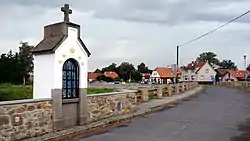
Buzice
Buzice is a village and municipality (obec) in Strakonice District in the South Bohemian Region of the Czech Republic.
Buzice | |
|---|---|
Municipality | |
 | |
 Flag  Coat of arms | |
 Buzice | |
| Coordinates: 49°25′47″N 13°56′54″E | |
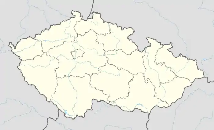
| Country | |
| Region | South Bohemian |
| District | Strakonice |
| Area | |
| • Total | 8.4 km2 (3.2 sq mi) |
| Elevation | 432 m (1,417 ft) |
| Population | |
| • Total | 131 |
| • Density | 16/km2 (40/sq mi) |
| Postal code | 388 01 |
| Website | http://www.blatensko.cz/buzice/ |
The municipality covers an area of 8.4 square kilometres (3.2 sq mi), and has a population of 131.
Buzice lies approximately 19 kilometres (12 mi) north of Strakonice, 64 km (40 mi) north-west of České Budějovice, and 81 km (50 mi) south-west of Prague.
History
There is evidence that the village of Buzice dates back to 1384. Boyars, members of higher Slav nobility, inhabited Buzice, the eldest was Predota (c.1384–1412). His brother, Pesik (first recorded in 1397) had a son named Busk (or Bohuslav) (c.1401–1412), then a popular name within the nobility. Omeljan Pritsak concluded in research about the Attila Clan of the Hunnic Empire that the religious suffix ‘sig’ when combined with Hunnic ‘Buz’ would mean “Wild Boar like-man”, a symbol in the family emblem. In addition she thinks that the movement of the Slavs in Europe is accompanied under the leadership of the ruling class of Huns, whose language is gradually melted into Slavonic. Es latest members were recalled: Jan (c.1446-1480), Vaclav of Buzice, recalls Busek (c.1451-1473) and the younger Busek (c.1463-1498). By the end of the 15th century, the enlarged family could no longer feed the estate and moved to Blatne. The fortress of Buzice was bought by his cousin Zdenek Lev of Rozmital.
The Castle
Located on a small hill, some one kilometre southwest of Buzice, the fortress has further decayed and used as a warehouse by fishermen. From the oldest part of the three storey rectangular building only remnants of the tower with the east wall of the body of the palace remain. Two one storey wings to the north and west were added through the 16th and 17th centuries and used as granaries. The courtyard is bounded by walls to the north and west. The original mound to the east and ditch to the south are preserved.