Cairnryan
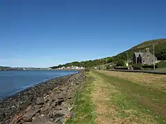
Cairnryan (Scots: The Cairn;[1] Scottish Gaelic: Machair an Sgithich) is a village in the historical county of Wigtownshire, Dumfries and Galloway, Scotland. It lies on the eastern shore of Loch Ryan, 6 miles (10 km) north of Stranraer and 81.1 miles (131 km) south west of Glasgow.
Cairnryan
| |
|---|---|
 | |
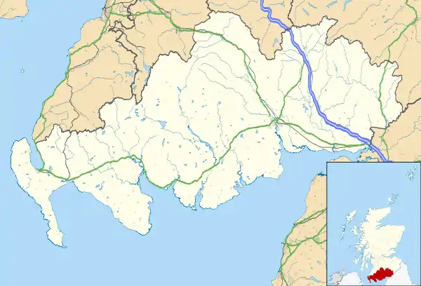 Cairnryan Location within Dumfries and Galloway | |
| Population | 142 (2001 Census) |
| OS grid reference | NX067683 |
| Council area | |
| Lieutenancy area | |
| Country | Scotland |
| Sovereign state | United Kingdom |
| Post town | STRANRAER |
| Postcode district | DG9 |
| Dialling code | 01776 |
| Police | Scotland |
| Fire | Scottish |
| Ambulance | Scottish |
| UK Parliament | |
| Scottish Parliament | |
History
Cairnryan is a linear settlement, looking across the main A77 road to Loch Ryan. It was established in 1701, when Lochryan House was built, (along with many of the houses, to the north of the village, for workers on the Lochryan Estate). A local slate quarry next to the Cairn Hill, which overlooks the village, provided the slates for the housing, the estate included a deer park, and a bowling green. Lochryan House was remodelled in the 1820s and is visible from the main road.
Into the 1800s, Cairnryan was an important staging post on the coach route to Ayr, with half a dozen inns along this short stretch of coast. It also achieved a less desirable reputation as a haunt of highwaymen preying on that same passing traffic.
During World War II, Cairnryan became No.2 Military Port, with three harbour piers and a military railway, linking the village with nearby Stranraer. To make room for the development of new railway tracks, the properties on the loch side of the village were demolished, reducing the local population as the occupiers were re-housed elsewhere.
Of the three piers built, only one pier remains; one being dismantled and the other being destroyed (in an ammunition explosion) shortly after the World War II, the remaining pier is now in a state of disrepair; (however it’s still used by anglers).
Another role, during World War II, was the building of some sections for the two Mulberry harbours, the floating ports on which the Allies depended after D-Day.Troops were based locally, in military camps. At the end of the World War II, the Atlantic U-boat fleet surrendered in Loch Ryan and was anchored in the port before being towed to the North Channel and scuttled, this activity was codenamed 'Operation Deadlight'. For a period after the WWII, (until at least 1958), the port was used to receive, by rail and by the Liberty and Victory ships, surplus/time-expired ammunition which was loaded onto army landing craft for disposal at sea. The ammunition being transported by rail, had their trucks labelled with the address, "Davy Jones' Locker, Cairnryan". Handling and disposal was carried out by 13 Coy Royal Pioneer Corps.
In 1957 and 1958, Cairnryan Lighterage Wharf and the port/jetty were again used in a joint Army/RAF operation called 'Operation Hardrock'. This operation was to build a rocket-tracking station on the remote island of St Kilda, serving the South Uist Missile Range, from where the 'MGM-5 Corporal' missiles were launched. The civil engineering work, involving an accommodation block and a winding road to the island's highest point, where the rocket-tracking building was built, was carried out by the RAF's 5004 Airfield Construction Squadron. Personnel, plant and other equipment was transported between the pier, Cairnryan and St. Kilda, using RASC Landing Craft Tanks, operated by 76 Squadron RASC. Military port activity ceased in the early 1960s, when most of the military infrastructure, including the railway line, was abandoned, then dismantled, apart from the pier and lighterage wharf.
In the early 1950s, the south end of the village, houses were built at Claddyburn Terrace, which increased the village's population. In the late 1960s, ship breaking became the main industry; the British aircraft carriers HMS Centaur, HMS Bulwark, HMS Eagle, and HMS Ark Royal were all sent for breaking up, as well as a number of other vessels, including HMS Mohawk and HMS Blake. The trawler Ross Revenge was waiting for scrapping in 1980 when the Radio Caroline organisation bought the ship for their new offshore radio station.
In July 1973, Townsend Thoreson started a ro-ro ferry service from Cairnryan to Larne for passengers and cars, using the ship 'Ionic Ferry', later, the service was extended to commercial vehicles. Townsend Thoreson was later taken over by P&O Ferries.
Harbour

Cairnryan has two ferry terminals connecting Scotland to Northern Ireland. The first, at the south of Cairnryan, opened in 1973, originally operated by Townsend Thoresen and now by P&O Ferries, links Scotland with the port of Larne. Part of this terminal utilises Cairnryan Lighterage Wharf. The second, at Old House Point, just north of Cairnryan, is operated by Stena Line linking to the Port of Belfast in Belfast.[2]
P&O Irish Sea continue to depart from Cairnryan, and Stena Line have operated from a new terminal at Old House Point since 2011.[3]
Transport
A bus link operated by Wigtownshire Community Transport runs between the P&O Ferries and Stena Line ferry terminals at Cairnryan and Stranraer. Stranraer railway station is approximately 15 minutes walk from the bus stop.
Stena Line operate a coach service between the ferry terminal and Ayr railway station to connect with certain sailings to and from Belfast.[4]
| Preceding station | Ferry | Following station | ||
|---|---|---|---|---|
| Ferry services | ||||
| Ayr (via coach link from Cairnryan |
Stena Line Ferry |
Port of Belfast (nearest stations Yorkgate, Lanyon Place & Belfast Great Victoria Street) | ||
| Stranraer Harbour (via bus link from Cairnryan |
P&O Ferries Ferry |
Larne Harbour | ||
References
- List of railway station names in English, Scots and Gaelic Archived 22 January 2013 at the Wayback Machine
- "Stranraer harbour bids farewell to ferries". BBC News. 18 November 2011.
- "Ferry terminal plan makes headway". BBC. 9 January 2009. Retrieved 13 January 2009.
- "Rail & Sail". www.stenaline.co.uk. Retrieved 16 July 2018.
External links
- Photos of Cairnryan
- Photos of Cairnryan during Operation Hardrock in 1958
- Listed Buildings in Cairnryan
| Wikimedia Commons has media related to Cairnryan. |