Carsphairn
Carsphairn (Scottish Gaelic: An Còrsa Feàrna) is a village in the historical county of Kirkcudbrightshire in Dumfries and Galloway, Scotland. It is located about halfway between Dalmellington and St John's Town of Dalry, on the A713 road. Carsphairn annual sheep show is held in the village. Cairnsmore of Carsphairn is to the north east of the village in the Carsphairn and Scaur Hills. To the west is the ridge of the Rhinns of Kells[1] in the Galloway Hills.
Carsphairn
| |
|---|---|
 Carsphairn | |
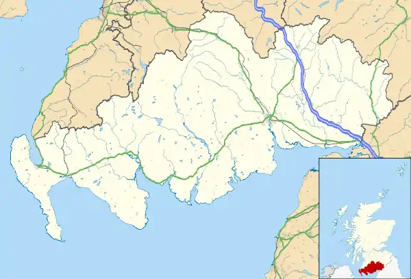 Carsphairn Location within Dumfries and Galloway | |
| OS grid reference | NX561933 |
| Council area | |
| Lieutenancy area | |
| Country | Scotland |
| Sovereign state | United Kingdom |
| Post town | CASTLE DOUGLAS |
| Postcode district | DG7 |
| Police | Scotland |
| Fire | Scottish |
| Ambulance | Scottish |
| UK Parliament | |
| Scottish Parliament | |
The village has many features ranging from an ancient stone circle[2] to a nuclear listening post[3] (now disused), and includes local amenities such as a shop, tearoom, a primary school and a village hall.
Carsphairn Church, Church of Scotland was built in 1815 on site of an earlier church. Additions and alterations in the 1930s include the apse and porch.
The Knockengorroch World Ceildh takes place here annually.
History
Carsphairn was made an independent parish around 1627,[4] prior to which it had been a part of the Parish of Dalry, and was created a Free Burgh in 1672 under a charter requested by Robert Grierson of Lag.[5]
Notable residents
- John Semple (minister) (c1602-c1677) First Presbyterian minister and Scots Worthy
- Prof Thomas Jackson FRSE (1773–1837) physicist was born and raised here.[6]
- John Loudon Macadam (1756–1836). Lagwyne just outside the village was his childhood home.
- Colonel Alexander Clark-Kennedy of Knockgray (1780–1864) captured the eagle and colours of a French regiment at the Battle of Waterloo.
Industry
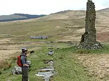
Industry is mainly rural, but, historically, a significant mining industry existed, particularly of lead, following the discovery of significant quantities in 1837. By the mid 1850s the mine was producing 1,000 tons annually.[7] Mining continued in the area, with peak production between 1906–1914. Following the end of the First World War, the industry collapsed and by 1928 all lead mining operations had ceased.[8]
List of listed buildings
List of listed buildings in Carsphairn, Dumfries and Galloway
References
- map of the Rhinns of Kells with hill walking routes
- Holm of Daltallochan stone circle
- Royal Observer Corps database of UK monitoring posts
- Great Britain. Parliament. House of Lords (1841) "Sessional Papers Printed by Order of the House of Lords, Or Presented by Royal Command, in the Session 40 & 50 Victoriæ (26th January-22d June) and the Session 50 Victoriæ (19th August-7th October) 1841", Volume 7, P190 Retrieved May 2013
- Nicholson, John, ed. (1855). Minute book kept by the war committee of the Covenanters in the stewartry of Kircudbright in the years 1640 and 1641. Kirkcudbright: John Nicholson. p. 179.
- Biographical Index of Former Fellows of the Royal Society of Edinburgh 1783–2002 (PDF). The Royal Society of Edinburgh. July 2006. ISBN 0 902 198 84 X.
- Royal Scottish Society of Arts (1851) "Transactions of the Royal Scottish Society of Arts", Volume 3, P21., Neill & Company. Retrieved May 2013
- Payne, P.L. (1967) "Studies in Scottish business history", P107, Routledge, ISBN 0714613495 Retrieved May 2013
External links
| Wikimedia Commons has media related to Carsphairn. |