Kirkcudbrightshire
Kirkcudbrightshire (/kərˈkuːbrɪʃər/ kər-KOO-bri-shər), or the County of Kirkcudbright or the Stewartry of Kirkcudbright, is a historic county, registration county and lieutenancy area in the informal Galloway area of south-western Scotland. For local government purposes, it forms part of the wider Dumfries and Galloway council area of which it forms a committee area under the name of the Stewartry.
Kirkcudbrightshire | |
|---|---|
 | |
| Country | Scotland |
| County town | Kirkcudbright |
| Area | |
| • Total | 899 sq mi (2,328 km2) |
| Ranked 10th of 34 | |
| Chapman code | KKD |
The county is occasionally referred to as East Galloway,[1] forming the larger Galloway region with Wigtownshire. It is bounded on the north and north-west by Ayrshire, on the west and south-west by Wigtownshire, on the south and south-east by the Irish Sea and the Solway Firth, and on the east and north-east by Dumfriesshire.
It maintains a strong regional and distinct political identity. It formed a district in the Dumfries and Galloway region and today the Stewartry is an area committee represented by eight councillors. Local administration of the area today is overseen by a Stewartry Area Manager, based in the county town of Kirkcudbright. The current Lord Lieutenant of Kirkcudbright, the Crown's representative in the area, is Elizabeth Patricia Gilroy.
History
Early history
The country west of the Nith was originally peopled by a tribe of Celts called Novantae, who long retained their independence.
After Gnaeus Julius Agricola's invasion in 79 AD, the country nominally formed part of the Roman province of Britannia, but the evidence is against there ever having been a prolonged effective Roman occupation. There was a Roman temporary marching camp at Shawhead, Irongray Parish.[2]
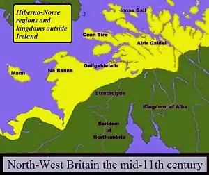
After the retreat of the Romans, the fate of the Novantae is unknown. By the 6th century, Galloway was part of the Brythonic kingdom of Strathclyde.[3]
11th, 12th, and 13th centuries
During the next two hundred years the country had no rest from Danish and Saxon incursions and the continual lawlessness of the Scandinavian rovers.
When Malcolm Canmore defeated and slew Macbeth in 1057 he married the dead king's relative Ingibiorg, a Pictish princess, (the view that there were Picts in Galloway in historical times can not be wholly rejected) an event which marked the beginning of the decay of Norse influence. The Galloway chiefs hesitated for a time whether to throw in their lot with the Northumbrians or with Malcolm; but language, race and the situation of their country at length induced them to become lieges of the Scottish king.
14th and 15th centuries
In 1308 the district was cleared of the English and brought under allegiance to the king, when the lordship of Galloway was given to Edward Bruce.
In 1372 Archibald the Grim, a natural son of Sir James Douglas "the Good", became Lord of Galloway and received in perpetual fee the Crown lands between the Nith and the Cree. He appointed a steward to collect his revenues and administer justice, and thus arose the designation of the "Stewartry of Kirkcudbright."[4]
In 1455 Threave Castle, the most important fortress in Galloway, which Archibald the Grim had built on the Dee immediately to the west of the modern town of Castle Douglas, was reduced and converted into a royal keep.
16th and 17th centuries
As the Douglases went down the Maxwells rose, and the debatable land on the south-east of Dumfriesshire was for generations the scene of strife and raid, not only between the two nations but also among the leading families, of whom the Maxwells, Johnstones and Armstrongs were always conspicuous. After the Battle of Solway Moss (1542) the shires of Kirkcudbright and Dumfries fell under English rule for a short period. The treaty of Norham (24 March 1550) established a truce between the nations for ten years; and in 1552, the Wardens of the Marches consenting, the debatable land ceased to be matter for debate, the parish of Canonbie being annexed to Dumfriesshire, that of Kirkandrews to Cumberland.
18th century
McCulloch and Gordon families were of Cardoness Castle, Anwoth Parish and Rev. Rutherford[5] was minister of Anwoth.
After the union (1707) things mended slowly but surely, curious evidence of growing commercial prosperity being the enormous extent to which smuggling was carried on. No coast could serve the "free traders" better than the shores of Kirkcudbright, and the contraband trade flourished until the 19th century. The Jacobite risings of 1715 and 1745 elicited small sympathy from the inhabitants of the shire. In the 1760s a military road was constructed from Bridge of Sark,[6] near Gretna, Dumfries and Galloway to Portpatrick by Major William Caulfeild.
Geography

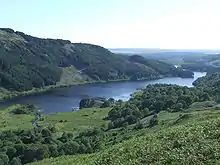
It has a shoreline on the Solway Firth, between the rivers Nith and Cree. Inland, the area has many hills, with its highest point being Merrick 843 m (2764 ft).[7]
There are many "burns" and "waters", but their length seldom exceeds 7 or 8 miles (13 km). Among the longer rivers are the Cree, which rises in Loch Moan and reaches the sea near Creetown after a course of about 30 miles (48 km); the Dee or Black Water of Dee (so named from the peat by which it is coloured), which rises in Loch Dee which after a course mainly S.E. and finally S., enters the sea at St Mary's Isle below Kirkcudbright, its length being nearly 36 miles (58 km); the Urr, rising in Loch Urr on the Dumfriesshire border, falls into the sea a few miles south of Dalbeattie 27 miles (43 km) from its source.
Geology
Silurian and Ordovician rocks are the most important in this county; they are thrown into oft-repeated folds with their axes lying in a north-east–south-west direction. The Ordovician rocks are graptolitic black shales and grits of Llandeilo and Caradoc age. They occupy all the northern part of the county north-west of a line which runs some 3 m. north of New Galloway and just south of the Rinns of Kells. South-east of this line graptolitic Silurian shales of Llandovery age prevail; they are found around Dalry, Creetown, New Galloway, Castle Douglas and Kirkcudbright.
Overlying the Llandovery beds on the south coast are strips of Wenlock rocks; they extend from Bridgehouse Bay to Auchinleck and are well exposed in Kirkcudbright Bay, and they can be traced farther round the coast between the granite and the younger rocks. Carboniferous rocks appear in small faulted tracts, unconformable on the Silurian, on the shores of the Solway Firth. They are best developed about Kirkbean, where they include a basal red breccia followed by conglomerates, grits and cement stones of Calciferous Sandstone age.
Brick-red sandstones of Permian age just come within the county on the W. side of the Nith at Dumfries. Volcanic necks occur in the Permian and basalt dikes penetrate the Silurian at Borgue, Kirkandrews, etc.
Most of the highest ground is formed by the masses of granite which have been intruded into the Ordovician and Silurian rocks; the Criffel mass lies about Dalbeattie and Bengairn, another mass extends east and west between the Cairnsmore of Fleet and Loch Ken, another lies north-west and south-east between Loch Doon and Loch Dee and a small mass forms the Cairnsmore of Carsphairn. Much granite was quarried from Kirkmabreck, near Creetown for dock construction from 1830 on.[8]
Glacial deposits occupy much of the low ground; the ice, having travelled in a southerly or south-easterly direction, has left abundant striae on the higher ground to indicate its course. Radiation of the ice streams took place from the heights of Merrick, Kells, etc.; local moraines are found near Carsphairn and in the Deagh and Minnoch valleys. Glacial drumlins of boulder clay lie in the vales of the Dee, Cree and Urr.
Climate and agriculture
The climate and soil suit grass and green crops rather than grain. The annual rainfall averages 1,160 millimetres (45.7 in). The mean temperature for the year is 9 °C (48 °F); for 4 January °C (39 °F); for 15 July °C (59 °F). The major part of the land is either waste or poor pasture.
Railways

Castle Douglas and Dumfries Railway was incorporated on 21 July 1856; the act was obtained by the Glasgow and South Western Railway.[9] It opened on 7 November 1859 and was substantially closed, under the Beeching cuts, on 14 June 1965.[9] The Portpatrick Railway was authorised on 10 August 1857. By 12 March 1861, the line connected Stranraer to Castle Douglas, where it joined the newly constructed Castle Douglas and Dumfries railway.[9] The branch to Portpatrick opened the following year, on 28 August 1862, with the Stranraer Harbour branch, which opened on 1 October 1862; although building work continued on the line for another five years.[9] The Kirkcudbright Railway was a railway branch line linking Kirkcudbright to the Castle Douglas and Dumfries Railway at Castle Douglas. It opened in 1864, and closed in 1965.
The Beeching cuts cut off the Castle Douglas and Dumfries Railway and Portpatrick Railway in 1965 resulting in an adverse mileage increase via the Glasgow South Western Line to reach Stranraer Harbour (for Larne Harbour and Port of Belfast) from Dumfries, Carlisle and the West Coast Main Line to London Euston, and leaving the county without any railway permanent way.
List of parishes
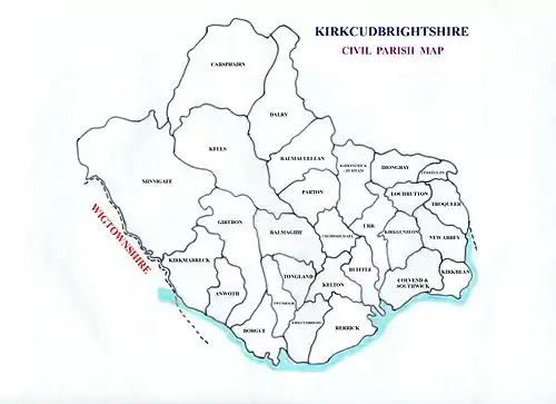
The Stewartry is composed of the following 28 civil parishes.[11]
- Anwoth
- Balmaclellan
- Balmaghie
- Borgue
- Buittle
- Carsphairn
- Colvend and Southwick[12]
- Crossmichael
- Dalry
- Girthon, see also Gatehouse of Fleet and Cally Palace[13][14][15]
- Irongray[16][17][18] John Welsh of Irongray
- Kells, Dumfries and Galloway[19]
- Kelton Sir William Douglas, 1st Baronet[20][21]
- Kirkbean
- Kirkcudbright
- Kirkgunzeon[22][23]
- Kirkmabreck[24][25]
- Kirkpatrick Durham
- Lochrutton[26][27]
- Minnigaff
- New Abbey
- Parton
- Rerrick[28][29] Dundrennan Abbey
- Terregles
- Tongland
- Troqueer
- Twynholm
- Urr
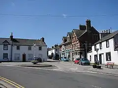
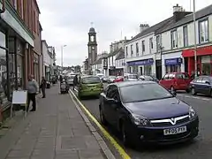
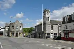
Towns and villages

- Auchencairn
- Balmaclellan
- Beeswing
- Borgue
- Bridge of Dee
- Cargenbridge
- Carsethorn
- Carsphairn
- Castle Douglas
- Colvend
- Corsock
- Creetown
- Crocketford
- Crossmichael
- Dalbeattie
- Gatehouse of Fleet
- Hardgate
- Haugh of Urr
- Ingleston
- Kirkcudbright
- Kirkgunzeon
- Kirkpatrick Durham
- Kippford
- Laurieston
- Maxwelltown (the largest burgh in the Stewartry, on the western side of Dumfries over the River Nith, was transferred in 1930 to Dumfriesshire, and is now a suburb of the town of Dumfries)
- Minnigaff
- New Abbey
- New Galloway
- Palnackie
- Rascarrel
- Ringford
- Rockcliffe
- St. John's Town of Dalry
- Sandyhills
- Shawhead
- Springholm
- Terregles
- Tongland
- Twynholm
Gallery
 Garlies Castle.
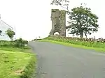 Wreaths Tower, Kirkbean.
 Orchardtown Tower, Buittle.
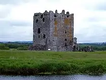
 Kenmure Castle, Kells parish.
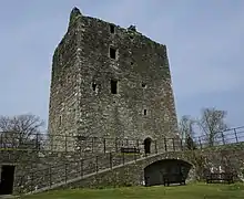
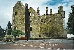 McLellan's Castle, Kirkcudbright.
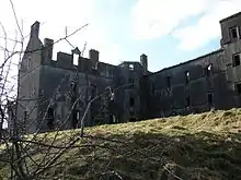
 Lochinvar Castle site.
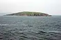 Hestan Island
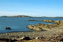 Gypsy Point looking over to Little Ross
 The Motte of Urr
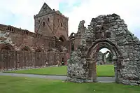 Remains of Sweetheart Abbey
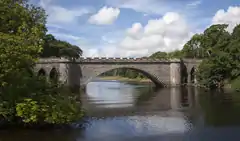 Bridge over the Dee at Tongland
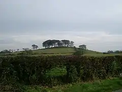 Hillfort near Twynham
Notable Inhabitants
- Alan of Galloway, Lord of Galloway and Constable of Scotland
- Archibald the Grim, Lord of Galloway and Earl of Douglas
- Malcolm Caldwell, Marxist writer, chair of the Campaign for Nuclear Disarmament
- James Clerk Maxwell, The most influential physicist of the 19th century
- Formula 1 driver David Coulthard from Twynholm
- S R Crockett, Minister and novelist
- Devorguilla, Mother of John I, king of Scotland
- Sir William Douglas, Founded the town of Castle Douglas
- E A Hornel, Painter born in Australia
- John Paul Jones, Scots born American and Russian naval commander
- Margaret McNaughton, Scottish Canadian writer
- Alexander Murray, Edinburgh University professor
References and bibliography
- The New Statistical Account of Scotland (1834)
- Togodumnus (Kevan White). "SHAWHEAD CAMPS". roman-britain.org. Archived from the original on 6 January 2014.
- P. H: M'Kerlie. "Galloway in ancient and modern times pg 62" (PDF).
- "Visit Kirkcudbright – Historical Sites". Kirkcudbright.co.uk. Retrieved 20 January 2013.
- "Archived copy". Archived from the original on 27 February 2014. Retrieved 22 February 2014.CS1 maint: archived copy as title (link)
- "Welcome to Canmore – Canmore". rcahms.gov.uk.
- "Kirkcudbrightshire". Encyclopaedia Britannica. Retrieved 31 December 2020.
- "Scotland, Creetown – Quarry at Kirkmabreck". dalbeattie.com.
- Awdry (1990), page 66
- Map of Parishes in the Counties of Wigtown & Kircudbright, ScotlandsFamily
- stephenclancy (22 May 2012). "The Parishes". Stewartrykirks.org.uk. Retrieved 20 January 2013.
- "The Parish of Colvend". Kirkcudbright.co. Retrieved 20 January 2013.
- Civil Parish of Girthon map. http://www.scottish-places.info/parishes/parmap1044.html
- A Topographical Dictionary of Scotland. by Samuel Lewis. Vol.I. Second Edition. Pub. 1851. (copyright expired) pp.490-491 https://archive.org/stream/topographicaldic01lewi#page/490/mode/2up
- "Parish of Girthon – History of the Lands and Their Owners in Galloway". Kirkcudbright.co. Retrieved 20 January 2013.
- Scotlands Places. http://www.scotlandsplaces.gov.uk/search/?action=do_search&p_type=PARISH&p_name=kirkpatrick_irongray&id=1014&p_county=kirkcudbrightshire Archived 9 November 2012 at the UK Government Web Archive
- A Topographical Dictionary of Scotland. by Samuel Lewis. Vol.II. Second Edition. Pub. 1851. p.125 https://archive.org/stream/topographicaldic02lewi#page/125/mode/1up
- Statistical Account.published 1792 https://archive.org/stream/statisticalacco09sincgoog#page/n533/mode/2up
- "Parish of Kells Map". Scottish-places.info. Retrieved 20 January 2013.
- Caledonia. Vol.III. by George Chalmers, P.R.S. and S.A.. published 1824. p.314 Parish of Kelton. https://archive.org/stream/caledoniaoraccou03chal#page/314/mode/1up
- "The Parish of Kelton". Kirkcudbright.co. Retrieved 20 January 2013.
- A Topographical Dictionary of Scotland. by Samuel Lewis. Vol.II. Second Edition. Pub. 1851. pp.106-107 https://archive.org/stream/topographicaldic02lewi#page/106/mode/2up
- "The Parish of Kirkgunzeon". Kirkcudbright.co. Retrieved 20 January 2013.
- A Topographical Dictionary of Scotland. by Samuel Lewis. Vol.II. Second Edition. Pub. 1851. pp.112-113 https://archive.org/stream/topographicaldic02lewi#page/112/mode/2up
- "The Parish of Kirkmabreck". Kirkcudbright.co. Retrieved 20 January 2013.
- A Topographical Dictionary of Scotland. by Samuel Lewis. Vol.II. Second Edition. Pub. 1851. pp.200-201 https://archive.org/stream/topographicaldic02lewi#page/200/mode/2up
- "The Parish of Lochrutton". Kirkcudbright.co. Retrieved 20 January 2013.
- A Topographical Dictionary of Scotland. by Samuel Lewis. Vol.II. Second Edition. Pub. 1851. pp.415-416 https://archive.org/stream/topographicaldic02lewi#page/414/mode/2up
- "The Parish of Rerrick". Kirkyards.co.uk. Retrieved 20 January 2013.
- Sir Herbert Maxwell, History of Dumfries and Galloway (Edinburgh, 1896)
- Rev. Andrew Symson, A Large Description of Galloway (1684; new ed., 1823) https://books.google.com/books?id=4mYLAAAAYAAJ&printsec=frontcover#v=onepage&q=Dalry&f=false
- Thomas Murray, The Literary History of Galloway (1822)
- Rev. William Mackenzie, History of Galloway (1841)
- P. H. McKerlie, History of the Lands and their Owners in Galloway (Edinburgh, 1870–1879)
- Galloway Ancient and Modern (Edinburgh, 1891)
- J. A. H. Murray, Dialect of the Southern Counties of Scotland (London, 1873).
External links
| Wikisource has the text of the 1911 Encyclopædia Britannica article Kirkcudbrightshire. |
| Wikimedia Commons has media related to Kirkcudbrightshire. |
![]() This article incorporates text from a publication now in the public domain: Chisholm, Hugh, ed. (1911). "Kirkcudbrightshire". Encyclopædia Britannica (11th ed.). Cambridge University Press.
This article incorporates text from a publication now in the public domain: Chisholm, Hugh, ed. (1911). "Kirkcudbrightshire". Encyclopædia Britannica (11th ed.). Cambridge University Press.