Castellar de n'Hug
Castellar de n'Hug (Catalan pronunciation: [kəstəˈʎa ðə ˈnuk], Spanish: Castellar de Nuch) is a municipality in the comarca of the Berguedà in Catalonia, Spain. It is situated on the southern slopes of the pyrenean range of the Creueta. The Llobregat river has its source on the territory of the municipality. The village is served by the B-403 road, which links it with La Pobla de Lillet and which continues over the Creueta to the comarques of the Ripollès and the Cerdanya.
Castellar de n'Hug | |
|---|---|
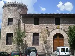 Town Hall. | |
.svg.png.webp) Coat of arms | |
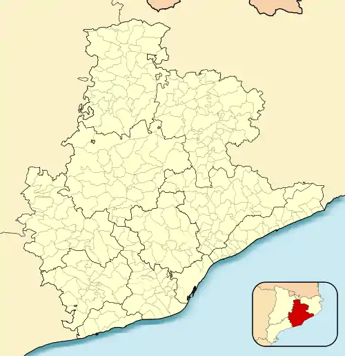 Castellar de n'Hug Location in Catalonia 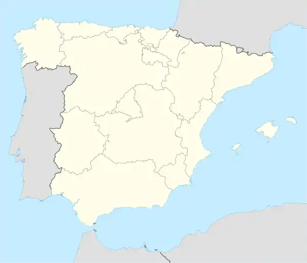 Castellar de n'Hug Castellar de n'Hug (Spain) | |
| Coordinates: 42°17′06″N 2°01′08″E | |
| Country | |
| Community | |
| Province | Barcelona |
| Comarca | Berguedà |
| Government | |
| • Mayor | Salvador Juncà Armengou (2015)[1] (CiU) |
| Area | |
| • Total | 47.1 km2 (18.2 sq mi) |
| Elevation | 1,395 m (4,577 ft) |
| Population (2018)[3] | |
| • Total | 165 |
| • Density | 3.5/km2 (9.1/sq mi) |
| Demonym(s) | Castellanès |
| Postal code | 08696 |
| Website | www |
The Asland del Clot del Moro cement factory, now closed along with the railway line which linked it to Guardiola de Berguedà, is a notable example of modernista industrial architecture. The Roman church of Sant Vincenç de Rus conserves some original mural paintings.
References
- "Ajuntament de Castellar de n'Hug". Generalitat of Catalonia. Retrieved 2015-11-13.
- "El municipi en xifres: Castellar de n'Hug". Statistical Institute of Catalonia. Retrieved 2015-11-23.
- Municipal Register of Spain 2018. National Statistics Institute.
External links
- Official website (in Catalan)
- Government data pages (in Catalan)
Places adjacent to Castellar de n'Hug | ||||||||||
|---|---|---|---|---|---|---|---|---|---|---|
| ||||||||||
.svg.png.webp)
This article is issued from Wikipedia. The text is licensed under Creative Commons - Attribution - Sharealike. Additional terms may apply for the media files.