Castle Rock, Minnesota
Castle Rock is an unincorporated community in Castle Rock Township, Dakota County, Minnesota, United States.
Castle Rock | |
|---|---|
 Castle Rock Location of the community of Castle Rock within Castle Rock Township, Dakota County  Castle Rock Castle Rock (the United States) | |
| Coordinates: 44°32′38″N 93°09′09″W | |
| Country | United States |
| State | Minnesota |
| County | Dakota County |
| Township | Castle Rock Township |
| Elevation | 938 ft (286 m) |
| Time zone | UTC-6 (Central (CST)) |
| • Summer (DST) | UTC-5 (CDT) |
| ZIP code | 55010 |
| Area code(s) | 651, 507 |
| GNIS feature ID | 640969[1] |
Geography
Castle Rock is located 7 miles (11 km) north of Northfield. Nearby places also include Farmington and Randolph. State Highway 3 (MN 3) is nearby.
Nomenclature
%252C_1818_or_1824-after_1901_3.png.webp)
The community is named for a local rock formation. The rock formation is located at the point where 275th Street and Cambodia Avenue join, on private property. The rock formation, known to Dakota Native Americans as Inyan Bosdata or "Rock Standing on End" was also the namesake of the nearby Inyan Bosdata Wakpa, known today as the Cannon River.
History
A post office called Castle Rock was first established in 1858.[2] The community took its name from Castle Rock Township.[3]
Education
The community has a school, Prairie Creek Community School.
See also
References
- "Castle Rock, Minnesota". Geographic Names Information System. United States Geological Survey.
- "Dakota County". Jim Forte Postal History. Retrieved 10 May 2015.
- Upham, Warren (1920). Minnesota Geographic Names: Their Origin and Historic Significance. Minnesota Historical Society. p. 167.
Municipalities and communities of Dakota County, Minnesota, United States | ||
|---|---|---|
| Cities | 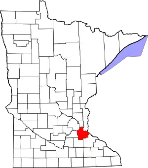 Map of Minnesota highlighting Dakota County | |
| Townships | ||
| Unincorporated communities | ||
| Ghost towns | ||
| Indian reservation | ||
| Footnotes | ‡This populated place also has portions in an adjacent county or counties | |
| ||
| Authority control |
|---|