Eureka Township, Dakota County, Minnesota
Eureka Township is an urban township in Dakota County, Minnesota, United States.[3] The population was 1,490 at the 2000 census.
Eureka Township | |
|---|---|
| Motto(s): "Your Home Town" | |
 Eureka Township Location within the state of Minnesota  Eureka Township Eureka Township (the United States) | |
| Coordinates: 44°35′21″N 93°13′27″W | |
| Country | United States |
| State | Minnesota |
| County | Dakota |
| Area | |
| • Total | 35.9 sq mi (92.9 km2) |
| • Land | 35.4 sq mi (91.6 km2) |
| • Water | 0.5 sq mi (1.3 km2) |
| Elevation | 984 ft (300 m) |
| Population (2000) | |
| • Total | 1,490 |
| • Density | 42.1/sq mi (16.3/km2) |
| Time zone | UTC-6 (Central (CST)) |
| • Summer (DST) | UTC-5 (CDT) |
| Area code(s) | 952 and 651 |
| FIPS code | 27-19871[1] |
| GNIS feature ID | 0664113[2] |
| Website | eurekatownship-mn.us |
Eureka Township was organized in 1858. Eureka is a name derived from Greek, meaning "I have found it".[4]
Geography
According to the United States Census Bureau, the township has a total area of 35.9 square miles (93 km2), of which 35.3 square miles (91 km2) of it is land and 0.5 square miles (1.3 km2) of it (1.42%) is water.
Eureka Township lies near the western boundary line of Dakota County, and is located within its southern half.
Adjacent townships, cities, and communities
The following are adjacent to Eureka Township:
- The city of Lakeville (north-northwest)
- The city of Farmington (north-northeast)
- Empire Township (northeast)
- Castle Rock Township (east)
- The unincorporated community of Castle Rock (east-southeast)
- New Market Township of Scott County (west)
The city of Elko New Market in Scott County is nearby to the west, but does not border the township.
The city of Hampton is nearby to the east, but does not border the township.
The city of Northfield in Rice County is nearby to the south-southeast, but does not border the township.
Unincorporated communities
Eureka Center is an unincorporated community, containing the Town Hall, located in the geographical center of Eureka Township.
Highways
- Dakota County Road 23 passes through Eureka Center, running north and south-southeast from it.
- State Highway 50 (MN 50) and Dakota County Road 50 both run east–west about 4 miles north of Eureka Center.
- Dakota County Road 86 runs east–west about 4 miles south of Eureka Center.
- State Highway 3 (MN 3), a more prominent road, runs north–south about 4 miles east of Eureka Center, but with the shortest route to it via minor roads.
- Interstate 35 runs north–south, with its nearest interchange about 4 miles west-southwest from Eureka Center, if reached via minor roads.
Demographics
| Historical population | |||
|---|---|---|---|
| Census | Pop. | %± | |
| 1860 | 480 | — | |
| 1870 | 924 | 92.5% | |
| 1880 | 895 | −3.1% | |
| 1890 | 761 | −15.0% | |
| 1900 | 839 | 10.2% | |
| 1910 | 720 | −14.2% | |
| 1920 | 712 | −1.1% | |
| 1930 | 682 | −4.2% | |
| 1940 | 690 | 1.2% | |
| 1950 | 600 | −13.0% | |
| 1960 | 666 | 11.0% | |
| 1970 | 860 | 29.1% | |
| 1980 | 1,268 | 47.4% | |
| 1990 | 1,405 | 10.8% | |
| 2000 | 1,490 | 6.0% | |
| 2010 | 1,426 | −4.3% | |
| U.S. Decennial Census[5] | |||
As of the census[1] of 2000, there were 1,490 people, 496 households, and 407 families residing in the township. The population density was 42.1 people per square mile (16.3/km2). There were 501 housing units at an average density of 14.2/sq mi (5.5/km2). The racial makeup of the township was 97.99% White, 0.27% Native American, 0.34% Asian, 0.54% from other races, and 0.87% from two or more races. Hispanic or Latino of any race were 1.14% of the population.
There were 469 households, out of which 41.1% had children under the age of 18 living with them, 74.2% were married couples living together, 2.6% had a female householder with no husband present, and 17.9% were non-families. 14.3% of all households were made up of individuals, and 4.4% had someone living alone who was 65 years of age or older. The average household size was 3.00 and the average family size was 3.33.
In the township the population was spread out, with 30.1% under the age of 18, 6.3% from 18 to 24, 29.2% from 25 to 44, 27.4% from 45 to 64, and 6.9% who were 65 years of age or older. The median age was 38 years. For every 100 females, there were 111.0 males. For every 100 females age 18 and over, there were 109.5 males.
The median income for a household in the township was $66,875, and the median income for a family was $73,125. Males had a median income of $45,625 versus $32,788 for females. The per capita income for the township was $26,636. About 0.5% of families and 1.3% of the population were below the poverty line, including none of those under age 18 and 2.1% of those age 65 or over.
References
- "U.S. Census website". United States Census Bureau. Retrieved 2008-01-31.
- "US Board on Geographic Names". United States Geological Survey. 2007-10-25. Retrieved 2008-01-31.
- "About Us". Eureka Township. Retrieved 2018-01-16.
- Upham, Warren (1920). Minnesota Geographic Names: Their Origin and Historic Significance. Minnesota Historical Society. p. 165.
- "Census of Population and Housing". Census.gov. Retrieved May 19, 2019.
External links
Municipalities and communities of Dakota County, Minnesota, United States | ||
|---|---|---|
| Cities | 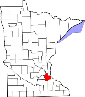 Map of Minnesota highlighting Dakota County | |
| Townships | ||
| Unincorporated communities | ||
| Ghost towns | ||
| Indian reservation | ||
| Footnotes | ‡This populated place also has portions in an adjacent county or counties | |
| ||