Mendota, Minnesota
Mendota is a city in Dakota County, Minnesota, United States. The name is derived from the Dakota language, meaning "mouth or junction of one river with another.[7] The population was 198 at the 2010 census.
Mendota | |
|---|---|
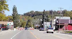 Highway 13 in Mendota | |
 Location of the city of Mendota within Dakota County, Minnesota | |
| Coordinates: 44°53′8″N 93°9′38″W | |
| Country | United States |
| State | Minnesota |
| County | Dakota |
| Area | |
| • Total | 0.29 sq mi (0.76 km2) |
| • Land | 0.27 sq mi (0.69 km2) |
| • Water | 0.03 sq mi (0.07 km2) |
| Elevation | 768 ft (234 m) |
| Population | |
| • Total | 198 |
| • Estimate (2019)[3] | 217 |
| • Density | 818.87/sq mi (316.36/km2) |
| Time zone | UTC-6 (Central (CST)) |
| • Summer (DST) | UTC-5 (CDT) |
| ZIP code | 55150 |
| Area code(s) | 651 |
| FIPS code | 27-41678[4] |
| GNIS feature ID | 0647762[5] |
| Website | www.cityofmendota.org |
Mendota Historic District | |
  | |
| Location | Roughly bounded by government lot 2, I-55, Sibley Hwy., D St., and Minnesota River, Mendota, Minnesota |
| Area | 50 acres (20 ha) |
| NRHP reference No. | 70000293[6] |
| Added to NRHP | June 22, 1970 |
| Wikimedia Commons has media related to Mendota, Minnesota. |
History
The town was one of the first permanent settlements in the state of Minnesota, being founded around the same time as Fort Snelling. It also houses a small museum which used to be the Hypolite Du Puis house, the Henry Hastings Sibley house, the Faribault house, and buildings associated with the American Fur Company, all dating from the 1830s.[8] The main route through the small city is State Highway 13, also known as Sibley Memorial Highway. Other roads in the city are mainly small unimproved roads.
The city of Mendota is home to the Mendota Mdewakanton Dakota Tribal Community, they are the only non-federally recognized Indian community in Minnesota. They have sought federal recognition since 1996. They are a registered 501 C(3). Their present community came into existence after congress passed appropriation acts for the "Sioux in Minnesota" in the 1880s and 1890s. Mendota Mdewakanton Dakota Tribal Community[9] U.S. Stat. 25: pg.228[10] U.S. Stat. 25: pg.992[11] U.S. Stat. 26: pg.349[12]
Geography
According to the United States Census Bureau, the city has a total area of 0.30 square miles (0.78 km2), of which 0.27 square miles (0.70 km2) is land and 0.03 square miles (0.08 km2) is water.[13]
The city of Mendota is located at the confluence of the Mississippi and Minnesota rivers. The city is surrounded on three sides by the city of Mendota Heights. Fort Snelling State Park is nearby.
Demographics
| Historical population | |||
|---|---|---|---|
| Census | Pop. | %± | |
| 1880 | 348 | — | |
| 1890 | 248 | −28.7% | |
| 1900 | 282 | 13.7% | |
| 1910 | 245 | −13.1% | |
| 1920 | 193 | −21.2% | |
| 1930 | 173 | −10.4% | |
| 1940 | 228 | 31.8% | |
| 1950 | 243 | 6.6% | |
| 1960 | 259 | 6.6% | |
| 1970 | 266 | 2.7% | |
| 1980 | 219 | −17.7% | |
| 1990 | 164 | −25.1% | |
| 2000 | 197 | 20.1% | |
| 2010 | 198 | 0.5% | |
| 2019 (est.) | 217 | [3] | 9.6% |
| U.S. Decennial Census[14] | |||
2010 census
As of the census[2] of 2010, there were 198 people, 78 households, and 52 families living in the city. The population density was 733.3 inhabitants per square mile (283.1/km2). There were 82 housing units at an average density of 303.7 per square mile (117.3/km2). The racial makeup of the city was 91.4% White, 1.5% African American, 1.5% Native American, 2.0% Asian, 1.5% from other races, and 2.0% from two or more races. Hispanic or Latino of any race were 3.5% of the population.
There were 78 households, of which 34.6% had children under the age of 18 living with them, 46.2% were married couples living together, 12.8% had a female householder with no husband present, 7.7% had a male householder with no wife present, and 33.3% were non-families. 26.9% of all households were made up of individuals, and 2.6% had someone living alone who was 65 years of age or older. The average household size was 2.54 and the average family size was 3.06.
The median age in the city was 37.8 years. 26.8% of residents were under the age of 18; 5.5% were between the ages of 18 and 24; 27.4% were from 25 to 44; 30.4% were from 45 to 64; and 10.1% were 65 years of age or older. The gender makeup of the city was 47.5% male and 52.5% female.
2000 census
As of the census[4] of 2000, there were 197 people, 80 households, and 48 families living in the city. The population density was 1,045.8 people per square mile (400.3/km2). There were 80 housing units at an average density of 424.7 per square mile (162.6/km2). The racial makeup of the city was 92.39% White, 1.52% African American, 2.03% Native American, 0.51% Asian, 0.51% from other races, and 3.05% from two or more races.
There were 80 households, out of which 33.8% had children under the age of 18 living with them, 35.0% were married couples living together, 16.3% had a female householder with no husband present, and 40.0% were non-families. 28.8% of all households were made up of individuals, and 7.5% had someone living alone who was 65 years of age or older. The average household size was 2.46 and the average family size was 3.08.
In the city, the population was spread out, with 25.9% under the age of 18, 7.1% from 18 to 24, 33.0% from 25 to 44, 23.9% from 45 to 64, and 10.2% who were 65 years of age or older. The median age was 36 years. For every 100 females, there were 126.4 males. For every 100 females age 18 and over, there were 124.6 males.
The median income for a household in the city was $45,938, and the median income for a family was $51,250. Males had a median income of $40,750 versus $26,250 for females. The per capita income for the city was $26,745. None of the families and 1.3% of the population were living below the poverty line.
Notable residents and natives
- Timothy J. Corbett, first Roman Catholic bishop of the Diocese of Crookston
- Joseph Godfrey, only African American combatant in the Dakota War of 1862
- Henry H. Sibley, first Governor of Minnesota, arrived in Mendota 1835.
- Jean-Baptiste Faribault, trader and early Minnesota settler
Gallery of images
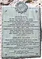 City historical marker
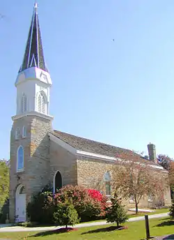 St. Peters Church
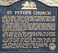 St. Peters Church plaque
 The original Mendota buildings
 The Henry Hastings Sibley house
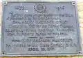 The Henry Hastings Sibley house plaque
 The Sibley summer kitchen
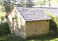 The fur company powder house
 American Fur Company cold store
 The fur company cold store
 The Jean-Baptiste Faribault house
References
- "2019 U.S. Gazetteer Files". United States Census Bureau. Retrieved July 26, 2020.
- "U.S. Census website". United States Census Bureau. Retrieved 2012-11-13.
- "Population and Housing Unit Estimates". United States Census Bureau. May 24, 2020. Retrieved May 27, 2020.
- "U.S. Census website". United States Census Bureau. Retrieved 2008-01-31.
- "US Board on Geographic Names". United States Geological Survey. 2007-10-25. Retrieved 2008-01-31.
- "National Register Information System". National Register of Historic Places. National Park Service. July 9, 2010.
- https://archive.org/stream/grammardictionar00riggrich#page/138/mode/2up
- "Mendota - Walking in the Footsteps of History". Archived from the original on 2008-01-24. Retrieved 2008-01-16.
- https://mendotadakota.com/mn/
- https://www.loc.gov/law/help/statutes-at-large/50th-congress/session-1/c50s1ch503.pdf
- https://www.loc.gov/law/help/statutes-at-large/50th-congress/session-2/c50s2ch412.pdf
- https://www.loc.gov/law/help/statutes-at-large/51st-congress/session-1/c51s1ch807.pdf
- "US Gazetteer files 2010". United States Census Bureau. Archived from the original on 2012-07-02. Retrieved 2012-11-13.
- "Census of Population and Housing". Census.gov. Retrieved June 4, 2015.
Mendota Walking in the Foot Steps of History source is from http://www.cityofmendota.org/donations.html current link to ref. # 8 is a phishing scam for verizon wireless
External links
| Wikimedia Commons has media related to Mendota, Minnesota. |
| Topics | |
|---|---|
| Lists by state |
|
| Lists by insular areas | |
| Lists by associated state | |
| Other areas | |
| Related | |
| |
Municipalities and communities of Dakota County, Minnesota, United States | ||
|---|---|---|
| Cities | 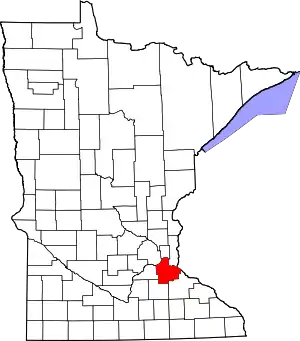 Map of Minnesota highlighting Dakota County | |
| Townships | ||
| Unincorporated communities | ||
| Ghost towns | ||
| Indian reservation | ||
| Footnotes | ‡This populated place also has portions in an adjacent county or counties | |
| ||

| Authority control |
|---|