Cetara, Campania
Cetara is a town and comune in the province of Salerno in the Campania region of south-western Italy. It is located in the territory of the Amalfi Coast.
Cetara | |
|---|---|
| Comune di Cetara | |
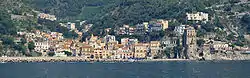 Panoramic view of Cetara | |
 Coat of arms | |
Location of Cetara 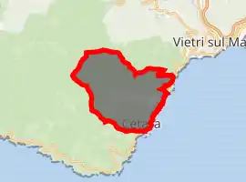
| |
 Cetara Location of Cetara in Italy 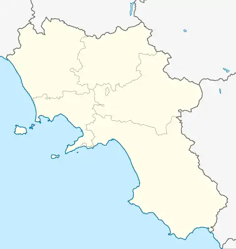 Cetara Cetara (Campania) | |
| Coordinates: 40°39′N 14°42′E | |
| Country | Italy |
| Region | Campania |
| Province | Salerno (SA) |
| Frazioni | Fuenti |
| Government | |
| • Mayor | Fortunato Della Monica |
| Area | |
| • Total | 4.97 km2 (1.92 sq mi) |
| Elevation | 15 m (49 ft) |
| Population | |
| • Total | 2,088 |
| • Density | 420/km2 (1,100/sq mi) |
| Demonym(s) | Cetaresi |
| Time zone | UTC+1 (CET) |
| • Summer (DST) | UTC+2 (CEST) |
| Postal code | 84011 |
| Dialing code | 089 |
| Patron saint | Saint Peter |
| Saint day | 29 June |
| Website | Official website |
History
The village was originally a settlement for a group of armed Muslims in 880. Characterized to be a village of fishermen (especially of tuna), its name take origins probably from the Latin word Cetaria (in Greek Ketèia), meaning almadraba (in Italian tonnara); or cetari, meaning fishmongers of big fishes.
Geography
Cetara is located by the Tyrrhenian Sea, on the Amalfi Drive road between the "Marina" of Albori and Erchie, bordering with the municipalities of Vietri sul Mare and Maiori. Its municipalities is extended from the coast to the Mount Falerio and counts only one civil parish (frazione): the little village of Fuenti, situated on the hills close to the Amalfi Drive.
See also
References
- "Superficie di Comuni Province e Regioni italiane al 9 ottobre 2011". Istat. Retrieved 16 March 2019.
- Source : Istat 2009
- "Popolazione Residente al 1° Gennaio 2018". Istat. Retrieved 16 March 2019.
External links
![]() Media related to Cetara at Wikimedia Commons
Media related to Cetara at Wikimedia Commons
- Official site of Cetara (in Italian)
- Practical Guide Cetara
| Authority control |
|
|---|