Châteauneuf-d'Entraunes
Châteauneuf-d'Entraunes (Occitan: Chasternòu d'Entraunas) is a commune in the Alpes-Maritimes department in southeastern France.
Châteauneuf-d'Entraunes | |
|---|---|
 Altarpiece | |
 Coat of arms | |
Location of Châteauneuf-d'Entraunes 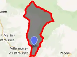
| |
 Châteauneuf-d'Entraunes  Châteauneuf-d'Entraunes | |
| Coordinates: 44°07′45″N 6°49′58″E | |
| Country | France |
| Region | Provence-Alpes-Côte d'Azur |
| Department | Alpes-Maritimes |
| Arrondissement | Nice |
| Canton | Vence |
| Government | |
| • Mayor (2008–2014) | Max Ginesy |
| Area 1 | 29.91 km2 (11.55 sq mi) |
| Population (2017-01-01)[1] | 58 |
| • Density | 1.9/km2 (5.0/sq mi) |
| Time zone | UTC+01:00 (CET) |
| • Summer (DST) | UTC+02:00 (CEST) |
| INSEE/Postal code | 06040 /06470 |
| Elevation | 880–2,813 m (2,887–9,229 ft) (avg. 1,282 m or 4,206 ft) |
| 1 French Land Register data, which excludes lakes, ponds, glaciers > 1 km2 (0.386 sq mi or 247 acres) and river estuaries. | |
Châteauneuf d'Entraunes is a municipality in the Val d'Entraunes. Former granary of the surroundings, this hamlet perched high but surrounded by vast fields enjoys an exceptional location: it dominates the valley of the Var with an unobstructed view almost at 360 ° on the needles of Pelens, the valley of the Var and towards the Valberg ski resort.
Many hikes start from Châteauneuf, towards the hamlet of Toures and further up towards the Cime de l'Aspre.
It is an unknown treasure of the Nice hinterland which is certainly worth a detour.
Population
| Year | Pop. | ±% |
|---|---|---|
| 1962 | 44 | — |
| 1968 | 19 | −56.8% |
| 1975 | 36 | +89.5% |
| 1982 | 47 | +30.6% |
| 1990 | 71 | +51.1% |
| 1999 | 56 | −21.1% |
| 2008 | 68 | +21.4% |
References
- "Populations légales 2017". INSEE. Retrieved 6 January 2020.
| Wikimedia Commons has media related to Châteauneuf-d'Entraunes. |
This article is issued from Wikipedia. The text is licensed under Creative Commons - Attribution - Sharealike. Additional terms may apply for the media files.