Saint-Blaise, Alpes-Maritimes
Saint-Blaise (Occitan: Sant Blai) is a commune in the Alpes-Maritimes département in southeastern France.
Saint-Blaise | |
|---|---|
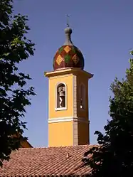 The bell tower of the church | |
 Coat of arms | |
Location of Saint-Blaise 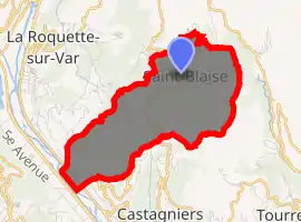
| |
 Saint-Blaise  Saint-Blaise | |
| Coordinates: 43°49′21″N 7°14′18″E | |
| Country | France |
| Region | Provence-Alpes-Côte d'Azur |
| Department | Alpes-Maritimes |
| Arrondissement | Nice |
| Canton | Tourrette-Levens |
| Intercommunality | Métropole Nice Côte d'Azur |
| Government | |
| • Mayor (2008–2014) | Jean-Paul Fabre |
| Area 1 | 8.04 km2 (3.10 sq mi) |
| Population (2017-01-01)[1] | 1,019 |
| • Density | 130/km2 (330/sq mi) |
| Time zone | UTC+01:00 (CET) |
| • Summer (DST) | UTC+02:00 (CEST) |
| INSEE/Postal code | 06117 /06670 |
| Elevation | 88–808 m (289–2,651 ft) (avg. 325 m or 1,066 ft) |
| 1 French Land Register data, which excludes lakes, ponds, glaciers > 1 km2 (0.386 sq mi or 247 acres) and river estuaries. | |
Population
| Year | Pop. | ±% |
|---|---|---|
| 1962 | 156 | — |
| 1968 | 190 | +21.8% |
| 1975 | 210 | +10.5% |
| 1982 | 339 | +61.4% |
| 1990 | 640 | +88.8% |
| 1999 | 892 | +39.4% |
| 2008 | 936 | +4.9% |
Tourism
Saint-Blaise is one of sixteen villages grouped together by the Métropole Nice Côte d'Azur tourist department as the Route des Villages Perchés (Route of Perched Villages). The others are: Aspremont, Carros, Castagniers, Coaraze, Colomars, Duranus, Èze, Falicon, La Gaude, Lantosque, Levens, La Roquette-sur-Var, Saint-Jeannet, Tourrette-Levens and Utelle.[2]
References
- "Populations légales 2017". INSEE. Retrieved 6 January 2020.
- "The route of perched villages" (PDF). Métropole Nice Côte d'Azur. 2013.
| Wikimedia Commons has media related to Saint-Blaise, Alpes-Maritimes. |
| Authority control |
|---|
This article is issued from Wikipedia. The text is licensed under Creative Commons - Attribution - Sharealike. Additional terms may apply for the media files.