Chaux-des-Crotenay
Chaux-des-Crotenay is a commune in the Jura department in Bourgogne-Franche-Comté in eastern France.
Chaux-des-Crotenay | |
|---|---|
.JPG.webp) The church in Chaux-des-Crotenay | |
.svg.png.webp) Coat of arms | |
Location of Chaux-des-Crotenay 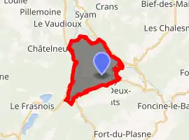
| |
 Chaux-des-Crotenay  Chaux-des-Crotenay | |
| Coordinates: 46°39′30″N 5°58′05″E | |
| Country | France |
| Region | Bourgogne-Franche-Comté |
| Department | Jura |
| Arrondissement | Lons-le-Saunier |
| Canton | Saint-Laurent-en-Grandvaux |
| Government | |
| • Mayor (2014–2020) | Daniel Vionnet |
| Area 1 | 11.67 km2 (4.51 sq mi) |
| Population (2017-01-01)[1] | 404 |
| • Density | 35/km2 (90/sq mi) |
| Time zone | UTC+01:00 (CET) |
| • Summer (DST) | UTC+02:00 (CEST) |
| INSEE/Postal code | 39129 /39150 |
| Elevation | 560–859 m (1,837–2,818 ft) |
| 1 French Land Register data, which excludes lakes, ponds, glaciers > 1 km2 (0.386 sq mi or 247 acres) and river estuaries. | |
Population
|
|
Battle of Alesia
The siege of Alesia was the last major battle between the Gauls under Vercingetorix and the Romans under Julius Caesar, but the location of the historical city of Alesia remains under dispute. The generally accepted location is in Alise-Sainte-Reine, but Danielle Porte, a professor at the Sorbonne, has argued for the alternative theory that a site in Chaux-des-Crotenay better fits the historical description.
See also
External links

Panorama of Chaux-des-crotenay
| Wikimedia Commons has media related to Chaux-des-Crotenay. |
| Authority control |
|---|
This article is issued from Wikipedia. The text is licensed under Creative Commons - Attribution - Sharealike. Additional terms may apply for the media files.
