Les Planches-près-Arbois
Les Planches-près-Arbois is a commune in the Jura department in Bourgogne-Franche-Comté in eastern France.
Les Planches-près-Arbois | |
|---|---|
.JPG.webp) A view within Les Planches-près-Arbois | |
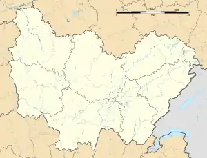
Location of Les Planches-près-Arbois 
| |
 Les Planches-près-Arbois  Les Planches-près-Arbois | |
| Coordinates: 46°52′46″N 5°48′27″E | |
| Country | France |
| Region | Bourgogne-Franche-Comté |
| Department | Jura |
| Arrondissement | Dole |
| Canton | Arbois |
| Intercommunality | Communauté des communes Arbois, Poligny, Salins - Coeur du Jura |
| Government | |
| • Mayor (2014–2020) | Hubert Darbon |
| Area 1 | 1.39 km2 (0.54 sq mi) |
| Population (2017-01-01)[1] | 96 |
| • Density | 69/km2 (180/sq mi) |
| Time zone | UTC+01:00 (CET) |
| • Summer (DST) | UTC+02:00 (CEST) |
| INSEE/Postal code | 39425 /39600 |
| Elevation | 320–571 m (1,050–1,873 ft) |
| 1 French Land Register data, which excludes lakes, ponds, glaciers > 1 km2 (0.386 sq mi or 247 acres) and river estuaries. | |
Population
|
|
Geography
The village is located in the Reculée des Planches, a gorge which is home to a series of impressive caves and ends in abrupt, limestone cliffs and scree slopes, making it one of the Jura's most prized natural sites. The whole of the gorge is a protected, natural area and also a Natura 2000 site.
The landscapes and the viewpoints are protected. This protection strictly limits any expansion of the village but seems to correspond to the current inhabitants' desire to treasure their shared heritage.
See also
References
- "Populations légales 2017". INSEE. Retrieved 6 January 2020.
| Wikimedia Commons has media related to Les Planches-près-Arbois. |
This article is issued from Wikipedia. The text is licensed under Creative Commons - Attribution - Sharealike. Additional terms may apply for the media files.