Montigny-lès-Arsures
Montigny-lès-Arsures is a commune in the Jura department in Bourgogne-Franche-Comté in eastern France.
Montigny-lès-Arsures | |
|---|---|
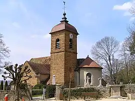 The church in Montigny-lès-Arsures | |
Location of Montigny-lès-Arsures 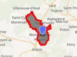
| |
 Montigny-lès-Arsures  Montigny-lès-Arsures | |
| Coordinates: 46°55′39″N 5°47′10″E | |
| Country | France |
| Region | Bourgogne-Franche-Comté |
| Department | Jura |
| Arrondissement | Dole |
| Canton | Arbois |
| Intercommunality | Communauté des communes, Arbois, Poligny, Salins - Coeur du Jura |
| Government | |
| • Mayor (2014–2020) | Philippe Riou |
| Area 1 | 10.63 km2 (4.10 sq mi) |
| Population (2017-01-01)[1] | 254 |
| • Density | 24/km2 (62/sq mi) |
| Time zone | UTC+01:00 (CET) |
| • Summer (DST) | UTC+02:00 (CEST) |
| INSEE/Postal code | 39355 /39600 |
| Elevation | 254–580 m (833–1,903 ft) |
| 1 French Land Register data, which excludes lakes, ponds, glaciers > 1 km2 (0.386 sq mi or 247 acres) and river estuaries. | |
Geography
Montigny is located in the heart of the Jura wine region, in the north-east of the Jura, on the Jura Wine Route and the Route Pasteur. The village also boasts the title of Capital of Trousseau, a local grape variety, since the village's limestone soils particularly suit these grapes' requirements. The Larine stream springs forth in the village which it then proceeds to cross.
Arbois is 3 km from Montigny, Besançon 45 km, Dijon 30 km and Lausanne 100 km.
See also
- Communes of the Jura department
- Frederic Lornet
- French wine
- Jura wine
External links
| Wikimedia Commons has media related to Montigny-lès-Arsures. |
Chisholm, Hugh, ed. (1911). . Encyclopædia Britannica. 2 (11th ed.). Cambridge University Press. p. 657.
This article is issued from Wikipedia. The text is licensed under Creative Commons - Attribution - Sharealike. Additional terms may apply for the media files.